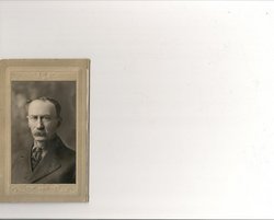
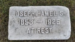
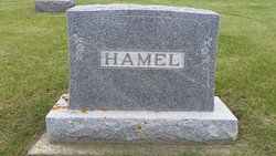
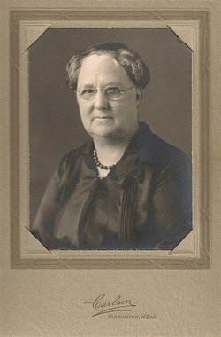
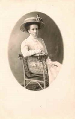
Joseph Octave Hamel Sr.
| Birth | : | Nov 1853 Quebec, Canada |
| Death | : | 22 Mar 1925 Carrington, Foster County, North Dakota, USA |
| Burial | : | Keynsham Cemetery, Keynsham, Bath and North East Somerset Unitary Authority, England |
| Coordinate | : | 51.4212975, -2.5116095 |
| Description | : | He was born in Quebec, Canada in Nov 1853. He died in Carrington, Foster County, ND. Joseph and Margaret were married on 31 Jan 1879 in Calumet, Houghton County, MI. This information comes from census records, Michigan Marriage Index, Quebec Vital and Church Records (Drouin Collection), and my family records. |
frequently asked questions (FAQ):
-
Where is Joseph Octave Hamel Sr.'s memorial?
Joseph Octave Hamel Sr.'s memorial is located at: Keynsham Cemetery, Keynsham, Bath and North East Somerset Unitary Authority, England.
-
When did Joseph Octave Hamel Sr. death?
Joseph Octave Hamel Sr. death on 22 Mar 1925 in Carrington, Foster County, North Dakota, USA
-
Where are the coordinates of the Joseph Octave Hamel Sr.'s memorial?
Latitude: 51.4212975
Longitude: -2.5116095
Family Members:
Spouse
Children
Flowers:
Nearby Cemetories:
1. Keynsham Cemetery
Keynsham, Bath and North East Somerset Unitary Authority, England
Coordinate: 51.4212975, -2.5116095
2. St. John the Baptist Churchyard
Keynsham, Bath and North East Somerset Unitary Authority, England
Coordinate: 51.4174570, -2.4987140
3. Ebenezer Baptist Church
Keynsham, Bath and North East Somerset Unitary Authority, England
Coordinate: 51.4160710, -2.4983170
4. Keynsham Abbey
Keynsham, Bath and North East Somerset Unitary Authority, England
Coordinate: 51.4172000, -2.4961000
5. Queen Charlton St. Margaret Churchyard
Compton Dando, Bath and North East Somerset Unitary Authority, England
Coordinate: 51.4009300, -2.5271800
6. Saint Margaret Churchyard
Compton Dando, Bath and North East Somerset Unitary Authority, England
Coordinate: 51.4009330, -2.5272136
7. Brislington Cemetery
Brislington, Bristol Unitary Authority, England
Coordinate: 51.4355480, -2.5438020
8. Hanham Baptist Church Cemetery
Hanham, South Gloucestershire Unitary Authority, England
Coordinate: 51.4474802, -2.5107480
9. St Anne Churchyard
Oldland, South Gloucestershire Unitary Authority, England
Coordinate: 51.4381800, -2.4780900
10. Christ Church Churchyard
Hanham, South Gloucestershire Unitary Authority, England
Coordinate: 51.4484992, -2.5222650
11. Hanham United Reform Church Cemetery
Hanham, South Gloucestershire Unitary Authority, England
Coordinate: 51.4509706, -2.5189809
12. Christ Church Churchyard
Bristol, Bristol Unitary Authority, England
Coordinate: 51.4213270, -2.5632460
13. St. Mary Churchyard
Bitton, South Gloucestershire Unitary Authority, England
Coordinate: 51.4223600, -2.4599100
14. Whitchurch Cemetery
Bristol Unitary Authority, England
Coordinate: 51.3990278, -2.5506809
15. Ebenezer Methodist Chapel
Warmley, South Gloucestershire Unitary Authority, England
Coordinate: 51.4514960, -2.4779637
16. Holy Souls Catholic Cemetery
Arnos Vale, Bristol Unitary Authority, England
Coordinate: 51.4422800, -2.5639300
17. Saint Michael Churchyard
Keynsham, Bath and North East Somerset Unitary Authority, England
Coordinate: 51.3865690, -2.4830350
18. Arnos Vale Cemetery and Crematorium
Arnos Vale, Bristol Unitary Authority, England
Coordinate: 51.4423740, -2.5648680
19. St. Mary Redcliffe Cemetery
Arnos Vale, Bristol Unitary Authority, England
Coordinate: 51.4428370, -2.5646220
20. Blessed Virgin Mary Churchyard
Saltford, Bath and North East Somerset Unitary Authority, England
Coordinate: 51.4056845, -2.4528274
21. Holy Trinity Churchyard
Kingswood, South Gloucestershire Unitary Authority, England
Coordinate: 51.4619990, -2.5040620
22. St Michael the Archangel Churchyard
Bristol Unitary Authority, England
Coordinate: 51.4619199, -2.5211279
23. Blessed Virgin Mary Churchyard
Compton Dando, Bath and North East Somerset Unitary Authority, England
Coordinate: 51.3796870, -2.5100920
24. Master's Church Cemetery
Kingswood, South Gloucestershire Unitary Authority, England
Coordinate: 51.4630871, -2.5068932

