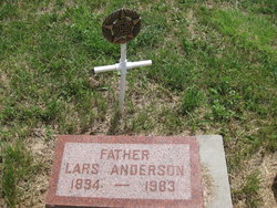
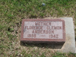
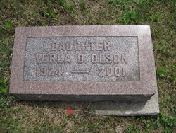
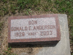
Lars Anderson
| Birth | : | 12 Apr 1893 |
| Death | : | 8 Apr 1983 |
| Burial | : | Howick Cemetery, Howick, Auckland Council, New Zealand |
| Coordinate | : | -36.9040400, 174.9380500 |
| Plot | : | Sect B K 48 |
| Description | : | Anderson, Lars ~ 1983~ VETERAN Funeral services were held on Monday, April 11, at 1:00 p.m. at the Dunlap Lutheran Church for Lars Anderson, 89 of Dunlap who died on Friday, April 8, at the Missouri Valley Hospital. Burial was in the Soldier Lutheran Cemetery under the direction of the Fouts Funeral Home. Lars was born April 12, 1893, in Denmark. He was a World War I veteran. He married Florence Clemon on January 24, 1924. Survivors include five children. Verla Olson of Weeping Water, Nebraska, Donald Anderson of Omaha, Mrs. Phil (Doris) Houston of Richardson, Texas, Mrs. Bill (Betty) Harris of... Read More |
frequently asked questions (FAQ):
-
Where is Lars Anderson's memorial?
Lars Anderson's memorial is located at: Howick Cemetery, Howick, Auckland Council, New Zealand.
-
When did Lars Anderson death?
Lars Anderson death on 8 Apr 1983 in
-
Where are the coordinates of the Lars Anderson's memorial?
Latitude: -36.9040400
Longitude: 174.9380500
Family Members:
Spouse
Children
Flowers:
Nearby Cemetories:
1. Howick Cemetery
Howick, Auckland Council, New Zealand
Coordinate: -36.9040400, 174.9380500
2. All Saints Cemetery
Howick, Auckland Council, New Zealand
Coordinate: -36.8954260, 174.9337600
3. Our Lady Star of the Sea Parish Cemetery
Howick, Auckland Council, New Zealand
Coordinate: -36.8932940, 174.9307940
4. St. Andrew Presbyterian Cemetery
Howick, Auckland Council, New Zealand
Coordinate: -36.8989900, 174.9201600
5. Howick Historical Village
Pakuranga, Auckland Council, New Zealand
Coordinate: -36.9067680, 174.9027080
6. Pakuranga Methodist Cemetery
Pakuranga, Auckland Council, New Zealand
Coordinate: -36.9054000, 174.8914900
7. Waikopua Cemetery
Whitford, Auckland Council, New Zealand
Coordinate: -36.9274400, 174.9998900
8. Flat Bush Cemetery
East Tamaki, Auckland Council, New Zealand
Coordinate: -36.9563500, 174.9097100
9. St. John's Church Cemetery
East Tamaki, Auckland Council, New Zealand
Coordinate: -36.9522250, 174.8964540
10. St. Paul's Anglican Cemetery
East Tamaki, Auckland Council, New Zealand
Coordinate: -36.9615200, 174.9082000
11. St Matthias Churchyard
Panmure, Auckland Council, New Zealand
Coordinate: -36.9053300, 174.8577200
12. St. Patrick's Roman Catholic Church Cemetery
Panmure, Auckland Council, New Zealand
Coordinate: -36.9029680, 174.8564960
13. Point England Presbyterian Cemetery
Point England, Auckland Council, New Zealand
Coordinate: -36.8823420, 174.8601550
14. St. Joseph and St. Joachim Catholic Cemetery
Ōtāhūhū, Auckland Council, New Zealand
Coordinate: -36.9436100, 174.8490100
15. Holy Trinity Memorial Park
Ōtāhūhū, Auckland Council, New Zealand
Coordinate: -36.9374510, 174.8448580
16. St. Thomas Churchyard
Tamaki, Auckland Council, New Zealand
Coordinate: -36.8675590, 174.8460560
17. St. John’s College Graveyard
Saint Johns, Auckland Council, New Zealand
Coordinate: -36.8738169, 174.8416826
18. Otahuhu Public Cemetery
Ōtāhūhū, Auckland Council, New Zealand
Coordinate: -36.9377500, 174.8432390
19. Nixon Memorial
Ōtāhūhū, Auckland Council, New Zealand
Coordinate: -36.9499366, 174.8449909
20. St. John's Presbyterian Church Cemetery
Papatoetoe, Auckland Council, New Zealand
Coordinate: -36.9674185, 174.8598178
21. Purewa Cemetery
Meadowbank, Auckland Council, New Zealand
Coordinate: -36.8674300, 174.8297900
22. Woodside Methodist Cemetery
Manukau, Auckland Council, New Zealand
Coordinate: -36.9929680, 174.8837860
23. Motuihe Island Cemetery
Auckland Council, New Zealand
Coordinate: -36.8000400, 174.9363920
24. Ōrākei (Rautara St) Urupā
Orakei, Auckland Council, New Zealand
Coordinate: -36.8610770, 174.8188960


