

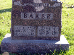
Lelitia Ann “Lettie” Harrison Baker
| Birth | : | 27 Jul 1850 Montgomery County, Indiana, USA |
| Death | : | 12 Jan 1942 Clarke County, Iowa, USA |
| Burial | : | Hazel Dell Cemetery, Council Bluffs, Pottawattamie County, USA |
| Coordinate | : | 41.3489723, -95.7939911 |
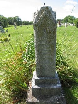
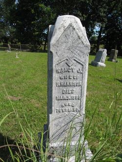
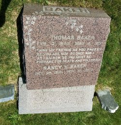
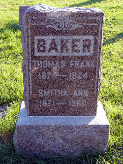
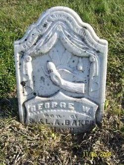
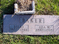
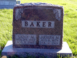
| Description | : | Samuel & Letitia had atleast 9 children: Thomas, George, Sherman, Silas, Joseph, Walter, Grace, Harriet & Alonzo. Daughter of Franklin Harrison & Nancy Clark. The Osceola Sentinel, Osceola, Iowa January 14, 1943, Page 6 IN MEMORIUM. In loving memory of my dear wife and mother, Mrs. Letta Bak- er, one year ago, Jan. 12, 1942. What is a home without a Mother? All things the world may send. But when I lost my darling mo- ther, I lost my dearest friend. From this world of pain and sor- row, To the land of peace and rest, God has taken you, dear one, Where you have found eternal rest. Her... Read More |
frequently asked questions (FAQ):
-
Where is Lelitia Ann “Lettie” Harrison Baker's memorial?
Lelitia Ann “Lettie” Harrison Baker's memorial is located at: Hazel Dell Cemetery, Council Bluffs, Pottawattamie County, USA.
-
When did Lelitia Ann “Lettie” Harrison Baker death?
Lelitia Ann “Lettie” Harrison Baker death on 12 Jan 1942 in Clarke County, Iowa, USA
-
Where are the coordinates of the Lelitia Ann “Lettie” Harrison Baker's memorial?
Latitude: 41.3489723
Longitude: -95.7939911
Family Members:
Parent
Spouse
Siblings
Children

Flowers:


Nearby Cemetories:
1. Hazel Dell Cemetery
Council Bluffs, Pottawattamie County, USA
Coordinate: 41.3489723, -95.7939911
2. Gregg Cemetery
Weston, Pottawattamie County, USA
Coordinate: 41.3330000, -95.7931000
3. Saint Columbanus Cemetery
Weston, Pottawattamie County, USA
Coordinate: 41.3429440, -95.7435260
4. Evans Cemetery
Crescent, Pottawattamie County, USA
Coordinate: 41.3255997, -95.8368988
5. Crescent Cemetery
Crescent, Pottawattamie County, USA
Coordinate: 41.3664894, -95.8566208
6. Garner Cemetery
Council Bluffs, Pottawattamie County, USA
Coordinate: 41.2956161, -95.8001709
7. Downsville Cemetery
Pottawattamie County, USA
Coordinate: 41.3502998, -95.7039032
8. William C McIntosh Cemetery
Crescent, Pottawattamie County, USA
Coordinate: 41.4088745, -95.8477097
9. Green Valley Cemetery
Council Bluffs, Pottawattamie County, USA
Coordinate: 41.2743988, -95.8225021
10. Saint Joseph Cemetery
Council Bluffs, Pottawattamie County, USA
Coordinate: 41.2722015, -95.8208008
11. Reels Cemetery
Crescent, Pottawattamie County, USA
Coordinate: 41.4234100, -95.8321700
12. Walnut Hill Cemetery
Council Bluffs, Pottawattamie County, USA
Coordinate: 41.2719002, -95.8255997
13. Bikhor Cholim Cemetery
Council Bluffs, Pottawattamie County, USA
Coordinate: 41.2703670, -95.8229350
14. Cedar Lawn Cemetery
Council Bluffs, Pottawattamie County, USA
Coordinate: 41.2694016, -95.8182983
15. Oak Hill Cemetery
Council Bluffs, Pottawattamie County, USA
Coordinate: 41.2700900, -95.8226400
16. Ridgewood Cemetery
Council Bluffs, Pottawattamie County, USA
Coordinate: 41.2694016, -95.8272018
17. H G Fisher Cemetery
Underwood, Pottawattamie County, USA
Coordinate: 41.3838997, -95.6889038
18. Memorial Park Cemetery
Council Bluffs, Pottawattamie County, USA
Coordinate: 41.2644005, -95.8261032
19. Saint Pauls Lutheran Cemetery
Neola, Pottawattamie County, USA
Coordinate: 41.4337000, -95.7607000
20. Fairview Cemetery
Council Bluffs, Pottawattamie County, USA
Coordinate: 41.2703018, -95.8480988
21. Grange Cemetery
Honey Creek, Pottawattamie County, USA
Coordinate: 41.4446678, -95.8034668
22. Clark Cemetery
Pottawattamie County, USA
Coordinate: 41.2551610, -95.8223390
23. Pottawattamie County Home Cemetery
McClelland, Pottawattamie County, USA
Coordinate: 41.3269400, -95.6691738
24. Stoker-Graybill Cemetery
Council Bluffs, Pottawattamie County, USA
Coordinate: 41.2532620, -95.7751770