
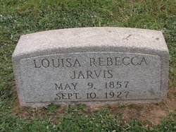
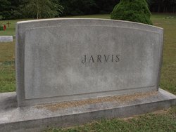
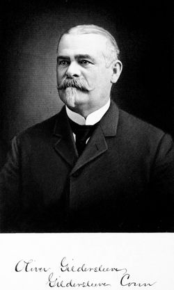
Louisa Rebecca Gildersleeve Jarvis
| Birth | : | 9 May 1857 Connecticut, USA |
| Death | : | 10 Sep 1927 Portland, Middlesex County, Connecticut, USA |
| Burial | : | St. Bartholomew Churchyard, Ducklington, West Oxfordshire District, England |
| Coordinate | : | 51.7658689, -1.4810340 |
frequently asked questions (FAQ):
-
Where is Louisa Rebecca Gildersleeve Jarvis's memorial?
Louisa Rebecca Gildersleeve Jarvis's memorial is located at: St. Bartholomew Churchyard, Ducklington, West Oxfordshire District, England.
-
When did Louisa Rebecca Gildersleeve Jarvis death?
Louisa Rebecca Gildersleeve Jarvis death on 10 Sep 1927 in Portland, Middlesex County, Connecticut, USA
-
Where are the coordinates of the Louisa Rebecca Gildersleeve Jarvis's memorial?
Latitude: 51.7658689
Longitude: -1.4810340
Family Members:
Parent

Spouse
Siblings
Children
Flowers:


Nearby Cemetories:
1. St. Bartholomew Churchyard
Ducklington, West Oxfordshire District, England
Coordinate: 51.7658689, -1.4810340
2. St. Mary's Churchyard
Witney, West Oxfordshire District, England
Coordinate: 51.7807116, -1.4850508
3. St Mary Churchyard
Cogges, West Oxfordshire District, England
Coordinate: 51.7839280, -1.4782010
4. Tower Hill Cemetery
Witney, West Oxfordshire District, England
Coordinate: 51.7852950, -1.4999610
5. Woodgreen (Holy Trinity) Churchyard
West Oxfordshire District, England
Coordinate: 51.7918400, -1.4793500
6. St John The Baptist
Curbridge, West Oxfordshire District, England
Coordinate: 51.7764570, -1.5203140
7. St. James the Great Churchyard
South Leigh, West Oxfordshire District, England
Coordinate: 51.7781050, -1.4298950
8. Cote Baptist Chapel
Cote, West Oxfordshire District, England
Coordinate: 51.7254430, -1.4929510
9. St. James the Great Churchyard
Aston, West Oxfordshire District, England
Coordinate: 51.7252620, -1.5059510
10. St Peter's Churchyard
Crawley, West Oxfordshire District, England
Coordinate: 51.8069700, -1.5100400
11. St John the Evangelist
Hailey, West Oxfordshire District, England
Coordinate: 51.8107740, -1.4879260
12. Saint Kenelm's Churchyard
Minster Lovell, West Oxfordshire District, England
Coordinate: 51.8000620, -1.5314550
13. St. Giles' Churchyard
Standlake, West Oxfordshire District, England
Coordinate: 51.7299550, -1.4262300
14. St Marys Churchyard
Shifford, West Oxfordshire District, England
Coordinate: 51.7151440, -1.4631340
15. St. Britius Churchyard Extension
Brize Norton, West Oxfordshire District, England
Coordinate: 51.7660800, -1.5662600
16. St. Britius Churchyard
Brize Norton, West Oxfordshire District, England
Coordinate: 51.7662000, -1.5667000
17. St Michael's Churchyard
Stanton Harcourt, West Oxfordshire District, England
Coordinate: 51.7480000, -1.3977000
18. Bampton Cemetery
Bampton, West Oxfordshire District, England
Coordinate: 51.7296400, -1.5490200
19. St. Mary the Virgin Churchyard
Bampton, West Oxfordshire District, England
Coordinate: 51.7278250, -1.5487270
20. St Mary Churchyard
North Leigh, West Oxfordshire District, England
Coordinate: 51.8201820, -1.4396170
21. Eynsham Abbey
Eynsham, West Oxfordshire District, England
Coordinate: 51.7786110, -1.3738890
22. St Mary the Virgin Churchyard
Freeland, West Oxfordshire District, England
Coordinate: 51.8116300, -1.4004700
23. St Leonard Churchyard
Eynsham, West Oxfordshire District, England
Coordinate: 51.7799470, -1.3738080
24. Eynsham War Memorial
Eynsham, West Oxfordshire District, England
Coordinate: 51.7801562, -1.3736687