
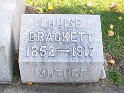
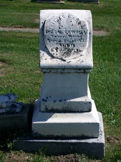
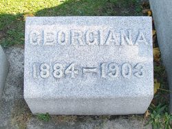
Louise Ely Brackett Holman
| Birth | : | 28 Jan 1852 Fulton County, Indiana, USA |
| Death | : | 20 Jun 1917 Battle Creek, Calhoun County, Michigan, USA |
| Burial | : | St. Peter's in the Forest Anglican Cemetery, Bombay, Auckland Council, New Zealand |
| Coordinate | : | -37.1869100, 174.9914100 |
| Plot | : | Section 1, Row 5 |
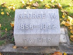
| Inscription | : | mother |
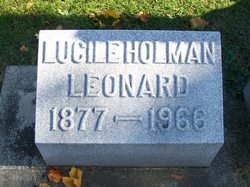
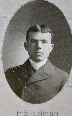
| Description | : | Published in the Rochester(IN) Sentinel, Thursday, June 21, 1917 Mrs. Louise Ely HOLMAN, 67, wife of George W. HOLMAN, died Wednesday evening at 9:20 at Battle Creek, Michigan, where she had been in a sanitarium for three weeks. Her husband, daughter, Mrs. Lucile Leonard, and John HOLMAN were with her when she passed away. The son, Capt. Hugh Holman, who has been located at Charleston, S.D., and daughter, Mrs. Grace Beach of New York City were unable to arrive before the end. Mrs. Holman had been in poor health for several months and recently it was said that she was... Read More |
frequently asked questions (FAQ):
-
Where is Louise Ely Brackett Holman's memorial?
Louise Ely Brackett Holman's memorial is located at: St. Peter's in the Forest Anglican Cemetery, Bombay, Auckland Council, New Zealand.
-
When did Louise Ely Brackett Holman death?
Louise Ely Brackett Holman death on 20 Jun 1917 in Battle Creek, Calhoun County, Michigan, USA
-
Where are the coordinates of the Louise Ely Brackett Holman's memorial?
Latitude: -37.1869100
Longitude: 174.9914100
Family Members:
Parent
Spouse
Siblings
Children
Flowers:


Nearby Cemetories:
1. St. Peter's in the Forest Anglican Cemetery
Bombay, Auckland Council, New Zealand
Coordinate: -37.1869100, 174.9914100
2. Bombay Presbyterian Church Cemetery
Bombay, Auckland Council, New Zealand
Coordinate: -37.1790700, 174.9826900
3. Pukekohe East Cemetery
Pukekohe East, Auckland Council, New Zealand
Coordinate: -37.1883500, 174.9459000
4. Pratt's Road Catholic Cemetery
Ramarama, Auckland Council, New Zealand
Coordinate: -37.1425500, 174.9871300
5. Pokeno Old Soldiers Cemetery
Pokeno, Waikato District, New Zealand
Coordinate: -37.2386120, 175.0094760
6. Ararimu Schoolhouse Cemetery
Ararimu, Auckland Council, New Zealand
Coordinate: -37.1448376, 175.0359288
7. Pokeno Cemetery
Pokeno, Waikato District, New Zealand
Coordinate: -37.2364600, 175.0215400
8. Ararimu Cemetery
Ararimu, Auckland Council, New Zealand
Coordinate: -37.1321000, 175.0484200
9. Pukekohe Catholic Cemetery
Pukekohe, Auckland Council, New Zealand
Coordinate: -37.1951510, 174.9014640
10. Heights Park Cemetery
Paerata, Auckland Council, New Zealand
Coordinate: -37.1781928, 174.8938836
11. Pukekohe Public Cemetery
Pukekohe, Auckland Council, New Zealand
Coordinate: -37.2106400, 174.8974900
12. St John's Anglican Cemetery Drury
Drury, Auckland Council, New Zealand
Coordinate: -37.1033710, 174.9506070
13. Drury-Runciman War Memorial
Drury, Auckland Council, New Zealand
Coordinate: -37.1025480, 174.9528240
14. Drury Presbyterian Cemetery
Drury, Auckland Council, New Zealand
Coordinate: -37.0991270, 174.9497870
15. Tuakau Cemetery
Tuakau, Waikato District, New Zealand
Coordinate: -37.2844420, 174.9465660
16. Mercer Cemetery
Mercer, Waikato District, New Zealand
Coordinate: -37.2764860, 175.0578300
17. Papakura South Cemetery
Papakura, Auckland Council, New Zealand
Coordinate: -37.0877300, 174.9464700
18. Alexandra Redoubt Cemetery
Tuakau, Waikato District, New Zealand
Coordinate: -37.2858200, 174.9419600
19. Papakura Cemetery
Papakura, Auckland Council, New Zealand
Coordinate: -37.0698600, 174.9448300
20. Hunua Presbyterian Cemetery
Hunua, Auckland Council, New Zealand
Coordinate: -37.0792290, 175.0742700
21. St Brides Church of England Cemetery
Mauku, Auckland Council, New Zealand
Coordinate: -37.2011260, 174.8120370
22. Onewhero Cemetery
Onewhero, Waikato District, New Zealand
Coordinate: -37.3158900, 174.9104900
23. Mauku Cemetery
Mauku, Auckland Council, New Zealand
Coordinate: -37.2011420, 174.8109100
24. St James Churchyard Ardmore
Auckland Council, New Zealand
Coordinate: -37.0364180, 174.9992160