
| Birth | : | 5 Jun 1820 Adams County, Ohio, USA |
| Death | : | 22 Mar 1900 Brown County, Ohio, USA |
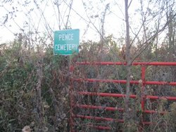
| Burial | : | Ashridge Cemetery, Ash Ridge, Brown County, USA |
| Coordinate | : | 38.9164009, -83.7536011 |
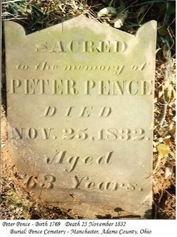
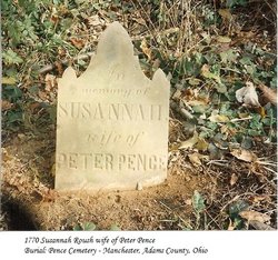
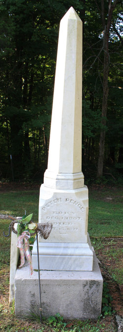
| Description | : | Lucinda Pence Laney 5 Jun 1820 – 22 Mar 1900 Lucinda married Thomas Moore about 1841 at Adams Co, OH, and they were the parents of: Martha Ellen/20 Oct 1842 (Mrs James Laney) Sylvester/7 May 1844 m. Mary Jane Cole Lucinda next married John W Laney on 20 Nov 1858 at Brown Co, OH, and they were the parents of: Mary/26 Mar 1859 - 26 Feb 1860 Anna Bell/26 Jun 1860 - 24 Jul 1890 John Wilson/26 Aug 1861 - 28 Nov 1946 George Pence/24 Mar 1863 - 2 Dec 1943 Her parents were Peter Pence and... Read More |
frequently asked questions (FAQ):
-
Where is Lucinda Pence Laney's memorial?
Lucinda Pence Laney's memorial is located at: Ashridge Cemetery, Ash Ridge, Brown County, USA.
-
When did Lucinda Pence Laney death?
Lucinda Pence Laney death on 22 Mar 1900 in Brown County, Ohio, USA
-
Where are the coordinates of the Lucinda Pence Laney's memorial?
Latitude: 38.9164009
Longitude: -83.7536011
Family Members:
Parent
Spouse

Siblings
Children
Flowers:


Nearby Cemetories:
1. Ashridge Cemetery
Ash Ridge, Brown County, USA
Coordinate: 38.9164009, -83.7536011
2. Waters Cemetery
Huntington Township, Brown County, USA
Coordinate: 38.9249992, -83.7127991
3. Independence Cemetery
Jackson Township, Brown County, USA
Coordinate: 38.9281006, -83.7138977
4. Rickey Cemetery
Jackson Township, Brown County, USA
Coordinate: 38.8913994, -83.7166977
5. Bennington Cemetery
Russellville, Brown County, USA
Coordinate: 38.8986015, -83.7007980
6. Pleasant Hill Cemetery
Jackson Township, Brown County, USA
Coordinate: 38.9185982, -83.6952972
7. Linwood Cemetery
Russellville, Brown County, USA
Coordinate: 38.8671989, -83.7671967
8. Shaw Cemetery
Russellville, Brown County, USA
Coordinate: 38.8737950, -83.7898490
9. Straight Creek Baptist Cemetery
Arnheim, Brown County, USA
Coordinate: 38.9317017, -83.8193970
10. Associated Reformed Churchyard
Russellville, Brown County, USA
Coordinate: 38.8657990, -83.7822037
11. Associated Reformed Churchyard
Russellville, Brown County, USA
Coordinate: 38.8596110, -83.7554720
12. Baird Cemetery
Russellville, Brown County, USA
Coordinate: 38.8594360, -83.7610016
13. Bohrer Cemetery
Franklin Township, Brown County, USA
Coordinate: 38.9019012, -83.8257980
14. German Reformed Presbyterian Cemetery
Arnheim, Brown County, USA
Coordinate: 38.9311066, -83.8263702
15. Lutheran Cemetery
Arnheim, Brown County, USA
Coordinate: 38.9281006, -83.8283005
16. Saint Marys Cemetery
Arnheim, Brown County, USA
Coordinate: 38.9407997, -83.8293991
17. Brush Creek Cemetery
Eagle Township, Brown County, USA
Coordinate: 38.9810982, -83.7566986
18. Wardlow Cemetery
Franklin Township, Brown County, USA
Coordinate: 38.8944016, -83.8358002
19. Abbott Burying Ground
Arnheim, Brown County, USA
Coordinate: 38.8944360, -83.8361210
20. Old Russellville Cemetery
Russellville, Brown County, USA
Coordinate: 38.8513985, -83.7878036
21. Lucas Homestead Cemetery
Sardinia, Brown County, USA
Coordinate: 38.9853680, -83.7854220
22. Methodist African American Cemetery
Eagle Township, Brown County, USA
Coordinate: 38.9891250, -83.7651090
23. Biehn Cemetery
Washington Township, Brown County, USA
Coordinate: 38.9894370, -83.7840220
24. Eckman Cemetery
Decatur, Brown County, USA
Coordinate: 38.8453903, -83.7043152