
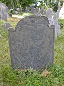
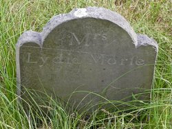
Lydia Glazier Morse
| Birth | : | 2 Sep 1735 Lancaster, Worcester County, Massachusetts, USA |
| Death | : | 22 Mar 1794 Natick, Middlesex County, Massachusetts, USA |
| Burial | : | Bainbridge Cemetery, Bainbridge, Richmondshire District, England |
| Coordinate | : | 54.3054000, -2.0994100 |
| Description | : | Lancaster, MA - Birth Records, 63. Glazier, Lydiah, d. John and Easter, Sept. 2, 1735. Natick, MA - Marriage Records, 168. Morse, Pelatiah and Lydia Glazor of Lancaster, int. Apr. 26, 1777. Natick, MA - Death Records, 230. Morse, Lydia, w. of Peletiah, Mar. 22, 1794. (a. 58 y., G.R. 3.). |
frequently asked questions (FAQ):
-
Where is Lydia Glazier Morse's memorial?
Lydia Glazier Morse's memorial is located at: Bainbridge Cemetery, Bainbridge, Richmondshire District, England.
-
When did Lydia Glazier Morse death?
Lydia Glazier Morse death on 22 Mar 1794 in Natick, Middlesex County, Massachusetts, USA
-
Where are the coordinates of the Lydia Glazier Morse's memorial?
Latitude: 54.3054000
Longitude: -2.0994100
Family Members:
Spouse
Flowers:


Nearby Cemetories:
1. Bainbridge Cemetery
Bainbridge, Richmondshire District, England
Coordinate: 54.3054000, -2.0994100
2. Friends Burial Ground
Bainbridge, Richmondshire District, England
Coordinate: 54.3093330, -2.1023380
3. Askrigg Cemetery
Askrigg, Richmondshire District, England
Coordinate: 54.3141230, -2.0915060
4. St. Oswald Churchyard
Askrigg, Richmondshire District, England
Coordinate: 54.3147100, -2.0817500
5. St Matthew Old Churchyard
Stalling Busk, Richmondshire District, England
Coordinate: 54.2695500, -2.1289300
6. St Matthew Churchyard
Stalling Busk, Richmondshire District, England
Coordinate: 54.2686220, -2.1302030
7. Friends Burial Ground
Hawes, Richmondshire District, England
Coordinate: 54.3039790, -2.1937940
8. St. Margaret's Churchyard
Hawes, Richmondshire District, England
Coordinate: 54.3032300, -2.1969700
9. Sandemanian Chapel Burial Ground
Hawes, Richmondshire District, England
Coordinate: 54.2992110, -2.1982010
10. Friends Meeting House Burial Ground
Carperby, Richmondshire District, England
Coordinate: 54.3031720, -1.9925670
11. St. Mary and St. John Churchyard
Hardraw, Richmondshire District, England
Coordinate: 54.3169800, -2.2052700
12. St. Andrew Churchyard
Aysgarth, Richmondshire District, England
Coordinate: 54.2922340, -1.9833760
13. Gunnerside Wesleyan Methodist Chapelyard
Gunnerside, Richmondshire District, England
Coordinate: 54.3783950, -2.0778320
14. St. Mary's Churchyard
Muker, Richmondshire District, England
Coordinate: 54.3763690, -2.1392860
15. Low Row United Reformed Chapelyard
Low Row, Richmondshire District, England
Coordinate: 54.3755880, -2.0317420
16. Low Row Methodist Cemetery
Low Row, Richmondshire District, England
Coordinate: 54.3798050, -2.0259320
17. Holy Trinity Churchyard
Low Row, Richmondshire District, England
Coordinate: 54.3812800, -2.0223090
18. St Mary Churchyard
Redmire, Richmondshire District, England
Coordinate: 54.3126200, -1.9227400
19. St. Michael and All Angels Churchyard
Hubberholme, Craven District, England
Coordinate: 54.2001100, -2.1147330
20. Keld United Reform Chapelyard
Keld, Richmondshire District, England
Coordinate: 54.4055920, -2.1660210
21. St Bartholomew Churchyard
West Witton, Richmondshire District, England
Coordinate: 54.2920100, -1.9073200
22. Preston Under Scar Cemetery
Preston-under-Scar, Richmondshire District, England
Coordinate: 54.3133800, -1.8964000
23. Reeth Congregational Chapelyard
Reeth, Richmondshire District, England
Coordinate: 54.3878600, -1.9422700
24. St. Andrew's Churchyard
Grinton, Richmondshire District, England
Coordinate: 54.3812610, -1.9305740