
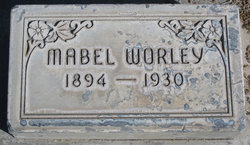
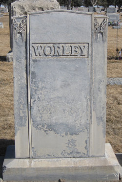
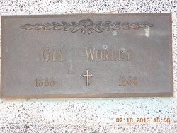
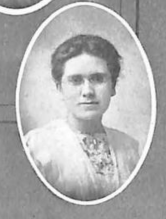
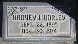
Mable Rebecca Worley
| Birth | : | 10 May 1894 |
| Death | : | 16 Oct 1930 |
| Burial | : | Maple Hill Cemetery, Stoutsville, Fairfield County, USA |
| Coordinate | : | 39.6006012, -82.8227997 |
| Plot | : | Block 8, Section 1, Lot 3, Space 1 |
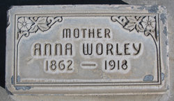
| Description | : | Mable was the daughter of Lewis N. & Anna (Perks) Worley. She was the owner/ photographer of WORLEY'S STUDIO, Alliance, Nebraska. OBITUARY, ALLIANCE TIMES HERALD, Alliance, Nebr. OCTOBER 1930: Miss Mabel Worley, proprietress of the Worley Studio, passed away rather suddenly yesterday morning at the ranch home of her father, L.N. Worley. Her death which came as a shock to acquaintances was caused by neuritis from which Miss Worley had been suffering for the past year. Attacks of the malady caused her to leave her work recently and two weeks ago she went out to her father's ranch to... Read More |
frequently asked questions (FAQ):
-
Where is Mable Rebecca Worley's memorial?
Mable Rebecca Worley's memorial is located at: Maple Hill Cemetery, Stoutsville, Fairfield County, USA.
-
When did Mable Rebecca Worley death?
Mable Rebecca Worley death on 16 Oct 1930 in
-
Where are the coordinates of the Mable Rebecca Worley's memorial?
Latitude: 39.6006012
Longitude: -82.8227997
Family Members:
Parent
Siblings
Flowers:


Nearby Cemetories:
1. Maple Hill Cemetery
Stoutsville, Fairfield County, USA
Coordinate: 39.6006012, -82.8227997
2. Heidelberg Reformed Church Cemetery
Stoutsville, Fairfield County, USA
Coordinate: 39.6047783, -82.8269348
3. Wolf Cemetery
Stoutsville, Fairfield County, USA
Coordinate: 39.5901600, -82.8070200
4. Bunker Hill Cemetery
Stoutsville, Fairfield County, USA
Coordinate: 39.5855100, -82.8308600
5. Neff Cemetery
Stoutsville, Fairfield County, USA
Coordinate: 39.5821991, -82.8106003
6. Stout Family Cemetery
Washington Township, Pickaway County, USA
Coordinate: 39.6241989, -82.8439026
7. Spengler Cemetery
Stoutsville, Fairfield County, USA
Coordinate: 39.5653290, -82.8241650
8. Zion Cemetery
Circleville, Pickaway County, USA
Coordinate: 39.6119003, -82.8688965
9. Saint Pauls Evangelical Church Cemetery
Pickaway County, USA
Coordinate: 39.5925600, -82.8718400
10. Infirmary Cemetery
Pickaway County, USA
Coordinate: 39.6183014, -82.8675003
11. Dresbach Cemetery
Stoutsville, Fairfield County, USA
Coordinate: 39.5608978, -82.8262863
12. Mace Cemetery
Amanda, Fairfield County, USA
Coordinate: 39.6474710, -82.7978680
13. Old Conrad Cemetery
Amanda, Fairfield County, USA
Coordinate: 39.6153720, -82.7594120
14. Old Dutch Hollow Cemetery
Amanda, Fairfield County, USA
Coordinate: 39.6466410, -82.7908450
15. Conrad Cemetery
Amanda, Fairfield County, USA
Coordinate: 39.6156006, -82.7568970
16. Dutch Hollow Cemetery
Amanda, Fairfield County, USA
Coordinate: 39.6478004, -82.7897034
17. Bethany Cemetery
Circleville, Pickaway County, USA
Coordinate: 39.6437700, -82.8643000
18. Pontius Chapel Cemetery
Pickaway County, USA
Coordinate: 39.6009000, -82.8932300
19. Tarlton United Brethren Cemetery
Stoutsville, Fairfield County, USA
Coordinate: 39.5576530, -82.7792140
20. Walter Leist Farm Cemetery
Circleville, Pickaway County, USA
Coordinate: 39.6384060, -82.8743330
21. John Graffis Farm Cemetery
Circleville, Pickaway County, USA
Coordinate: 39.6280070, -82.8891730
22. Tarlton Cemetery
Tarlton, Pickaway County, USA
Coordinate: 39.5550630, -82.7737820
23. Emanuel Mennonite Church Cemetery
Amanda, Fairfield County, USA
Coordinate: 39.6171580, -82.7471100
24. Zinser Cemetery
Circleville, Pickaway County, USA
Coordinate: 39.6513090, -82.8660930