
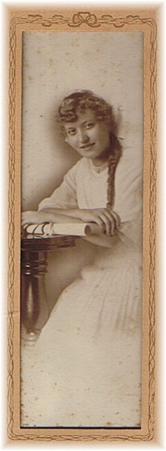

Margery Ethel Wiant Lane
| Birth | : | 5 Aug 1899 Clarke County, Iowa, USA |
| Death | : | 14 Jun 1945 Iowa, USA |
| Burial | : | St James Cemetery, Dover, Dover District, England |
| Coordinate | : | 51.1361389, 1.3146530 |
| Plot | : | 15-02 |
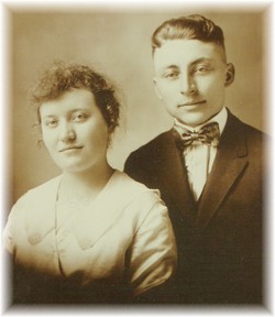
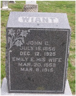
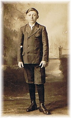
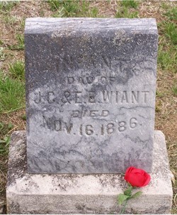
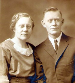
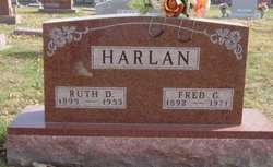
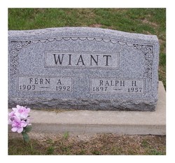
| Description | : | Youngest child of John Charles Fremont Wiant and Emily Ellen Harlan. She married Ralph B. "Hap" Lane on December 24, 1918 in Osceola, Clarke Co, IA. He was the son of Stephen Azro Lane and Nancy Augusta Harris. They had one child, George Arlie Lane. He married Bernadine Ball. They lived in Shawnee Mission, KS. Hap Lane is buried in Memorial Park Cemetery, Burlington, IA with his 2nd wife Cleo Florence Hollenbeck. Margery died age 45 and is buried beside her parents. |
frequently asked questions (FAQ):
-
Where is Margery Ethel Wiant Lane's memorial?
Margery Ethel Wiant Lane's memorial is located at: St James Cemetery, Dover, Dover District, England.
-
When did Margery Ethel Wiant Lane death?
Margery Ethel Wiant Lane death on 14 Jun 1945 in Iowa, USA
-
Where are the coordinates of the Margery Ethel Wiant Lane's memorial?
Latitude: 51.1361389
Longitude: 1.3146530
Family Members:
Parent
Spouse
Siblings
Flowers:


Nearby Cemetories:
1. St James Cemetery
Dover, Dover District, England
Coordinate: 51.1361389, 1.3146530
2. Dover Jewish Cemetery
Dover, Dover District, England
Coordinate: 51.1366310, 1.3106850
3. Charlton Cemetery
Dover, Dover District, England
Coordinate: 51.1366920, 1.3101200
4. St Marys New Cemetery
Dover, Dover District, England
Coordinate: 51.1345300, 1.3073700
5. St Peter and St Paul Churchyard
Dover, Dover District, England
Coordinate: 51.1331673, 1.3062360
6. Dover War Memorial
Dover, Dover District, England
Coordinate: 51.1277847, 1.3091190
7. St Mary in Castro Churchyard
Dover, Dover District, England
Coordinate: 51.1283490, 1.3232430
8. St. James Old Churchyard
Dover, Dover District, England
Coordinate: 51.1261340, 1.3177210
9. St Mary the Virgin Churchyard
Dover, Dover District, England
Coordinate: 51.1259842, 1.3127910
10. Dover Priory (Defunct)
Dover, Dover District, England
Coordinate: 51.1258370, 1.3053770
11. Cowgate Cemetery
Dover, Dover District, England
Coordinate: 51.1237970, 1.3101560
12. St Andrew Churchyard
Buckland, Dover District, England
Coordinate: 51.1373749, 1.2937800
13. St Peter and St Paul Churchyard
River, Dover District, England
Coordinate: 51.1447480, 1.2733710
14. St Peter Churchyard
Whitfield, Dover District, England
Coordinate: 51.1655000, 1.3037000
15. St Augustine's Church
East Langdon, Dover District, England
Coordinate: 51.1654990, 1.3357270
16. Saint Peters Church
Westcliffe, Dover District, England
Coordinate: 51.1542430, 1.3573340
17. St. Peter and St. Paul's Churchyard
Temple Ewell, Dover District, England
Coordinate: 51.1515565, 1.2675213
18. St. Margaret of Antioch Churchyard
St Margarets at Cliffe, Dover District, England
Coordinate: 51.1534950, 1.3714350
19. St Laurence the Martyr Churchyard
Church Hougham, Dover District, England
Coordinate: 51.1137180, 1.2536650
20. All Saints Churchyard
Waldershare, Dover District, England
Coordinate: 51.1875170, 1.2857870
21. Saint Mary the Virgin Churchyard
Lydden, Dover District, England
Coordinate: 51.1658200, 1.2373050
22. St Anthony Churchyard
Alkham, Dover District, England
Coordinate: 51.1360930, 1.2226440
23. Saint Pancras Churchyard
Coldred, Dover District, England
Coordinate: 51.1822600, 1.2529260
24. St. Mary's Churchyard
Capel-le-Ferne, Dover District, England
Coordinate: 51.1149650, 1.2235540