
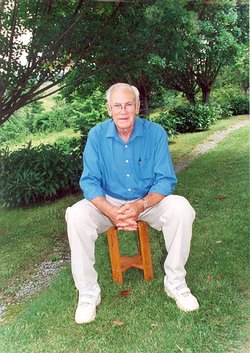

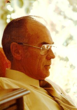
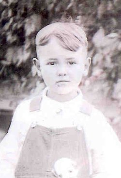


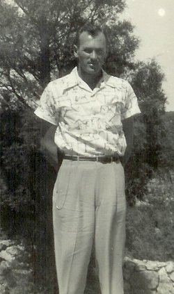

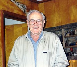
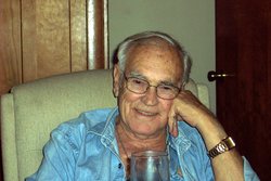
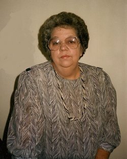
Marion Ralph Craighead
| Birth | : | 2 Jan 1922 Boles, Clay County, Tennessee, USA |
| Death | : | 21 Feb 2007 Tompkinsville, Monroe County, Kentucky, USA |
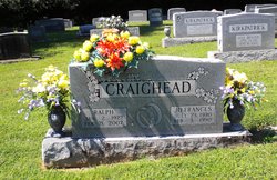
| Burial | : | Fitzgerald Cemetery, Celina, Clay County, USA |
| Coordinate | : | 36.5518990, -85.4966965 |
| Description | : | Marion Ralph Craighead Funeral services for Mr. Marion Ralph Craighead, 85, of Moss, were conducted at 11 a.m. Friday, Feb. 23, 2007, from the chapel of Hall Funeral Home in Celina. Burial was in Fitzgerald Cemetery. Mr. Craighead died Wednesday, Feb. 21 at Monroe County Medical Center. He was a World War II veteran, former principal of Hermitage Springs School, director of Clay County Welfare Department, and regional director of the Department of Human Services. He was a member of Moss Church of Christ. Born January 2, 1922, in the Boles community of Clay County, he... Read More |
frequently asked questions (FAQ):
-
Where is Marion Ralph Craighead's memorial?
Marion Ralph Craighead's memorial is located at: Fitzgerald Cemetery, Celina, Clay County, USA.
-
When did Marion Ralph Craighead death?
Marion Ralph Craighead death on 21 Feb 2007 in Tompkinsville, Monroe County, Kentucky, USA
-
Where are the coordinates of the Marion Ralph Craighead's memorial?
Latitude: 36.5518990
Longitude: -85.4966965
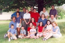
Family Members:
Parent
Spouse
Flowers:


Nearby Cemetories:
1. Hamilton Cemetery
Celina, Clay County, USA
Coordinate: 36.5517271, -85.4970509
2. Old Fitzgerald Cemetery
Celina, Clay County, USA
Coordinate: 36.5509750, -85.4958417
3. Green Cemetery
Celina, Clay County, USA
Coordinate: 36.5496418, -85.5024450
4. Free Hill Cemetery
Clay County, USA
Coordinate: 36.5628014, -85.4955978
5. Gates Cemetery
Celina, Clay County, USA
Coordinate: 36.5422640, -85.4891440
6. Tinsley Cemetery
Cave Springs, Clay County, USA
Coordinate: 36.5527992, -85.4800034
7. Page Family Cemetery
Free Hill, Clay County, USA
Coordinate: 36.5623018, -85.4844294
8. Peterman Bend Cemetery
Celina, Clay County, USA
Coordinate: 36.5370750, -85.4846300
9. Varney Andrews Cemetery
Celina, Clay County, USA
Coordinate: 36.5604650, -85.5209530
10. Stone Cemetery
Clay County, USA
Coordinate: 36.5713997, -85.5136032
11. Walker Cemetery
Celina, Clay County, USA
Coordinate: 36.5372009, -85.4728012
12. Robert Arms Cemetery
Pea Ridge, Clay County, USA
Coordinate: 36.5432790, -85.4657820
13. Plumlee Cemetery
Celina, Clay County, USA
Coordinate: 36.5694280, -85.5282830
14. Dale Davis Cemetery
Clay County, USA
Coordinate: 36.5143600, -85.4685300
15. Ray Williams Cemetery
Pea Ridge, Clay County, USA
Coordinate: 36.5856130, -85.4598120
16. Hamilton Cemetery
Clay County, USA
Coordinate: 36.5181007, -85.5338974
17. Edens-Smith Cemetery
Clay County, USA
Coordinate: 36.5979390, -85.4976300
18. Crawford Cemetery
Celina, Clay County, USA
Coordinate: 36.5979660, -85.4976660
19. Walker Reecer Cemetery
Celina, Clay County, USA
Coordinate: 36.5746290, -85.5480270
20. Dalton Cemetery
Arcott, Clay County, USA
Coordinate: 36.5429540, -85.5546170
21. Key Cemetery
Pea Ridge, Clay County, USA
Coordinate: 36.5875015, -85.4518967
22. Grover Rich Cemetery
Pea Ridge, Clay County, USA
Coordinate: 36.5946370, -85.4602970
23. Bowe Cemetery
Pea Ridge, Clay County, USA
Coordinate: 36.5833015, -85.4439011
24. Mabry Cemetery
Clay County, USA
Coordinate: 36.5139008, -85.5464020