


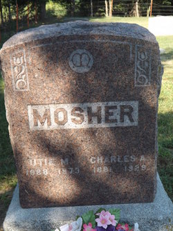
Mary Edwina Wise Mosher
| Birth | : | 19 Aug 1844 Fayette County, Kentucky, USA |
| Death | : | 25 Mar 1914 Arrington, Atchison County, Kansas, USA |
| Burial | : | Lower Amwell Cemetery - New Yard, Sergeantsville, Hunterdon County, USA |
| Coordinate | : | 40.4475098, -74.9133453 |
| Description | : | Mary Edwina Wise was born in Donaville, Fayette County, Ky., Aug. 14, 1844, and died at her home in Arrington, March 25, 1914, aged 69 years, 6 months and 6 days. She was married to Simeon Mosher in Leavenworth, Aug. 8, 1867. To this union were born 9 children, one dying in infancy, one at the age of 8 years and one daughter, Mrs. Melissa Duffy, dying last winter at her home in Canada. The remaining children are: Sydney, Benjamin, Charles and Edward, of this place, and Mrs. Katie Post, of Valley Falls, and Mrs. Lula Brown, of Effingham. She... Read More |
frequently asked questions (FAQ):
-
Where is Mary Edwina Wise Mosher's memorial?
Mary Edwina Wise Mosher's memorial is located at: Lower Amwell Cemetery - New Yard, Sergeantsville, Hunterdon County, USA.
-
When did Mary Edwina Wise Mosher death?
Mary Edwina Wise Mosher death on 25 Mar 1914 in Arrington, Atchison County, Kansas, USA
-
Where are the coordinates of the Mary Edwina Wise Mosher's memorial?
Latitude: 40.4475098
Longitude: -74.9133453
Family Members:
Parent

Spouse
Siblings
Children
Flowers:


Nearby Cemetories:
1. Lower Amwell Cemetery - New Yard
Sergeantsville, Hunterdon County, USA
Coordinate: 40.4475098, -74.9133453
2. Lower Amwell Cemetery - Old Yard
Sergeantsville, Hunterdon County, USA
Coordinate: 40.4479866, -74.9134750
3. Moore Family Burying Ground
Sergeantsville, Hunterdon County, USA
Coordinate: 40.4414400, -74.9008720
4. Rake Family Burying Ground
Sand Brook, Hunterdon County, USA
Coordinate: 40.4598999, -74.9170914
5. Opdycke Cemetery
Hunterdon County, USA
Coordinate: 40.4375000, -74.9250000
6. Sand Brook German Baptist Church Cemetery
Sand Brook, Hunterdon County, USA
Coordinate: 40.4687500, -74.9162216
7. Sutton Farm Cemetery
Hunterdon County, USA
Coordinate: 40.4737206, -74.9048309
8. Barber Burying Ground
Sandy Ridge, Hunterdon County, USA
Coordinate: 40.4190292, -74.9282608
9. Sergeantville Methodist Episcopal Church Cemetery
Sergeantsville, Hunterdon County, USA
Coordinate: 40.4458333, -74.9538880
10. Saint Andrews Episcopal Churchyard
Ringoes, Hunterdon County, USA
Coordinate: 40.4406586, -74.8734360
11. Trout Family Burying Ground
Sand Brook, Hunterdon County, USA
Coordinate: 40.4777778, -74.8972222
12. Servis-Quick Family Cemetery
Ringoes, Hunterdon County, USA
Coordinate: 40.4375000, -74.8722220
13. Kitchen Cemetery
Sand Brook, Hunterdon County, USA
Coordinate: 40.4803810, -74.9092480
14. Union Cemetery
Ringoes, Hunterdon County, USA
Coordinate: 40.4261017, -74.8732986
15. Pine Hill Cemetery
Sergeantsville, Hunterdon County, USA
Coordinate: 40.4580498, -74.9622192
16. Sandy Ridge Cemetery
Sandy Ridge, Hunterdon County, USA
Coordinate: 40.4232178, -74.9541168
17. Geary Gravesite
Amwell, Hunterdon County, USA
Coordinate: 40.4561386, -74.8564301
18. Amwell Ridge Cemetery
Ringoes, Hunterdon County, USA
Coordinate: 40.4415970, -74.8554840
19. Second English Presbyterian Church Cemetery
Amwell, Hunterdon County, USA
Coordinate: 40.3984718, -74.9072189
20. Carmelite Monastery Cemetery
Flemington, Hunterdon County, USA
Coordinate: 40.4976610, -74.8980680
21. Williamson Farm Family Cemetery
Stockton, Hunterdon County, USA
Coordinate: 40.4457220, -74.9818690
22. Locktown Christian Cemetery
Locktown, Hunterdon County, USA
Coordinate: 40.4820137, -74.9694443
23. Valley School Cemetery
Hunterdon County, USA
Coordinate: 40.4981500, -74.8814430
24. Old School Baptist Cemetery
Locktown, Hunterdon County, USA
Coordinate: 40.4844290, -74.9725060