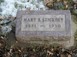
Mary Goforth Stickney
| Birth | : | 16 Nov 1871 Missouri, USA |
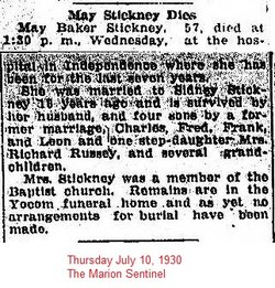
| Death | : | 9 Jul 1930 Marion, Linn County, Iowa, USA |
| Burial | : | Gods Acre Cemetery, Burlington, Racine County, USA |
| Coordinate | : | 42.6741982, -88.2853012 |
| Plot | : | Pioneer Section lot 114 space 9 |
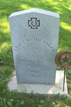
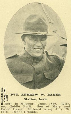
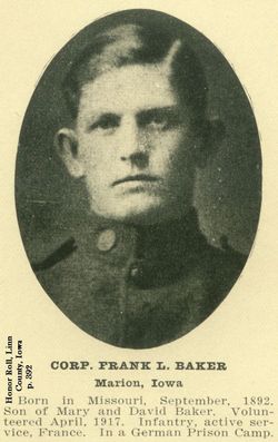
| Description | : | 1st Husband: David Lewis Baker, married in 1890 1910 US Census: Marion, Linn, Iowa Mary Baker, widowed 33 born abt 1877 Missouri Andrew W Baker 19, son divorced born abt 1891 Missouri, father born Kentucky Frank Baker 17 born abt 1893 Missouri, son Sid S Stickney boarder 52 born abt 1858 New Hampshire Elizabeth Stickney boarder, married born abt 1829 New Hampshire ----------------------------- Iowa Marriages: Mary Baker, born Missouri, daughter of Andrew Go..roth and Nettie Calkin, married Sid Stickney, born New Hampshire, son of Daniel Stickney and Elizabeth Hadlock on August 4, 1911 in Davenport, Scott, Iowa -------------------------------- 1920 US Census: Marion, Linn, Iowa Sidney Strong Stickney 66 born abt 1854... Read More |
frequently asked questions (FAQ):
-
Where is Mary Goforth Stickney's memorial?
Mary Goforth Stickney's memorial is located at: Gods Acre Cemetery, Burlington, Racine County, USA.
-
When did Mary Goforth Stickney death?
Mary Goforth Stickney death on 9 Jul 1930 in Marion, Linn County, Iowa, USA
-
Where are the coordinates of the Mary Goforth Stickney's memorial?
Latitude: 42.6741982
Longitude: -88.2853012
Family Members:
Parent
Spouse
Siblings
Children
Flowers:
Nearby Cemetories:
1. Gods Acre Cemetery
Burlington, Racine County, USA
Coordinate: 42.6741982, -88.2853012
2. Saint John the Divine Episcopal Church Columbarium
Burlington, Racine County, USA
Coordinate: 42.6750700, -88.2750200
3. Saint Charles Cemetery
Burlington, Racine County, USA
Coordinate: 42.6739006, -88.3000031
4. Old Voree Cemetery
Spring Prairie, Walworth County, USA
Coordinate: 42.6767100, -88.3062000
5. Burlington Cemetery
Burlington, Racine County, USA
Coordinate: 42.6831017, -88.2585983
6. Rooker Cemetery
Burlington, Racine County, USA
Coordinate: 42.6974983, -88.2925034
7. Old Burlington Cemetery
Burlington, Racine County, USA
Coordinate: 42.6843500, -88.2522500
8. Frank Williams Cemetery
Spring Prairie, Walworth County, USA
Coordinate: 42.7048600, -88.3218000
9. Diener Cemetery
Spring Prairie, Walworth County, USA
Coordinate: 42.7049490, -88.3219990
10. Mount Hope Cemetery
Spring Prairie, Walworth County, USA
Coordinate: 42.7006400, -88.3356900
11. Hudson Cemetery
Lyons, Walworth County, USA
Coordinate: 42.6577988, -88.3585968
12. Karcher Cemetery
Burlington, Racine County, USA
Coordinate: 42.6215800, -88.2535400
13. Lyons Quaker Cemetery
Lyons, Walworth County, USA
Coordinate: 42.6402300, -88.3577500
14. High Street Cemetery
Wheatland, Kenosha County, USA
Coordinate: 42.6067009, -88.2668991
15. Saint Josephs Catholic Cemetery
Lyons, Walworth County, USA
Coordinate: 42.6371994, -88.3668976
16. Honey Creek Cemetery
Rochester, Racine County, USA
Coordinate: 42.7478300, -88.3059200
17. West Meadows Cemetery
Rochester, Racine County, USA
Coordinate: 42.7203760, -88.2021470
18. Honey Creek Memorial Cemetery
Rochester, Racine County, USA
Coordinate: 42.7494800, -88.3073400
19. Rochester Cemetery
Rochester, Racine County, USA
Coordinate: 42.7444900, -88.2386800
20. Eagle Creek Religious Society Cemetery
Burlington, Racine County, USA
Coordinate: 42.7143500, -88.1936900
21. German Settlement Cemetery
Spring Prairie, Walworth County, USA
Coordinate: 42.7413800, -88.3622200
22. Rosewood Cemetery
Rosewood, Racine County, USA
Coordinate: 42.6840800, -88.1650300
23. Saint Johns Evangelical Lutheran Cemetery
Slades Corners, Kenosha County, USA
Coordinate: 42.5824780, -88.2837510
24. Springfield Union Cemetery
Springfield, Walworth County, USA
Coordinate: 42.6556900, -88.4131900

