
| Birth | : | 6 Nov 1918 Ellis, Ellis County, Kansas, USA |
| Death | : | 26 Mar 2007 USA |
| Burial | : | Saint Joseph Cemetery, Council Bluffs, Pottawattamie County, USA |
| Coordinate | : | 41.2722015, -95.8208008 |
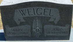
| Description | : | Mary Krannawitter, age 88, passed away March 26, 2007. She was born in Ellis, Kan., on November 6, 1918, to John A. and Mary (Dreiling) Weigel. Mary married James Krannawitter on November 7, 1938, and they moved to Council Bluffs in 1950. She had previously worked at Benos Department Store and Hinky Dinky Grocery Store. Mary is a member of the Holy Family Church, a founding member of their church quilting group, a member of Sew-N-Sews, and Catholic Daughters of American. Survivors include husband, James; daughter, Mary Kay Quigley and her husband, Tom, all of Council Bluffs; son, Jim and his wife,... Read More |
frequently asked questions (FAQ):
-
Where is Mary Weigel Krannawitter's memorial?
Mary Weigel Krannawitter's memorial is located at: Saint Joseph Cemetery, Council Bluffs, Pottawattamie County, USA.
-
When did Mary Weigel Krannawitter death?
Mary Weigel Krannawitter death on 26 Mar 2007 in USA
-
Where are the coordinates of the Mary Weigel Krannawitter's memorial?
Latitude: 41.2722015
Longitude: -95.8208008
Family Members:
Parent

Spouse

Siblings
Flowers:


Nearby Cemetories:
1. Saint Joseph Cemetery
Council Bluffs, Pottawattamie County, USA
Coordinate: 41.2722015, -95.8208008
2. Bikhor Cholim Cemetery
Council Bluffs, Pottawattamie County, USA
Coordinate: 41.2703670, -95.8229350
3. Oak Hill Cemetery
Council Bluffs, Pottawattamie County, USA
Coordinate: 41.2700900, -95.8226400
4. Green Valley Cemetery
Council Bluffs, Pottawattamie County, USA
Coordinate: 41.2743988, -95.8225021
5. Cedar Lawn Cemetery
Council Bluffs, Pottawattamie County, USA
Coordinate: 41.2694016, -95.8182983
6. Walnut Hill Cemetery
Council Bluffs, Pottawattamie County, USA
Coordinate: 41.2719002, -95.8255997
7. Ridgewood Cemetery
Council Bluffs, Pottawattamie County, USA
Coordinate: 41.2694016, -95.8272018
8. Memorial Park Cemetery
Council Bluffs, Pottawattamie County, USA
Coordinate: 41.2644005, -95.8261032
9. Clark Cemetery
Pottawattamie County, USA
Coordinate: 41.2551610, -95.8223390
10. Fairview Cemetery
Council Bluffs, Pottawattamie County, USA
Coordinate: 41.2703018, -95.8480988
11. Garner Cemetery
Council Bluffs, Pottawattamie County, USA
Coordinate: 41.2956161, -95.8001709
12. Stoker-Graybill Cemetery
Council Bluffs, Pottawattamie County, USA
Coordinate: 41.2532620, -95.7751770
13. Maple Grove Cemetery
Council Bluffs, Pottawattamie County, USA
Coordinate: 41.2265560, -95.8187100
14. Evans Cemetery
Crescent, Pottawattamie County, USA
Coordinate: 41.3255997, -95.8368988
15. Lewis Township Cemetery
Council Bluffs, Pottawattamie County, USA
Coordinate: 41.2117004, -95.7938995
16. Gregg Cemetery
Weston, Pottawattamie County, USA
Coordinate: 41.3330000, -95.7931000
17. Council Point Cemetery
Council Bluffs, Pottawattamie County, USA
Coordinate: 41.2110830, -95.8788610
18. Hazel Dell Cemetery
Council Bluffs, Pottawattamie County, USA
Coordinate: 41.3489723, -95.7939911
19. Trinity Cathedral Columbarium
Omaha, Douglas County, USA
Coordinate: 41.2603900, -95.9393660
20. Saint Columbanus Cemetery
Weston, Pottawattamie County, USA
Coordinate: 41.3429440, -95.7435260
21. Crescent Cemetery
Crescent, Pottawattamie County, USA
Coordinate: 41.3664894, -95.8566208
22. Prospect Hill Cemetery
Omaha, Douglas County, USA
Coordinate: 41.2780991, -95.9593964
23. First Central Congregational Columbarium
Omaha, Douglas County, USA
Coordinate: 41.2563456, -95.9658365
24. Saint Pauls Evangelical Country Church Cemetery
Dumfries, Pottawattamie County, USA
Coordinate: 41.1748352, -95.7492371