
| Birth | : | 21 Apr 1915 Glenwood, Mills County, Iowa, USA |
| Death | : | 9 Mar 2008 Glenwood, Mills County, Iowa, USA |
| Burial | : | Saint Joseph Cemetery, Council Bluffs, Pottawattamie County, USA |
| Coordinate | : | 41.2722015, -95.8208008 |
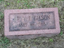
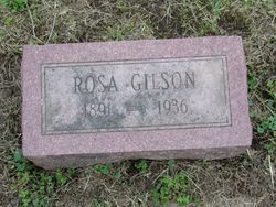
| Description | : | May Dinovo, 92, of Glenwood, Iowa, formerly of Council Bluffs, Iowa, entered into eternal rest at her daughter's home in Glenwood. She was born April 21, 1915 in Glenwood, Iowa to Orvey and Rosa (Rotter) Gilson. May was united in marriage to Joseph Dinovo on December 22, 1933 in Council Bluffs, Iowa. The couple co-owned Dinovo Shoe Repair in Council Bluffs for many years. May enjoyed sewing, traveling and spending time with her grandchildren. She was a faithful member of Holy Rosary Catholic Church in Glenwood. Preceding May in death were her parents, daughter Rose Kern in 1969, husband Joseph... Read More |
frequently asked questions (FAQ):
-
Where is May Veronica Gilson Dinovo's memorial?
May Veronica Gilson Dinovo's memorial is located at: Saint Joseph Cemetery, Council Bluffs, Pottawattamie County, USA.
-
When did May Veronica Gilson Dinovo death?
May Veronica Gilson Dinovo death on 9 Mar 2008 in Glenwood, Mills County, Iowa, USA
-
Where are the coordinates of the May Veronica Gilson Dinovo's memorial?
Latitude: 41.2722015
Longitude: -95.8208008
Family Members:
Parent
Spouse

Siblings
Children
Flowers:


Nearby Cemetories:
1. Saint Joseph Cemetery
Council Bluffs, Pottawattamie County, USA
Coordinate: 41.2722015, -95.8208008
2. Bikhor Cholim Cemetery
Council Bluffs, Pottawattamie County, USA
Coordinate: 41.2703670, -95.8229350
3. Oak Hill Cemetery
Council Bluffs, Pottawattamie County, USA
Coordinate: 41.2700900, -95.8226400
4. Green Valley Cemetery
Council Bluffs, Pottawattamie County, USA
Coordinate: 41.2743988, -95.8225021
5. Cedar Lawn Cemetery
Council Bluffs, Pottawattamie County, USA
Coordinate: 41.2694016, -95.8182983
6. Walnut Hill Cemetery
Council Bluffs, Pottawattamie County, USA
Coordinate: 41.2719002, -95.8255997
7. Ridgewood Cemetery
Council Bluffs, Pottawattamie County, USA
Coordinate: 41.2694016, -95.8272018
8. Memorial Park Cemetery
Council Bluffs, Pottawattamie County, USA
Coordinate: 41.2644005, -95.8261032
9. Clark Cemetery
Pottawattamie County, USA
Coordinate: 41.2551610, -95.8223390
10. Fairview Cemetery
Council Bluffs, Pottawattamie County, USA
Coordinate: 41.2703018, -95.8480988
11. Garner Cemetery
Council Bluffs, Pottawattamie County, USA
Coordinate: 41.2956161, -95.8001709
12. Stoker-Graybill Cemetery
Council Bluffs, Pottawattamie County, USA
Coordinate: 41.2532620, -95.7751770
13. Maple Grove Cemetery
Council Bluffs, Pottawattamie County, USA
Coordinate: 41.2265560, -95.8187100
14. Evans Cemetery
Crescent, Pottawattamie County, USA
Coordinate: 41.3255997, -95.8368988
15. Lewis Township Cemetery
Council Bluffs, Pottawattamie County, USA
Coordinate: 41.2117004, -95.7938995
16. Gregg Cemetery
Weston, Pottawattamie County, USA
Coordinate: 41.3330000, -95.7931000
17. Council Point Cemetery
Council Bluffs, Pottawattamie County, USA
Coordinate: 41.2110830, -95.8788610
18. Hazel Dell Cemetery
Council Bluffs, Pottawattamie County, USA
Coordinate: 41.3489723, -95.7939911
19. Trinity Cathedral Columbarium
Omaha, Douglas County, USA
Coordinate: 41.2603900, -95.9393660
20. Saint Columbanus Cemetery
Weston, Pottawattamie County, USA
Coordinate: 41.3429440, -95.7435260
21. Crescent Cemetery
Crescent, Pottawattamie County, USA
Coordinate: 41.3664894, -95.8566208
22. Prospect Hill Cemetery
Omaha, Douglas County, USA
Coordinate: 41.2780991, -95.9593964
23. First Central Congregational Columbarium
Omaha, Douglas County, USA
Coordinate: 41.2563456, -95.9658365
24. Saint Pauls Evangelical Country Church Cemetery
Dumfries, Pottawattamie County, USA
Coordinate: 41.1748352, -95.7492371