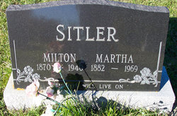
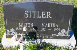
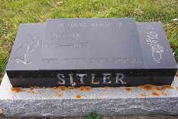
Milton Sitler
| Birth | : | 11 Nov 1870 Woolwich Township, Waterloo Regional Municipality, Ontario, Canada |
| Death | : | 31 Dec 1940 Camrose, Lloydminster Census Division, Alberta, Canada |
| Burial | : | St. Peter Churchyard, Newton Bromswold, East Northamptonshire Borough, England |
| Coordinate | : | 52.2815200, -0.5376600 |
| Description | : | Sitler Milton, son of Isaac and Hannah (Groh) Sitler, was born in Waterloo Co., Ont., Nov. 11, 1870; died Dec. 31, 1940 in the Camrose Hospital; aged 70 y. 1 m. 20 d. For the past few years he had been suffering from diabetes, but the immediate cause of his death was heart failure. At the age of 25 he went to Osceola Co., Iowa, where he stayed for five years. From here he moved to Mayton, Alberta, where he took up a homestead. In 1906 he was united in marriage to Martha Wideman. To this union were born... Read More |
frequently asked questions (FAQ):
-
Where is Milton Sitler's memorial?
Milton Sitler's memorial is located at: St. Peter Churchyard, Newton Bromswold, East Northamptonshire Borough, England.
-
When did Milton Sitler death?
Milton Sitler death on 31 Dec 1940 in Camrose, Lloydminster Census Division, Alberta, Canada
-
Where are the coordinates of the Milton Sitler's memorial?
Latitude: 52.2815200
Longitude: -0.5376600
Family Members:
Parent
Spouse
Siblings
Children
Flowers:
Nearby Cemetories:
1. St. Peter Churchyard
Newton Bromswold, East Northamptonshire Borough, England
Coordinate: 52.2815200, -0.5376600
2. St. Mary the Virgin Churchyard
Yelden, Bedford Borough, England
Coordinate: 52.2930600, -0.5182700
3. St. Margaret of Antioch Churchyard
Knotting, Bedford Borough, England
Coordinate: 52.2599172, -0.5323686
4. St. Mary Magdalene Churchyard
Melchbourne, Bedford Borough, England
Coordinate: 52.2770600, -0.4935690
5. Newton Road Cemetery
Rushden, East Northamptonshire Borough, England
Coordinate: 52.2882140, -0.5859750
6. St. John the Baptist Churchyard
Chelveston, East Northamptonshire Borough, England
Coordinate: 52.3112800, -0.5501200
7. St Mary Churchyard
Rushden, East Northamptonshire Borough, England
Coordinate: 52.2885570, -0.5973860
8. All Saints Churchyard
Souldrop, Bedford Borough, England
Coordinate: 52.2433000, -0.5584000
9. St Lawrence Churchyard
Wymington, Bedford Borough, England
Coordinate: 52.2694310, -0.6017230
10. St Mary the Virgin Churchyard
Shelton, Bedford Borough, England
Coordinate: 52.3076000, -0.4852000
11. St. Mary the Virgin Churchyard
Higham Ferrers, East Northamptonshire Borough, England
Coordinate: 52.3065500, -0.5915240
12. Higham Ferrers Cemetery
Higham Ferrers, East Northamptonshire Borough, England
Coordinate: 52.3084850, -0.5945270
13. All Saints Churchyard
Riseley, Bedford Borough, England
Coordinate: 52.2560000, -0.4785000
14. All Saints Churchyard
Upper Dean, Bedford Borough, England
Coordinate: 52.2969000, -0.4664000
15. Dean URC Cemetery
Upper Dean, Bedford Borough, England
Coordinate: 52.2999756, -0.4634887
16. Stanwick Cemetery
Stanwick, East Northamptonshire Borough, England
Coordinate: 52.3298800, -0.5531500
17. St. Laurence Churchyard Stanwick
Stanwick, East Northamptonshire Borough, England
Coordinate: 52.3324970, -0.5628585
18. St. Nicholas Churchyard
Swineshead, Bedford Borough, England
Coordinate: 52.2805558, -0.4506214
19. All Hallow's Church Hargrave Churchyard
Hargrave, East Northamptonshire Borough, England
Coordinate: 52.3242316, -0.4800580
20. St. Peter's Churchyard
Sharnbrook, Bedford Borough, England
Coordinate: 52.2255210, -0.5468540
21. St Mary the Virgin Churchyard
Podington, Bedford Borough, England
Coordinate: 52.2539100, -0.6220900
22. St Peter's Churchyard
Irthlingborough, East Northamptonshire Borough, England
Coordinate: 52.3251642, -0.6101925
23. Irchester Saint Katherine Churchyard
Irchester, Wellingborough Borough, England
Coordinate: 52.2843900, -0.6446900
24. St. Michael's Church
Farndish, Bedford Borough, England
Coordinate: 52.2638108, -0.6416839


