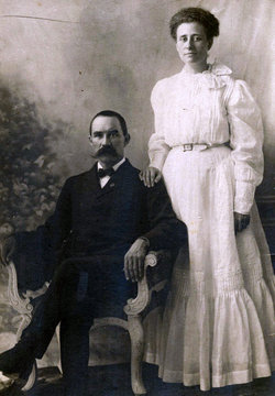
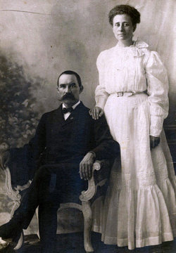
Minnie M. Mull Linker
| Birth | : | 31 Aug 1879 Wayne County, Indiana, USA |
| Death | : | 18 Oct 1906 Danville, City of Tshwane Metropolitan Municipality, Gauteng, South Africa |
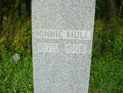
| Burial | : | St Paul Churchyard, Sarisbury, Fareham Borough, England |
| Coordinate | : | 50.8756100, -1.2870670 |
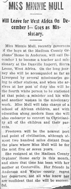
| Description | : | Minnie, of Sierra Leone, West Africa, a United Brethren missionary married Charles Linker on June 27, 1906, in Freetown, Sierra Leone. At the time, they were the only UB missionaries on the field. They chose June because children at the two homes at the Danville station in Gbangbaia were on vacation. Four months later, Minnie was dead. And she would not be the only missionary to die there. In 1900, the Women’s Missionary Association decided to build a home for girls at the Danville station in Gbangbaia. Rev. B. O. and Margaret Hazzard arrived in September... Read More |
frequently asked questions (FAQ):
-
Where is Minnie M. Mull Linker's memorial?
Minnie M. Mull Linker's memorial is located at: St Paul Churchyard, Sarisbury, Fareham Borough, England.
-
When did Minnie M. Mull Linker death?
Minnie M. Mull Linker death on 18 Oct 1906 in Danville, City of Tshwane Metropolitan Municipality, Gauteng, South Africa
-
Where are the coordinates of the Minnie M. Mull Linker's memorial?
Latitude: 50.8756100
Longitude: -1.2870670
Family Members:
Parent
Spouse
Siblings
Flowers:
Nearby Cemetories:
1. St Paul Churchyard
Sarisbury, Fareham Borough, England
Coordinate: 50.8756100, -1.2870670
2. Holly Hill Cemetery
Sarisbury, Fareham Borough, England
Coordinate: 50.8678930, -1.2888890
3. St. Leonard Churchyard
Bursledon, Eastleigh Borough, England
Coordinate: 50.8850230, -1.3068370
4. St John's Cemetery
Locks Heath, Fareham Borough, England
Coordinate: 50.8608400, -1.2651570
5. St Andrew the Apostle Churchyard
Hamble-le-Rice, Eastleigh Borough, England
Coordinate: 50.8589100, -1.3179090
6. St Mary Churchyard
Warsash, Fareham Borough, England
Coordinate: 50.8473220, -1.2910610
7. St Mary the Virgin Churchyard
Hound, Eastleigh Borough, England
Coordinate: 50.8762820, -1.3322160
8. Netley Military Cemetery
Netley, Eastleigh Borough, England
Coordinate: 50.8682632, -1.3317170
9. St Bartholomew Churchyard
Botley, Eastleigh Borough, England
Coordinate: 50.9048000, -1.2754000
10. Albert Road Cemetery
Hedge End, Eastleigh Borough, England
Coordinate: 50.9066535, -1.3099266
11. St John the Evangelist Churchyard
Hedge End, Eastleigh Borough, England
Coordinate: 50.9089200, -1.3091100
12. All Saints Churchyard
Botley, Eastleigh Borough, England
Coordinate: 50.9143000, -1.2737000
13. Posbrook Lane Cemetery
Titchfield, Fareham Borough, England
Coordinate: 50.8463100, -1.2403000
14. St. Peter's Churchyard
Titchfield, Fareham Borough, England
Coordinate: 50.8490620, -1.2330780
15. St Mary Extra Cemetery
Southampton, Southampton Unitary Authority, England
Coordinate: 50.8948700, -1.3522600
16. St Mary Churchyard
Sholing, Southampton Unitary Authority, England
Coordinate: 50.8991260, -1.3571350
17. Holy Trinity Churchyard
Southampton, Southampton Unitary Authority, England
Coordinate: 50.8896750, -1.3659150
18. St Peter Churchyard
Curdridge, City of Winchester, England
Coordinate: 50.9219470, -1.2499850
19. Knowle Hospital Cemetery
Fareham, Fareham Borough, England
Coordinate: 50.8849120, -1.2043980
20. Redcote Convent Cemetery
Bitterne, Southampton Unitary Authority, England
Coordinate: 50.9168600, -1.3510700
21. St James Churchyard
West End, Eastleigh Borough, England
Coordinate: 50.9243200, -1.3382300
22. St. James' Church Cemetery
West End, Eastleigh Borough, England
Coordinate: 50.9267690, -1.3326580
23. Crofton Cemetery
Stubbington, Fareham Borough, England
Coordinate: 50.8364160, -1.2173260
24. Holy Saviour Churchyard
Bitterne, Southampton Unitary Authority, England
Coordinate: 50.9138840, -1.3583560

