
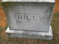
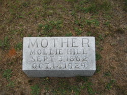
Mollie A Tolbert Hill
| Birth | : | 3 Sep 1862 Virginia, USA |
| Death | : | 14 Oct 1929 |
| Burial | : | St Cuthbert's Churchyard, Greenhead, Northumberland Unitary Authority, England |
| Coordinate | : | 54.9813930, -2.5324120 |
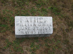
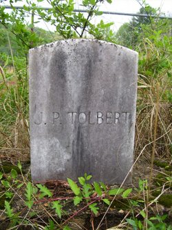
| Description | : | Father: Elisha Washington Tolbert Mother: Margie Frances Grover Marriage 1 William G Hill Children Racy Velna Hill Minnie Hill Nealie Hill |
frequently asked questions (FAQ):
-
Where is Mollie A Tolbert Hill's memorial?
Mollie A Tolbert Hill's memorial is located at: St Cuthbert's Churchyard, Greenhead, Northumberland Unitary Authority, England.
-
When did Mollie A Tolbert Hill death?
Mollie A Tolbert Hill death on 14 Oct 1929 in
-
Where are the coordinates of the Mollie A Tolbert Hill's memorial?
Latitude: 54.9813930
Longitude: -2.5324120
Family Members:
Parent

Spouse
Siblings
Children

Flowers:


Nearby Cemetories:
1. St Cuthbert's Churchyard
Greenhead, Northumberland Unitary Authority, England
Coordinate: 54.9813930, -2.5324120
2. St Mary Magdalene Churchyard
Gilsland, Northumberland Unitary Authority, England
Coordinate: 54.9989150, -2.5743860
3. Haltwhistle Cemetery
Haltwhistle, Northumberland Unitary Authority, England
Coordinate: 54.9652600, -2.4740100
4. Holy Cross Churchyard
Haltwhistle, Northumberland Unitary Authority, England
Coordinate: 54.9699900, -2.4583480
5. St Cuthbert's Churchyard
Nether Denton, City of Carlisle, England
Coordinate: 54.9743370, -2.6340210
6. Cowburn Primitive Methodist Chapel
Cowburn, Northumberland Unitary Authority, England
Coordinate: 55.0034880, -2.4323380
7. St Mary & St Patrick Churchyard
Lambley, Northumberland Unitary Authority, England
Coordinate: 54.9209060, -2.5122140
8. Friends Meeting House Cemetery
Coanwood, Northumberland Unitary Authority, England
Coordinate: 54.9241920, -2.4540450
9. All Hallows Churchyard
Henshaw, Northumberland Unitary Authority, England
Coordinate: 54.9731030, -2.3704408
10. Lanercost Priory
Lanercost, City of Carlisle, England
Coordinate: 54.9659840, -2.6954990
11. St Thomas a Becket
Farlam, City of Carlisle, England
Coordinate: 54.9319760, -2.6751970
12. St Jude's Churchyard
Knarsdale, Northumberland Unitary Authority, England
Coordinate: 54.8817960, -2.5024290
13. Beltingham Cemetery
Beltingham, Northumberland Unitary Authority, England
Coordinate: 54.9690700, -2.3312200
14. St. Cuthbert's Churchyard
Beltingham, Northumberland Unitary Authority, England
Coordinate: 54.9694330, -2.3305080
15. St. Cuthbert's Churchyard
Bewcastle, City of Carlisle, England
Coordinate: 55.0635980, -2.6821690
16. Bewcastle Cemetery
Bewcastle, City of Carlisle, England
Coordinate: 55.0630549, -2.6909662
17. St Mary's Churchyard
Walton, City of Carlisle, England
Coordinate: 54.9725960, -2.7483910
18. St. Martin's Churchyard
Brampton, City of Carlisle, England
Coordinate: 54.9416500, -2.7378200
19. Brampton Cemetery
Brampton, City of Carlisle, England
Coordinate: 54.9457080, -2.7631810
20. St Peter Churchyard
Castle Carrock, City of Carlisle, England
Coordinate: 54.8913590, -2.7133890
21. St. Martin's Old Churchyard
Brampton, City of Carlisle, England
Coordinate: 54.9461250, -2.7664640
22. Holy Paraclete Churchyard
Kirkhaugh, Northumberland Unitary Authority, England
Coordinate: 54.8385700, -2.4695550
23. St. Kentigern Churchyard
Irthington, City of Carlisle, England
Coordinate: 54.9467410, -2.7842350
24. Keenley Methodist Chapel Graveyard
Allendale, Northumberland Unitary Authority, England
Coordinate: 54.9053170, -2.3075580