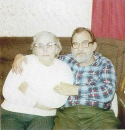
| Birth | : | 14 May 1916 Colebrook, Ashtabula County, Ohio, USA |
| Death | : | 5 Oct 1996 Orwell, Ashtabula County, Ohio, USA |
| Burial | : | Ryde Cemetery, Ryde, Isle of Wight Unitary Authority, England |
| Coordinate | : | 50.7249730, -1.1668550 |
| Description | : | Orlan C. Rodgers ORWELL-Orlan C. "Mickey" Rodgers, 80, died Saturday, Oct. 5, 1996, at Grand Valley Country Manor in Windsor Township. He was born May 14, 1916 in Colebrook, the son of Gaylord Rodgers and Bertha Cleve. Mr. Rodgers worked for Welded Tube Inc., Orwell, for 30 years. He retired as plant manager. From 1955 to 1958, he was a member of Orwell Village Council. He was a member of Orwell United Methodist Church, Symbol Lodge 452, New Lyme; and a 32nd degree Mason at Valley of Cleveland Lodge. He enjoyed hunting, fishing, golfing and working with sports cars. Survivors include three sons, Ronald... Read More |
frequently asked questions (FAQ):
-
Where is Orlan Cleeve “Mickey” Rodgers's memorial?
Orlan Cleeve “Mickey” Rodgers's memorial is located at: Ryde Cemetery, Ryde, Isle of Wight Unitary Authority, England.
-
When did Orlan Cleeve “Mickey” Rodgers death?
Orlan Cleeve “Mickey” Rodgers death on 5 Oct 1996 in Orwell, Ashtabula County, Ohio, USA
-
Where are the coordinates of the Orlan Cleeve “Mickey” Rodgers's memorial?
Latitude: 50.7249730
Longitude: -1.1668550
Family Members:
Parent
Spouse
Siblings
Flowers:
Nearby Cemetories:
1. Ryde Cemetery
Ryde, Isle of Wight Unitary Authority, England
Coordinate: 50.7249730, -1.1668550
2. St Thomas Churchyard
Ryde, Isle of Wight Unitary Authority, England
Coordinate: 50.7305600, -1.1632540
3. Binstead Cemetery
Binstead, Isle of Wight Unitary Authority, England
Coordinate: 50.7264610, -1.1866180
4. St Cecilia's Abbey
Ryde, Isle of Wight Unitary Authority, England
Coordinate: 50.7279800, -1.1463120
5. Holy Cross Churchyard
Binstead, Isle of Wight Unitary Authority, England
Coordinate: 50.7320080, -1.1863070
6. St. Johns Churchyard
Ryde, Isle of Wight Unitary Authority, England
Coordinate: 50.7149770, -1.1482370
7. Quarr Old Abbey
Ryde, Isle of Wight Unitary Authority, England
Coordinate: 50.7310000, -1.1996000
8. Quarr Abbey
Binstead, Isle of Wight Unitary Authority, England
Coordinate: 50.7311862, -1.2034333
9. St Peter's
Havenstreet, Isle of Wight Unitary Authority, England
Coordinate: 50.7095580, -1.2063290
10. St. Edmund's Churchyard
Wootton, Isle of Wight Unitary Authority, England
Coordinate: 50.7308220, -1.2344490
11. St Mary the Virgin Churchyard
Brading, Isle of Wight Unitary Authority, England
Coordinate: 50.6824400, -1.1429600
12. Isle of Wight Crematorium
Whippingham, Isle of Wight Unitary Authority, England
Coordinate: 50.7217910, -1.2573910
13. St. Mark's Churchyard
Alverstoke, Gosport Borough, England
Coordinate: 50.7826800, -1.1436100
14. Clayhall Naval Cemetery
Gosport, Gosport Borough, England
Coordinate: 50.7833862, -1.1373420
15. Turkish Naval Cemetery
Gosport, Gosport Borough, England
Coordinate: 50.7840710, -1.1383980
16. St Mary Churchyard
Alverstoke, Gosport Borough, England
Coordinate: 50.7856760, -1.1480810
17. Lane End Cemetery
Bembridge, Isle of Wight Unitary Authority, England
Coordinate: 50.6863554, -1.0809575
18. St. Mildred's Churchyard
Whippingham, Isle of Wight Unitary Authority, England
Coordinate: 50.7398230, -1.2768350
19. Christ Churchyard
Sandown, Isle of Wight Unitary Authority, England
Coordinate: 50.6521319, -1.1621056
20. Portsmouth Naval Memorial
Portsmouth, Portsmouth Unitary Authority, England
Coordinate: 50.7824440, -1.0957720
21. Ann's Hill Cemetery
Gosport, Gosport Borough, England
Coordinate: 50.7982670, -1.1549450
22. Holy Trinity Churchyard
Gosport, Gosport Borough, England
Coordinate: 50.7930600, -1.1207620
23. Lake Cemetery
Lake, Isle of Wight Unitary Authority, England
Coordinate: 50.6498713, -1.1734786
24. Royal Garrison Church Churchyard
Plymouth, Plymouth Unitary Authority, England
Coordinate: 50.7889690, -1.1039650


