
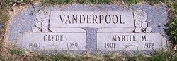
| Birth | : | 4 Mar 1860 Mercer County, Missouri, USA |
| Death | : | 6 Jan 1933 Council Bluffs, Pottawattamie County, Iowa, USA |
| Burial | : | Memorial Park Cemetery, Council Bluffs, Pottawattamie County, USA |
| Coordinate | : | 41.2644005, -95.8261032 |
| Plot | : | Eastlawn, lot 006.05, grave 4 |
| Description | : | Phillip was the son of Elisha Vanderpool and Mary (Polly) Wild. He married Mary Jane Manley, 1887, in Iowa County, IA, and they had eight children. Home in 1900: Hamburg, Fremont, Iowa (1 Jun) Philip Vanderpool, 40, Mar 1860, MO-KY-TN, Married 12 years, Blacksmith Mary Vanderpool, 30, Nov 1869, IA-IA-IA, Children 5/5 Victor Vanderpool, 11, Dec 1888, IA Celia Vanderpool, 9, Oct 1890, IA Ralph Vanderpool, 7, Mar 1893, IA Iva Vanderpool, 4, Sep 1895, IA Katie Vanderpool, 2, Apr 1898, IA Philip Anthony Vanderpool, 73, a resident of Council Bluffs for twenty-seven years, died at the home of his son at 2148 Avenue K Friday. Death resulted from... Read More |
frequently asked questions (FAQ):
-
Where is Phillip Anthony “Tab” Vanderpool's memorial?
Phillip Anthony “Tab” Vanderpool's memorial is located at: Memorial Park Cemetery, Council Bluffs, Pottawattamie County, USA.
-
When did Phillip Anthony “Tab” Vanderpool death?
Phillip Anthony “Tab” Vanderpool death on 6 Jan 1933 in Council Bluffs, Pottawattamie County, Iowa, USA
-
Where are the coordinates of the Phillip Anthony “Tab” Vanderpool's memorial?
Latitude: 41.2644005
Longitude: -95.8261032
Family Members:
Parent
Spouse

Children
Flowers:


Nearby Cemetories:
1. Memorial Park Cemetery
Council Bluffs, Pottawattamie County, USA
Coordinate: 41.2644005, -95.8261032
2. Ridgewood Cemetery
Council Bluffs, Pottawattamie County, USA
Coordinate: 41.2694016, -95.8272018
3. Oak Hill Cemetery
Council Bluffs, Pottawattamie County, USA
Coordinate: 41.2700900, -95.8226400
4. Bikhor Cholim Cemetery
Council Bluffs, Pottawattamie County, USA
Coordinate: 41.2703670, -95.8229350
5. Walnut Hill Cemetery
Council Bluffs, Pottawattamie County, USA
Coordinate: 41.2719002, -95.8255997
6. Cedar Lawn Cemetery
Council Bluffs, Pottawattamie County, USA
Coordinate: 41.2694016, -95.8182983
7. Saint Joseph Cemetery
Council Bluffs, Pottawattamie County, USA
Coordinate: 41.2722015, -95.8208008
8. Clark Cemetery
Pottawattamie County, USA
Coordinate: 41.2551610, -95.8223390
9. Green Valley Cemetery
Council Bluffs, Pottawattamie County, USA
Coordinate: 41.2743988, -95.8225021
10. Fairview Cemetery
Council Bluffs, Pottawattamie County, USA
Coordinate: 41.2703018, -95.8480988
11. Garner Cemetery
Council Bluffs, Pottawattamie County, USA
Coordinate: 41.2956161, -95.8001709
12. Maple Grove Cemetery
Council Bluffs, Pottawattamie County, USA
Coordinate: 41.2265560, -95.8187100
13. Stoker-Graybill Cemetery
Council Bluffs, Pottawattamie County, USA
Coordinate: 41.2532620, -95.7751770
14. Lewis Township Cemetery
Council Bluffs, Pottawattamie County, USA
Coordinate: 41.2117004, -95.7938995
15. Evans Cemetery
Crescent, Pottawattamie County, USA
Coordinate: 41.3255997, -95.8368988
16. Council Point Cemetery
Council Bluffs, Pottawattamie County, USA
Coordinate: 41.2110830, -95.8788610
17. Gregg Cemetery
Weston, Pottawattamie County, USA
Coordinate: 41.3330000, -95.7931000
18. Trinity Cathedral Columbarium
Omaha, Douglas County, USA
Coordinate: 41.2603900, -95.9393660
19. Hazel Dell Cemetery
Council Bluffs, Pottawattamie County, USA
Coordinate: 41.3489723, -95.7939911
20. Saint Columbanus Cemetery
Weston, Pottawattamie County, USA
Coordinate: 41.3429440, -95.7435260
21. Prospect Hill Cemetery
Omaha, Douglas County, USA
Coordinate: 41.2780991, -95.9593964
22. Crescent Cemetery
Crescent, Pottawattamie County, USA
Coordinate: 41.3664894, -95.8566208
23. First Central Congregational Columbarium
Omaha, Douglas County, USA
Coordinate: 41.2563456, -95.9658365
24. Saint Pauls Evangelical Country Church Cemetery
Dumfries, Pottawattamie County, USA
Coordinate: 41.1748352, -95.7492371