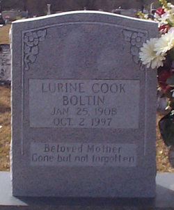
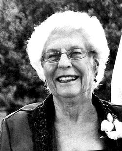
| Birth | : | 19 Sep 1928 Orangeburg County, South Carolina, USA |
| Death | : | 3 Dec 2006 Orangeburg, Orangeburg County, South Carolina, USA |
| Burial | : | St Everilda Churchyard, Nether Poppleton, York Unitary Authority, England |
| Coordinate | : | 53.9882060, -1.1403710 |
| Description | : | Obituary in THE TIMES AND DEMOCRAT, Orangeburg, SC, 4 Dec 2006: Mrs. Priscilla Boltin Wannamaker, 78, of 170 Sugar Maple Road, St. Matthews, died Sunday, Dec. 3, 2006, at The Regional Medical Center in Orangeburg. Funeral services will be held at 3 p.m. Tuesday, Dec. 5, at West Bethel United Methodist Church, with the Rev. Judy Hames and the Rev. Bobby Williams officiating. Burial will follow in the church cemetery. The casket will be placed in the church one hour before the service. Mrs. Wannamaker was born Sept. 19, 1928, in Orangeburg County, a daughter of the late Gilmore Boltin... Read More |
frequently asked questions (FAQ):
-
Where is Priscilla Lorine Boltin Wannamaker's memorial?
Priscilla Lorine Boltin Wannamaker's memorial is located at: St Everilda Churchyard, Nether Poppleton, York Unitary Authority, England.
-
When did Priscilla Lorine Boltin Wannamaker death?
Priscilla Lorine Boltin Wannamaker death on 3 Dec 2006 in Orangeburg, Orangeburg County, South Carolina, USA
-
Where are the coordinates of the Priscilla Lorine Boltin Wannamaker's memorial?
Latitude: 53.9882060
Longitude: -1.1403710
Family Members:
Parent
Spouse
Siblings
Children
Flowers:
Nearby Cemetories:
1. St Everilda Churchyard
Nether Poppleton, York Unitary Authority, England
Coordinate: 53.9882060, -1.1403710
2. All Saints Churchyard
Upper Poppleton, York Unitary Authority, England
Coordinate: 53.9776970, -1.1510780
3. St. Giles' Churchyard
Skelton, York Unitary Authority, England
Coordinate: 54.0019111, -1.1342660
4. Skelton Parish Council Cemetery
Skelton, York Unitary Authority, England
Coordinate: 54.0070970, -1.1150970
5. St Barnabas Church
York, York Unitary Authority, England
Coordinate: 53.9639530, -1.1030490
6. St Stephen Churchyard
Acomb, York Unitary Authority, England
Coordinate: 53.9558840, -1.1289100
7. Moorlands Nature Reserve
Skelton, York Unitary Authority, England
Coordinate: 54.0226680, -1.1201180
8. Holy Evangelists Churchyard
Shipton, Hambleton District, England
Coordinate: 54.0234400, -1.1572300
9. St John's the Baptist Church
Hessay, York Unitary Authority, England
Coordinate: 53.9767283, -1.2027246
10. St Olave Churchyard
York, York Unitary Authority, England
Coordinate: 53.9622570, -1.0891560
11. Abbey of St Mary (defunct)
York, York Unitary Authority, England
Coordinate: 53.9620290, -1.0883600
12. St Giles Churchyard
York, York Unitary Authority, England
Coordinate: 53.9640010, -1.0843930
13. York Cholera Burial Ground
York, York Unitary Authority, England
Coordinate: 53.9586930, -1.0908420
14. Blackfriars Abbey Church (Defunct)
York, York Unitary Authority, England
Coordinate: 53.9594100, -1.0880900
15. Lendal Congregational Chapel
York, York Unitary Authority, England
Coordinate: 53.9606360, -1.0860970
16. St Wilfred Churchyard
York, York Unitary Authority, England
Coordinate: 53.9610550, -1.0848990
17. Augustinian Friary, York (Nonextant)
York, York Unitary Authority, England
Coordinate: 53.9601683, -1.0860521
18. St Michael le Belfrey Churchyard
York, York Unitary Authority, England
Coordinate: 53.9618620, -1.0829730
19. St Helen Churchyard
York, York Unitary Authority, England
Coordinate: 53.9603030, -1.0841970
20. York Minster
York, York Unitary Authority, England
Coordinate: 53.9619440, -1.0819440
21. All Saints North Street Churchyard
York, York Unitary Authority, England
Coordinate: 53.9584400, -1.0862400
22. Holy Trinity Priory Churchyard
York, York Unitary Authority, England
Coordinate: 53.9565340, -1.0892450
23. St Martin le Grand Churchyard
York, York Unitary Authority, England
Coordinate: 53.9593870, -1.0843800
24. St Mary's Convent - The Bar Convent
York, York Unitary Authority, England
Coordinate: 53.9552520, -1.0911020


