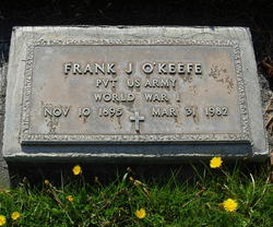
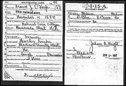
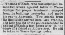
Pvt Frank J. O'Keefe
| Birth | : | 10 Nov 1895 Anaconda, Deer Lodge County, Montana, USA |
| Death | : | 31 Mar 1982 Beaverhead County, Montana, USA |
| Burial | : | Holy Trinity Churchyard, Acaster Malbis, York Unitary Authority, England |
| Coordinate | : | 53.9052480, -1.0975170 |
| Inscription | : | PVT US ARMY WORLD WAR I |
frequently asked questions (FAQ):
-
Where is Pvt Frank J. O'Keefe's memorial?
Pvt Frank J. O'Keefe's memorial is located at: Holy Trinity Churchyard, Acaster Malbis, York Unitary Authority, England.
-
When did Pvt Frank J. O'Keefe death?
Pvt Frank J. O'Keefe death on 31 Mar 1982 in Beaverhead County, Montana, USA
-
Where are the coordinates of the Pvt Frank J. O'Keefe's memorial?
Latitude: 53.9052480
Longitude: -1.0975170
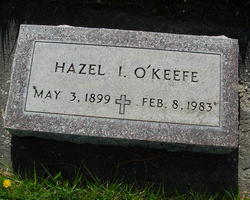
Family Members:
Flowers:

May eternal blessings be yours
Left by Anonymous on 12 Jun 2007

Rest well in Heaven
Left by Anonymous on 14 Nov 2007
Happy Belated Birthday!
Left by Anonymous on 25 Nov 2008

Left by Anonymous on 31 Mar 2009

Left by Anonymous on 11 Nov 2009

May you rest in glorious peace
Left by Anonymous on 09 Feb 2010

Left by Anonymous on 31 Mar 2010

Left by Anonymous on 11 Nov 2010

Left by Anonymous on 10 Nov 2011

Left by Anonymous on 24 Aug 2020
Nearby Cemetories:
1. Holy Trinity Churchyard
Acaster Malbis, York Unitary Authority, England
Coordinate: 53.9052480, -1.0975170
2. St Matthew Churchyard
Naburn, York Unitary Authority, England
Coordinate: 53.9009520, -1.0899200
3. St. Andrew's Old Churchyard
Bishopthorpe, York Unitary Authority, England
Coordinate: 53.9221490, -1.0929640
4. St Andrew Churchyard
Bishopthorpe, York Unitary Authority, England
Coordinate: 53.9236690, -1.0955320
5. York Crematorium
York, York Unitary Authority, England
Coordinate: 53.9264970, -1.0936130
6. Dringhouses Cemetery
York, York Unitary Authority, England
Coordinate: 53.9297740, -1.1156780
7. St Giles Churchyard
Copmanthorpe, York Unitary Authority, England
Coordinate: 53.9149240, -1.1410420
8. Moor Lane Burial Ground
Copmanthorpe, York Unitary Authority, England
Coordinate: 53.9096890, -1.1449400
9. Fulford Cemetery
Fulford, York Unitary Authority, England
Coordinate: 53.9304450, -1.0683670
10. St. Edward the Confessor
Dringhouses, York Unitary Authority, England
Coordinate: 53.9399810, -1.1061270
11. St Oswald's Old Churchyard
Fulford, York Unitary Authority, England
Coordinate: 53.9391350, -1.0809020
12. St. Helen's Churchyard
Escrick, Selby District, England
Coordinate: 53.8805200, -1.0460990
13. St Nicholas Churchyard
Askham Bryan, York Unitary Authority, England
Coordinate: 53.9294600, -1.1581240
14. St Helen Churchyard
Stillingfleet, Selby District, England
Coordinate: 53.8618710, -1.0994760
15. Tyburn Cemetery
York, York Unitary Authority, England
Coordinate: 53.9486800, -1.1008400
16. St Clement Church
York, York Unitary Authority, England
Coordinate: 53.9511660, -1.0871720
17. St John Churchyard
Acaster Selby, Selby District, England
Coordinate: 53.8614750, -1.1283740
18. St Helen Churchyard
York, York Unitary Authority, England
Coordinate: 53.9509330, -1.0753630
19. York Cemetery
York, York Unitary Authority, England
Coordinate: 53.9503960, -1.0723530
20. Friends Burial Ground
York, York Unitary Authority, England
Coordinate: 53.9478920, -1.0618450
21. All Saints Churchyard
Appleton Roebuck, Selby District, England
Coordinate: 53.8734600, -1.1580870
22. St Paul Churchyard
Colton, Selby District, England
Coordinate: 53.8964660, -1.1773770
23. St Clement Priory Churchyard (Defunct)
York, York Unitary Authority, England
Coordinate: 53.9524710, -1.0827970
24. St Mary's Convent - The Bar Convent
York, York Unitary Authority, England
Coordinate: 53.9552520, -1.0911020


