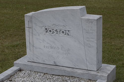
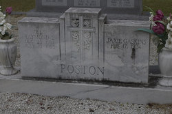
Raymond Laverne Poston Jr.
| Birth | : | 10 Oct 1945 |
| Death | : | 20 Sep 2005 |
| Burial | : | Refuge Baptist Church Cemetery, Dana, Henderson County, USA |
| Coordinate | : | 35.3288002, -82.3751984 |
| Description | : | PAMPLICO " Raymond Laverne Ray Poston Jr. died Tuesday, Sept. 20, 2005. Mr. Poston, 59, was born Oct. 10, 1945, in Florence County. He was the son of Jaxie Gaskins Poston and the late R.L. Poston Sr. of Pamplico. He graduated from Hannah High School and Spartanburg Junior College. Mr. Poston was also a former member of the South Carolina National Guard. He was self-employed and the owner of RRSB and A-Plus Services. He was a member of Mt. Zion Baptist Church. Ray will always be remembered and treasured as a special loving son, father, grandfather, brother and uncle. Surviving are his... Read More |
frequently asked questions (FAQ):
-
Where is Raymond Laverne Poston Jr.'s memorial?
Raymond Laverne Poston Jr.'s memorial is located at: Refuge Baptist Church Cemetery, Dana, Henderson County, USA.
-
When did Raymond Laverne Poston Jr. death?
Raymond Laverne Poston Jr. death on 20 Sep 2005 in
-
Where are the coordinates of the Raymond Laverne Poston Jr.'s memorial?
Latitude: 35.3288002
Longitude: -82.3751984
Family Members:
Parent
Flowers:
Nearby Cemetories:
1. Refuge Baptist Church Cemetery
Dana, Henderson County, USA
Coordinate: 35.3288002, -82.3751984
2. Dana United Methodist Church Cemetery
Dana, Henderson County, USA
Coordinate: 35.3367271, -82.3744049
3. Dana Baptist Church Cemetery
Dana, Henderson County, USA
Coordinate: 35.3395300, -82.3729300
4. Basiewicz Family Cemetery
Dana, Henderson County, USA
Coordinate: 35.3343700, -82.3603700
5. Hill Family Cemetery
Dana, Henderson County, USA
Coordinate: 35.3416300, -82.3652940
6. Hammett Family Cemetery
Upward, Henderson County, USA
Coordinate: 35.3090400, -82.3868630
7. Stepp Cemetery
Hendersonville, Henderson County, USA
Coordinate: 35.3365000, -82.3464000
8. Stepp Round Hill Cemetery
Hendersonville, Henderson County, USA
Coordinate: 35.3367483, -82.3464429
9. Jones Family Cemetery at Upward
Upward, Henderson County, USA
Coordinate: 35.3022003, -82.3855972
10. Tracy Grove Baptist Church
Henderson County, USA
Coordinate: 35.3142014, -82.4045029
11. Bethel Wesleyan Church Cemetery
Henderson County, USA
Coordinate: 35.3157234, -82.4103165
12. Union Hill Holiness Baptist Church Cemetery
Hendersonville, Henderson County, USA
Coordinate: 35.3522000, -82.3395000
13. Reese Bradley Cemetery
Dana, Henderson County, USA
Coordinate: 35.3386500, -82.3294800
14. Fair Haven Baptist Church Cemetery
Hendersonville, Henderson County, USA
Coordinate: 35.3447800, -82.4203100
15. Kings Grove Church Cemetery
Henderson County, USA
Coordinate: 35.3716740, -82.3685470
16. Gilbert-Justus Family Cemetery
Upward, Henderson County, USA
Coordinate: 35.2861000, -82.3894380
17. Forest Lawn Memorial Park
Henderson County, USA
Coordinate: 35.3225403, -82.4362411
18. Moores Grove Methodist Cemetery
Henderson County, USA
Coordinate: 35.3488007, -82.4318008
19. Ebenezer Baptist Church Cemetery
Hendersonville, Henderson County, USA
Coordinate: 35.3498001, -82.4326019
20. Jones Cemetery at Sugarloaf
Henderson County, USA
Coordinate: 35.3669014, -82.3321991
21. Seagle Cemetery
Henderson County, USA
Coordinate: 35.3553009, -82.4300003
22. Mills Cemetery
Henderson County, USA
Coordinate: 35.3863860, -82.3652670
23. Fruitland Cemetery
Henderson County, USA
Coordinate: 35.3833008, -82.4019012
24. Oak Grove Baptist Church Cemetery
East Flat Rock, Henderson County, USA
Coordinate: 35.2729000, -82.4031580


