
| Memorials | : | 0 |
| Location | : | Upward, Henderson County, USA |
| Coordinate | : | 35.3090400, -82.3868630 |
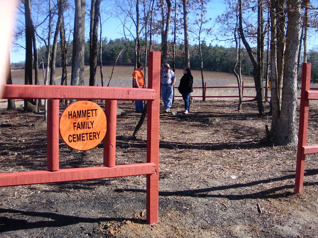
| Description | : | Located among trees in the middle of an agricultural field about 1,035 feet east from S. Orchard Road and behind a home at 5621 Howard Gap Road in the Upward community. In deeds from Hammett to Blackwell, the corner of the tract of land was designated as the tombstone of Hezekiah Dunn. The cemetery is located near Dunn’s Creek. This cemetery is surrounded by private property. Permission should be obtained from property owners prior to visitation. Based on land deeds, persons with grave sites within the cemetery most probably descend from families with the surname Dunn, Hammett and Blackwell. There are 10 to 15... Read More |
frequently asked questions (FAQ):
-
Where is Hammett Family Cemetery?
Hammett Family Cemetery is located at Upward, Henderson County ,North Carolina ,USA.
-
Hammett Family Cemetery cemetery's updated grave count on graveviews.com?
0 memorials
-
Where are the coordinates of the Hammett Family Cemetery?
Latitude: 35.3090400
Longitude: -82.3868630

Nearby Cemetories:
1. Jones Family Cemetery at Upward
Upward, Henderson County, USA
Coordinate: 35.3022003, -82.3855972
2. Tracy Grove Baptist Church
Henderson County, USA
Coordinate: 35.3142014, -82.4045029
3. Bethel Wesleyan Church Cemetery
Henderson County, USA
Coordinate: 35.3157234, -82.4103165
4. Refuge Baptist Church Cemetery
Dana, Henderson County, USA
Coordinate: 35.3288002, -82.3751984
5. Gilbert-Justus Family Cemetery
Upward, Henderson County, USA
Coordinate: 35.2861000, -82.3894380
6. Dana United Methodist Church Cemetery
Dana, Henderson County, USA
Coordinate: 35.3367271, -82.3744049
7. Dana Baptist Church Cemetery
Dana, Henderson County, USA
Coordinate: 35.3395300, -82.3729300
8. Basiewicz Family Cemetery
Dana, Henderson County, USA
Coordinate: 35.3343700, -82.3603700
9. Hill Family Cemetery
Dana, Henderson County, USA
Coordinate: 35.3416300, -82.3652940
10. Oak Grove Baptist Church Cemetery
East Flat Rock, Henderson County, USA
Coordinate: 35.2729000, -82.4031580
11. Forest Lawn Memorial Park
Henderson County, USA
Coordinate: 35.3225403, -82.4362411
12. Stepp Cemetery
Hendersonville, Henderson County, USA
Coordinate: 35.3365000, -82.3464000
13. Stepp Round Hill Cemetery
Hendersonville, Henderson County, USA
Coordinate: 35.3367483, -82.3464429
14. Oakland Cemetery
East Flat Rock, Henderson County, USA
Coordinate: 35.2835999, -82.4302979
15. Fair Haven Baptist Church Cemetery
Hendersonville, Henderson County, USA
Coordinate: 35.3447800, -82.4203100
16. Anders Cemetery
East Flat Rock, Henderson County, USA
Coordinate: 35.2654700, -82.4064300
17. Pinecrest Presbyterian Church Memorial Garden
Flat Rock, Henderson County, USA
Coordinate: 35.2822100, -82.4426360
18. Saint John In the Wilderness Cemetery
Flat Rock, Henderson County, USA
Coordinate: 35.2821170, -82.4435670
19. Moores Grove Methodist Cemetery
Henderson County, USA
Coordinate: 35.3488007, -82.4318008
20. Ebenezer Baptist Church Cemetery
Hendersonville, Henderson County, USA
Coordinate: 35.3498001, -82.4326019
21. Reese Bradley Cemetery
Dana, Henderson County, USA
Coordinate: 35.3386500, -82.3294800
22. Mud Creek Baptist Church Cemetery
Flat Rock, Henderson County, USA
Coordinate: 35.2905998, -82.4536972
23. Union Hill Holiness Baptist Church Cemetery
Hendersonville, Henderson County, USA
Coordinate: 35.3522000, -82.3395000
24. Seagle Cemetery
Henderson County, USA
Coordinate: 35.3553009, -82.4300003