Reva Helen Dirks Albright
| Birth | : | 11 Feb 1920 Ireton, Sioux County, Iowa, USA |
| Death | : | 16 Nov 2008 Le Mars, Plymouth County, Iowa, USA |
| Burial | : | Raunds Cemetery, Raunds, East Northamptonshire Borough, England |
| Coordinate | : | 52.3494100, -0.5467400 |
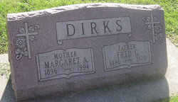
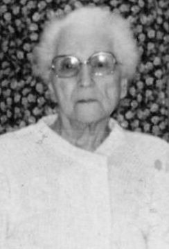
| Description | : | From: Le Mars Daily Sentinel, November 19, 2008 Reva H. Albright, 88, of Le Mars, died Sunday evening, Nov. 16, 2008, at the Good Samaritan Society-Le Mars, where she had made her home since August 2007. Reva Helen Albright, the daughter of Fred G. and Margaret A. (Renken) Dirks, was born Feb. 11, 1920, at rural Ireton. She was baptized and confirmed at St. Paul Lutheran Church in Ireton and attended rural Ireton country school. On Nov. 4, 1940, in Onawa, Reva was united in marriage to Arthur C. Albright. They became the busy... Read More |
frequently asked questions (FAQ):
-
Where is Reva Helen Dirks Albright's memorial?
Reva Helen Dirks Albright's memorial is located at: Raunds Cemetery, Raunds, East Northamptonshire Borough, England.
-
When did Reva Helen Dirks Albright death?
Reva Helen Dirks Albright death on 16 Nov 2008 in Le Mars, Plymouth County, Iowa, USA
-
Where are the coordinates of the Reva Helen Dirks Albright's memorial?
Latitude: 52.3494100
Longitude: -0.5467400
Family Members:
Parent
Spouse
Siblings
Flowers:
Nearby Cemetories:
1. Raunds Cemetery
Raunds, East Northamptonshire Borough, England
Coordinate: 52.3494100, -0.5467400
2. Station Road Cemetery
Ringsted Kommune, Denmark
Coordinate: 52.3638126, -0.5592430
3. Nativity of the Blessed Virgin Mary Churchyard
Ringstead, East Northamptonshire Borough, England
Coordinate: 52.3652660, -0.5533620
4. Station Street Cemetery
Ringstead, East Northamptonshire Borough, England
Coordinate: 52.3654427, -0.5538628
5. St. Laurence Churchyard Stanwick
Stanwick, East Northamptonshire Borough, England
Coordinate: 52.3324970, -0.5628585
6. Stanwick Cemetery
Stanwick, East Northamptonshire Borough, England
Coordinate: 52.3298800, -0.5531500
7. Holy Trinity Church
Denford, East Northamptonshire Borough, England
Coordinate: 52.3787353, -0.5450568
8. All Saints Churchyard
Great Addington, East Northamptonshire Borough, England
Coordinate: 52.3657660, -0.5937010
9. St. John the Baptist Churchyard
Chelveston, East Northamptonshire Borough, England
Coordinate: 52.3112800, -0.5501200
10. St Peter's Churchyard
Irthlingborough, East Northamptonshire Borough, England
Coordinate: 52.3251642, -0.6101925
11. All Hallow's Church Hargrave Churchyard
Hargrave, East Northamptonshire Borough, England
Coordinate: 52.3242316, -0.4800580
12. St. Nicholas Churchyard
Islip, East Northamptonshire Borough, England
Coordinate: 52.3991300, -0.5513600
13. Higham Ferrers Cemetery
Higham Ferrers, East Northamptonshire Borough, England
Coordinate: 52.3084850, -0.5945270
14. St. Mary the Virgin Churchyard
Higham Ferrers, East Northamptonshire Borough, England
Coordinate: 52.3065500, -0.5915240
15. Thrapston Cemetery
Thrapston, East Northamptonshire Borough, England
Coordinate: 52.4000170, -0.5292640
16. St. Nicholas' Churchyard
Twywell, East Northamptonshire Borough, England
Coordinate: 52.3936001, -0.6024166
17. St Mary the Virgin Churchyard
Shelton, Bedford Borough, England
Coordinate: 52.3076000, -0.4852000
18. St. Mary the Virgin Churchyard
Yelden, Bedford Borough, England
Coordinate: 52.2930600, -0.5182700
19. New Irthlingborough Cemetery
Irthlingborough, East Northamptonshire Borough, England
Coordinate: 52.3178531, -0.6294229
20. St. Peter's Churchyard
Lowick, East Northamptonshire Borough, England
Coordinate: 52.4116300, -0.5570600
21. Covington Parish Church
Covington, Huntingdonshire District, England
Coordinate: 52.3238459, -0.4505520
22. St. Mary's Churchyard
Titchmarsh, East Northamptonshire Borough, England
Coordinate: 52.4076080, -0.4998860
23. Newton Road Cemetery
Rushden, East Northamptonshire Borough, England
Coordinate: 52.2882140, -0.5859750
24. St. John's Churchyard
Cranford St John, Kettering Borough, England
Coordinate: 52.3840560, -0.6391670


