
| Birth | : | 21 Mar 1919 Nebraska City, Otoe County, Nebraska, USA |
| Death | : | 4 Jul 1964 Oshkosh, Garden County, Nebraska, USA |
| Burial | : | Mount Olive Cemetery, Dyer, Gibson County, USA |
| Coordinate | : | 36.0807991, -89.0278015 |
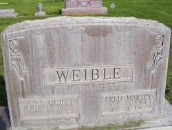
| Description | : | Son of Fred & Katie Hahn Weible. Enlisted in the Army on 17 October 1940, in Fort Mcpherson Atlanta, Georgia. He married Ruth Robinson. SOUTH CAROLINA T SGT 422 BASE UNIT AAF WORLD WAR II |
frequently asked questions (FAQ):
-
Where is Richard Albert Weible's memorial?
Richard Albert Weible's memorial is located at: Mount Olive Cemetery, Dyer, Gibson County, USA.
-
When did Richard Albert Weible death?
Richard Albert Weible death on 4 Jul 1964 in Oshkosh, Garden County, Nebraska, USA
-
Where are the coordinates of the Richard Albert Weible's memorial?
Latitude: 36.0807991
Longitude: -89.0278015
Family Members:
Parent

Spouse
Siblings

Flowers:


Nearby Cemetories:
1. Mount Olive Cemetery
Dyer, Gibson County, USA
Coordinate: 36.0807991, -89.0278015
2. Flowers - Wright Cemetery
Dyer, Gibson County, USA
Coordinate: 36.0951100, -89.0348700
3. Taylor Family Cemetery
Rutherford, Gibson County, USA
Coordinate: 36.1049700, -89.0226300
4. Crenshaw-Wyatt Cemetery
Dyer, Gibson County, USA
Coordinate: 36.0778090, -89.0589010
5. Wilkes Cemetery
Rutherford, Gibson County, USA
Coordinate: 36.1097380, -89.0214500
6. Thompson Cemetery
Rutherford, Gibson County, USA
Coordinate: 36.1047220, -89.0553430
7. Hopper Cemetery
Dyer, Gibson County, USA
Coordinate: 36.0936200, -88.9878680
8. Bobbitt Cemetery
Dyer, Gibson County, USA
Coordinate: 36.0774994, -88.9850006
9. Good Hope Cemetery
Dyer, Gibson County, USA
Coordinate: 36.0477982, -89.0438995
10. Oakwood Cemetery
Dyer, Gibson County, USA
Coordinate: 36.0619011, -88.9875031
11. Flowers Chapel Cemetery
Rutherford, Gibson County, USA
Coordinate: 36.1198820, -89.0265080
12. Clear Creek Cemetery
Currie, Gibson County, USA
Coordinate: 36.0400009, -89.0299988
13. Cowan Cemetery
Dyer, Gibson County, USA
Coordinate: 36.0978120, -89.0753020
14. Keas Cemetery
Dyer, Gibson County, USA
Coordinate: 36.0769005, -88.9757996
15. Bells Chapel Cemetery
Dyer, Gibson County, USA
Coordinate: 36.1164017, -89.0686035
16. Duck Hill Cemetery
Trenton, Gibson County, USA
Coordinate: 36.0331001, -89.0413971
17. Apostolic Faith Tabernacle Cemetery
Dyer, Gibson County, USA
Coordinate: 36.0732460, -88.9674180
18. Rutherford Cemetery
Rutherford, Gibson County, USA
Coordinate: 36.1258011, -88.9989014
19. Hall Family Cemetery
Dyer, Gibson County, USA
Coordinate: 36.0302900, -89.0393600
20. Bucksnort Cemetery
Gibson County, USA
Coordinate: 36.0318985, -88.9888992
21. Balentine Family Cemetery
Dyer, Gibson County, USA
Coordinate: 36.0544690, -89.0928070
22. Crockett Memorial Plot
Rutherford, Gibson County, USA
Coordinate: 36.1299620, -88.9871980
23. Beech Grove Baptist Church Cemetery
Dyer, Gibson County, USA
Coordinate: 36.0281710, -88.9886220
24. Liberty Grove Cemetery
Rutherford, Gibson County, USA
Coordinate: 36.1439760, -89.0371100