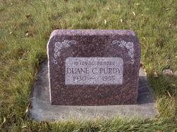
| Birth | : | 6 Feb 1929 |
| Death | : | 4 May 1983 Missoula County, Montana, USA |
| Burial | : | St. Peter and St. Paul Churchyard, Swalcliffe, Cherwell District, England |
| Coordinate | : | 52.0380790, -1.4497340 |
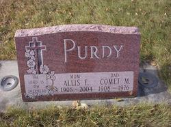
| Description | : | US Army, Korea Robert C Purdy, 54, of Lincoln, died Wednesday in Lucky Shot Creek, northeast of Missoula as a result of injuries received in a logging accident. He was born on 6 Feb 1929 in Eureka, the son of Comet and Allis Purdy. He was raised and attended schools in Eureka. On 26 Jun 1948, he married Alene Voorhees in Eureka. He worked for the Lincoln Electric Co-op for a short time and served with the US Army during the Korean War. In 1957 they moved to Lincoln, where he worked as a logging truck driver. he had... Read More |
frequently asked questions (FAQ):
-
Where is Robert C “Robby” Purdy's memorial?
Robert C “Robby” Purdy's memorial is located at: St. Peter and St. Paul Churchyard, Swalcliffe, Cherwell District, England.
-
When did Robert C “Robby” Purdy death?
Robert C “Robby” Purdy death on 4 May 1983 in Missoula County, Montana, USA
-
Where are the coordinates of the Robert C “Robby” Purdy's memorial?
Latitude: 52.0380790
Longitude: -1.4497340
Family Members:
Parent
Siblings
Flowers:
Nearby Cemetories:
1. St. Peter and St. Paul Churchyard
Swalcliffe, Cherwell District, England
Coordinate: 52.0380790, -1.4497340
2. St Nicholas Churchyard
Tadmarton, Cherwell District, England
Coordinate: 52.0377060, -1.4295690
3. Holy Trinity Churchyard
Sibford Gower, Cherwell District, England
Coordinate: 52.0374300, -1.4822670
4. Friends Burial Ground
Sibford Gower, Cherwell District, England
Coordinate: 52.0373140, -1.4889440
5. St Anne's Parish Church
Epwell, Cherwell District, England
Coordinate: 52.0615780, -1.4866280
6. St Mary the Virgin Churchyard
Broughton, Cherwell District, England
Coordinate: 52.0417020, -1.3912030
7. Saint Laurence Churchyard
Milcombe, Cherwell District, England
Coordinate: 52.0083060, -1.4033990
8. Saint Giles
Wigginton, Cherwell District, England
Coordinate: 51.9966400, -1.4324000
9. Hook Norton Cemetery
Hook Norton, Cherwell District, England
Coordinate: 51.9969440, -1.4787690
10. St Michael and All Angels Churchyard
Alkerton, Cherwell District, England
Coordinate: 52.0834080, -1.4509680
11. St Peters Churchyard
Hook Norton, Cherwell District, England
Coordinate: 51.9954200, -1.4842490
12. Hook Norton Baptist Burial Ground
Hook Norton, Cherwell District, England
Coordinate: 51.9953000, -1.4860900
13. South Newington St Peter ad Vincula
South Newington, Cherwell District, England
Coordinate: 51.9970000, -1.4082300
14. All Saints Churchyard
Wroxton, Cherwell District, England
Coordinate: 52.0726220, -1.3925790
15. St Mary's Churchyard
Bloxham, Cherwell District, England
Coordinate: 52.0181100, -1.3748900
16. St Peter's Churchyard
Drayton, Cherwell District, England
Coordinate: 52.0707360, -1.3764670
17. Compton Wynyates Burial Grounds
Compton Wynyates, Stratford-on-Avon District, England
Coordinate: 52.0747020, -1.5198000
18. St. George's Church of England
Brailes, Stratford-on-Avon District, England
Coordinate: 52.0515110, -1.5414420
19. St Mary Churchyard
Swerford, West Oxfordshire District, England
Coordinate: 51.9773470, -1.4593150
20. St Etheldreda Churchyard
Horley, Cherwell District, England
Coordinate: 52.0924610, -1.3930320
21. St. John's Churchyard
Hornton, Cherwell District, England
Coordinate: 52.1020090, -1.4287560
22. St. Michael's
Whichford, Stratford-on-Avon District, England
Coordinate: 52.0094910, -1.5467784
23. St Mary's churchyard
Tysoe, Stratford-on-Avon District, England
Coordinate: 52.0966300, -1.5036400
24. Bodicote Cemetery
Bodicote, Cherwell District, England
Coordinate: 52.0391710, -1.3397380

