
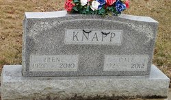
Ruth Irene Smith Knapp
| Birth | : | 16 Feb 1921 Farmer, Defiance County, Ohio, USA |
| Death | : | 11 Nov 2010 Auburn, DeKalb County, Indiana, USA |
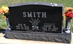
| Burial | : | Farmer Cemetery, Farmer, Defiance County, USA |
| Coordinate | : | 41.3903008, -84.6410980 |
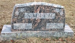
| Description | : | AUBURN — Ruth Irene Knapp, 89, of Auburn died Thursday, Nov. 11, 2010, at Laurels of DeKalb in Butler. Mrs. Knapp was a homemaker and was also a clerk at Newberry's Dime Store in Auburn for 17 years. She was born Feb. 16, 1921, in Farmer, Ohio, to William O. and Amy (Ross) Smith. She married Dale Knapp on Jan. 26, 1945, in Texas and he survives in Auburn. Also surviving are a son, Dennis L. Knapp of Battle Creek, Mich.; a daughter, Cheryl A. Carnahan of Auburn; a sister, Betty Ellert of Auburn; five grandchildren; five great-grandchildren; and two... Read More |
frequently asked questions (FAQ):
-
Where is Ruth Irene Smith Knapp's memorial?
Ruth Irene Smith Knapp's memorial is located at: Farmer Cemetery, Farmer, Defiance County, USA.
-
When did Ruth Irene Smith Knapp death?
Ruth Irene Smith Knapp death on 11 Nov 2010 in Auburn, DeKalb County, Indiana, USA
-
Where are the coordinates of the Ruth Irene Smith Knapp's memorial?
Latitude: 41.3903008
Longitude: -84.6410980
Family Members:
Parent

Spouse
Siblings
Flowers:


Nearby Cemetories:
1. Farmer Cemetery
Farmer, Defiance County, USA
Coordinate: 41.3903008, -84.6410980
2. Upper Lost Creek Cemetery
Farmer, Defiance County, USA
Coordinate: 41.3840000, -84.6700000
3. Kemp Cemetery
Defiance County, USA
Coordinate: 41.3703003, -84.6802979
4. Lost Creek Cemetery
Farmer, Defiance County, USA
Coordinate: 41.3553000, -84.6700000
5. Williams Center Cemetery
Williams Center, Williams County, USA
Coordinate: 41.4288902, -84.6125031
6. Tamarack Cemetery
Milford Township, Defiance County, USA
Coordinate: 41.4117012, -84.7089005
7. Zion Lutheran Church Cemetery
Defiance County, USA
Coordinate: 41.4261017, -84.7099991
8. Fetters Cemetery
Williams County, USA
Coordinate: 41.4519500, -84.6159900
9. Melbern-Neihardt Cemetery
Melbern, Williams County, USA
Coordinate: 41.4633600, -84.6416330
10. Lintz Cemetery
Ney, Defiance County, USA
Coordinate: 41.3760986, -84.5402985
11. Trinity Lutheran Cemetery
Ney, Defiance County, USA
Coordinate: 41.4016991, -84.5353012
12. Yackee Cemetery
Williams County, USA
Coordinate: 41.4707985, -84.6324997
13. Ney Cemetery
Ney, Defiance County, USA
Coordinate: 41.3856010, -84.5271988
14. Six Corners Cemetery
Hicksville, Defiance County, USA
Coordinate: 41.3213997, -84.7153015
15. Saint Johns Lutheran Cemetery
Sherwood, Defiance County, USA
Coordinate: 41.3092003, -84.5931015
16. Doud Cemetery
Ney, Defiance County, USA
Coordinate: 41.3811680, -84.5161110
17. Fountain Grove Cemetery
Bryan, Williams County, USA
Coordinate: 41.4572182, -84.5480576
18. Thomas Cemetery
Williams County, USA
Coordinate: 41.4769100, -84.6994240
19. Brown Cemetery
Bryan, Williams County, USA
Coordinate: 41.4822006, -84.5935974
20. Maple Grove Cemetery
Edgerton, Williams County, USA
Coordinate: 41.4435997, -84.7521973
21. St. Mary's Cemetery
Edgerton, Williams County, USA
Coordinate: 41.4441120, -84.7542700
22. Clarksville Cemetery
Edgerton, Williams County, USA
Coordinate: 41.4281006, -84.7677994
23. Auglaize Village Cemetery
Defiance, Defiance County, USA
Coordinate: 41.3399760, -84.5165610
24. Funk Cemetery
Defiance County, USA
Coordinate: 41.3396988, -84.5164032