| Birth | : | 2 Oct 1838 Harrison County, Ohio, USA |
| Death | : | 4 Dec 1906 Orange Township, Carroll County, Ohio, USA |
| Burial | : | Palermo Cemetery, Carroll County, USA |
| Coordinate | : | 40.4894444, -81.1522220 |
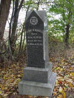
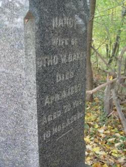
| Description | : | Biographical Record of Carroll County, Ohio, J. H. Beers & Co., 1891, p. 907 Samuel B. Baker, farmer and proprietor of saw mill in Orange Township, Carroll County, was born October 2, 1838, in Harrison County, Ohio, a son of Otho and Nancy (Buchanon) Baker, former of whom was also of Harrison County. The father lived the greater part of his life in Harrison County, and was there married to Miss Nancy Buchanon, whose grandparents came from Germany to this country her parents being natives of Pennsylvania, whence they moved to Ohio in early times. Mr. and... Read More |
frequently asked questions (FAQ):
-
Where is Samuel Buchanan Baker's memorial?
Samuel Buchanan Baker's memorial is located at: Palermo Cemetery, Carroll County, USA.
-
When did Samuel Buchanan Baker death?
Samuel Buchanan Baker death on 4 Dec 1906 in Orange Township, Carroll County, Ohio, USA
-
Where are the coordinates of the Samuel Buchanan Baker's memorial?
Latitude: 40.4894444
Longitude: -81.1522220
Family Members:
Parent
Spouse
Siblings
Children
Flowers:
Nearby Cemetories:
1. Palermo Cemetery
Carroll County, USA
Coordinate: 40.4894444, -81.1522220
2. Mount Tabor Cemetery
Carroll County, USA
Coordinate: 40.4817009, -81.1483002
3. Bethel Cemetery
Leavittsville, Carroll County, USA
Coordinate: 40.4921989, -81.1841965
4. Veteran's Grave
Orange Township, Carroll County, USA
Coordinate: 40.4931470, -81.2003677
5. Price-Rollins Cemetery
Carroll County, USA
Coordinate: 40.5088997, -81.1956024
6. Leavittsville Cemetery
Leavittsville, Carroll County, USA
Coordinate: 40.5133018, -81.1967010
7. Mount Olive Cemetery
Carroll County, USA
Coordinate: 40.4488983, -81.1382980
8. Seceders Cemetery
Carroll County, USA
Coordinate: 40.5332985, -81.1446991
9. Saint Luke Cemetery
Carroll County, USA
Coordinate: 40.5303001, -81.1810989
10. Perrysville Methodist Episcopal Church Cemetery
Perrysville, Carroll County, USA
Coordinate: 40.4655991, -81.0982971
11. Farnsworth Cemetery
Carroll County, USA
Coordinate: 40.5385017, -81.1567001
12. Scotts Cemetery
Carroll County, USA
Coordinate: 40.5386009, -81.1556015
13. Perrysville United Methodist Cemetery
Perrysville, Carroll County, USA
Coordinate: 40.4625510, -81.0973610
14. New Perrysville Cemetery
Perrysville, Carroll County, USA
Coordinate: 40.4569016, -81.1016998
15. Mount Pleasant Cemetery
Carrollton, Carroll County, USA
Coordinate: 40.5238991, -81.1003036
16. New Hagerstown Cemetery
New Hagerstown, Carroll County, USA
Coordinate: 40.4446983, -81.1893997
17. Hagey Family Cemetery
Perrysville, Carroll County, USA
Coordinate: 40.4525980, -81.0996160
18. Leesville Cemetery
Leesville, Carroll County, USA
Coordinate: 40.4550018, -81.2114029
19. Swinehart Cemetery
Carroll County, USA
Coordinate: 40.4327000, -81.1642170
20. Old Scott Cemetery
Carroll County, USA
Coordinate: 40.5483017, -81.1541977
21. McGuire Cemetery
Tabor, Carroll County, USA
Coordinate: 40.5518990, -81.1564026
22. Longview Cemetery
Bowerston, Harrison County, USA
Coordinate: 40.4324989, -81.1872025
23. Saint Francis Catholic Cemetery
Sherrodsville, Carroll County, USA
Coordinate: 40.4951920, -81.2349170
24. Arabia Cemetery
Perrysville, Carroll County, USA
Coordinate: 40.4803009, -81.0678024


