
| Birth | : | 25 Apr 1700 Taunton, Bristol County, Massachusetts, USA |
| Death | : | 28 Nov 1726 Lebanon, New London County, Connecticut, USA |
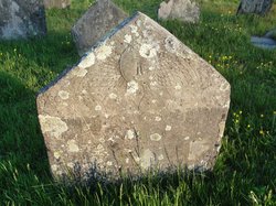
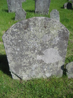
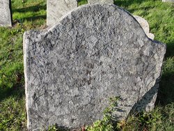
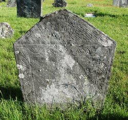
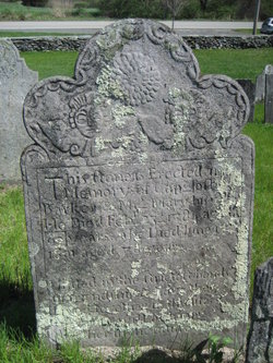
| Burial | : | Fort Steuben Burial Estates, Wintersville, Jefferson County, USA |
| Coordinate | : | 40.3891983, -80.7236023 |
| Description | : | Samuel Throop's birth is noted in the Vital Record of Rhode Island as follows: THROOP Samuel, (Taunton), April 25, 1700. Knowing that Deborah Macey was his mother, and that she was from Taunton (George Macey was one of the original proprietors there), I believe this note is telling us that he was actually born in Taunton. Possibly, Deborah had gone to Taunton to visit her mother and solicit advice about childbirth (it was her first baby), when she went into labor. Son of Daniel Throope and Deborah Macey. He married Dorothy Gray (1704 - 1743) on... Read More |
frequently asked questions (FAQ):
-
Where is Samuel Throope's memorial?
Samuel Throope's memorial is located at: Fort Steuben Burial Estates, Wintersville, Jefferson County, USA.
-
When did Samuel Throope death?
Samuel Throope death on 28 Nov 1726 in Lebanon, New London County, Connecticut, USA
-
Where are the coordinates of the Samuel Throope's memorial?
Latitude: 40.3891983
Longitude: -80.7236023
Family Members:
Parent
Spouse

Siblings
Children
Flowers:


Nearby Cemetories:
1. Fort Steuben Burial Estates
Wintersville, Jefferson County, USA
Coordinate: 40.3891983, -80.7236023
2. Two Ridges Cemetery
Wintersville, Jefferson County, USA
Coordinate: 40.3944016, -80.7328033
3. Wintersville United Methodist Church Cemetery
Wintersville, Jefferson County, USA
Coordinate: 40.3755360, -80.7064440
4. Coulter Cemetery
Wintersville, Jefferson County, USA
Coordinate: 40.4000970, -80.7014690
5. Carne Cemetery
Salem Township, Jefferson County, USA
Coordinate: 40.4089012, -80.7667007
6. Jefferson County Infirmary Cemetery
Steubenville, Jefferson County, USA
Coordinate: 40.3748880, -80.6725990
7. Center Chapel Cemetery
Island Creek Township, Jefferson County, USA
Coordinate: 40.4276600, -80.6942300
8. Cross Creek Cemetery
Wintersville, Jefferson County, USA
Coordinate: 40.3492928, -80.6872635
9. Holy Resurrection Serbian Eastern Orthodox Church
Steubenville, Jefferson County, USA
Coordinate: 40.3760986, -80.6580963
10. Bnai Israel Cemetery
Steubenville, Jefferson County, USA
Coordinate: 40.3744011, -80.6572037
11. Richmond United Presbyterian Cemetery
Salem Township, Jefferson County, USA
Coordinate: 40.4310989, -80.7680969
12. Quaker Cemetery
Richmond, Jefferson County, USA
Coordinate: 40.4112680, -80.7883450
13. Methodist-Episcopal Cemetery
Richmond, Jefferson County, USA
Coordinate: 40.4317460, -80.7709400
14. Richmond Union Cemetery
Richmond, Jefferson County, USA
Coordinate: 40.4289017, -80.7763977
15. Mount Tabor Methodist Church Cemetery
Richmond, Jefferson County, USA
Coordinate: 40.4519997, -80.7286987
16. Mount Calvary Cemetery
Steubenville, Jefferson County, USA
Coordinate: 40.3643990, -80.6466980
17. Queen of All Saints Cemetery
Bloomingdale, Jefferson County, USA
Coordinate: 40.3841050, -80.8094450
18. Union Cemetery
Steubenville, Jefferson County, USA
Coordinate: 40.3636017, -80.6399994
19. Longs Methodist Episcopal Cemetery
Jefferson County, USA
Coordinate: 40.3203400, -80.7400100
20. Saint James Episcopal Cemetery
Cross Creek Township, Jefferson County, USA
Coordinate: 40.3211700, -80.7563400
21. Mount Hope Cemetery
Salem Township, Jefferson County, USA
Coordinate: 40.4075012, -80.8182983
22. Holy Family Hermitage Cemetery
Bloomingdale, Jefferson County, USA
Coordinate: 40.3840650, -80.8243020
23. Tomb of the Unborn Child
Steubenville, Jefferson County, USA
Coordinate: 40.3753230, -80.6199840
24. Bloomingdale Cemetery
Bloomingdale, Jefferson County, USA
Coordinate: 40.3418110, -80.8134230