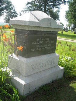
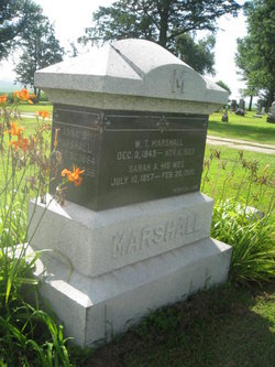
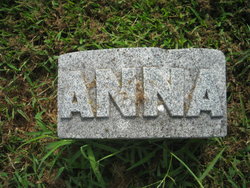
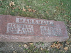
Sarah Ann “Sadie” Curry Marshall
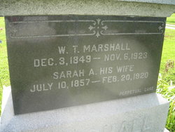
| Birth | : | 10 Jul 1857 Stronghurst, Henderson County, Illinois, USA |
| Death | : | 20 Feb 1920 Mills County, Iowa, USA |
| Burial | : | St. Luke's Churchyard, Hickling, Rushcliffe Borough, England |
| Coordinate | : | 52.8564100, -0.9742800 |
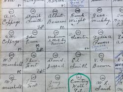
| Plot | : | Original Section #145 |
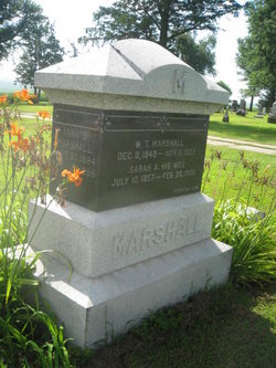
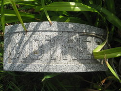
| Inscription | : | His Wife |
| Description | : | Sarah Ann Curry, daughter of John Whitting Curry and Eliza Rodman, was born July 19, 1857 in Stronghurst, Illinois and died February 20, 1920 in Mills County, Iowa after. She married William Thomas Marshall on February 5, 1880 in Henderson County, Illinois. |
frequently asked questions (FAQ):
-
Where is Sarah Ann “Sadie” Curry Marshall's memorial?
Sarah Ann “Sadie” Curry Marshall's memorial is located at: St. Luke's Churchyard, Hickling, Rushcliffe Borough, England.
-
When did Sarah Ann “Sadie” Curry Marshall death?
Sarah Ann “Sadie” Curry Marshall death on 20 Feb 1920 in Mills County, Iowa, USA
-
Where are the coordinates of the Sarah Ann “Sadie” Curry Marshall's memorial?
Latitude: 52.8564100
Longitude: -0.9742800
Family Members:
Parent
Spouse
Siblings
Children
Flowers:
Nearby Cemetories:
1. St. Luke's Churchyard
Hickling, Rushcliffe Borough, England
Coordinate: 52.8564100, -0.9742800
2. St. Luke's Churchyard, Hickling
Melton Mowbray, Melton Borough, England
Coordinate: 52.8563758, -0.9738774
3. St Luke's Churchyard
Kinoulton, Rushcliffe Borough, England
Coordinate: 52.8697400, -0.9964300
4. St Mary the Virgin Churchyard
Nether Broughton, Melton Borough, England
Coordinate: 52.8289780, -0.9687040
5. St Luke's Churchyard
Upper Broughton, Rushcliffe Borough, England
Coordinate: 52.8293700, -0.9870900
6. St. Remigius Churchyard
Long Clawson, Melton Borough, England
Coordinate: 52.8373290, -0.9294660
7. Long Clawson Sandpit Lane Cemetery
Long Clawson, Melton Borough, England
Coordinate: 52.8338110, -0.9273370
8. Saint Michael & All Angels Churchyard
Hose, Melton Borough, England
Coordinate: 52.8558840, -0.9080560
9. Hose Baptist Chapel Lane Churchyard
Hose, Melton Borough, England
Coordinate: 52.8588460, -0.9049480
10. Old Dalby Main Road Cemetery
Old Dalby, Melton Borough, England
Coordinate: 52.8084650, -1.0007670
11. St Mary the Virgin Churchyard
Harby, Melton Borough, England
Coordinate: 52.8739600, -0.8912030
12. St John the Baptist Churchyard
Old Dalby, Melton Borough, England
Coordinate: 52.8053510, -1.0017970
13. All Saints Churchyard
Stanton-on-the-Wolds, Rushcliffe Borough, England
Coordinate: 52.8693400, -1.0624900
14. St Andrews Churchyard
Langar, Rushcliffe Borough, England
Coordinate: 52.9034742, -0.9259344
15. St Giles Churchyard
Cropwell Bishop, Rushcliffe Borough, England
Coordinate: 52.9127600, -0.9831300
16. St Peter Churchyard
Widmerpool, Rushcliffe Borough, England
Coordinate: 52.8476890, -1.0679480
17. St. Michael's Churchyard
Wartnaby, Melton Borough, England
Coordinate: 52.8012220, -0.9447660
18. Church of St Mary and All Saints
Willoughby-on-the-Wolds, Rushcliffe Borough, England
Coordinate: 52.8227780, -1.0608330
19. St James Churchyard
Ab Kettleby, Melton Borough, England
Coordinate: 52.7985680, -0.9273270
20. St John the Baptist Churchyard
Grimston, Melton Borough, England
Coordinate: 52.7902720, -0.9850350
21. All Saints Churchyard
Cotgrave, Rushcliffe Borough, England
Coordinate: 52.9116900, -1.0436100
22. St. Guthlac's Churchyard
Stathern, Melton Borough, England
Coordinate: 52.8707708, -0.8528169
23. St Michael and All Angels Churchyard
Eastwell, Melton Borough, England
Coordinate: 52.8483680, -0.8508990
24. St Peter's Churchyard
Saxelbye, Melton Borough, England
Coordinate: 52.7817900, -0.9626700

