
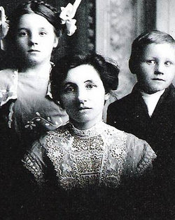
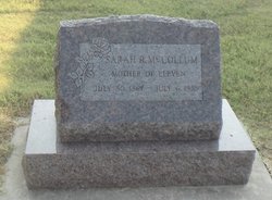
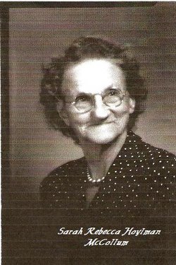
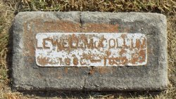
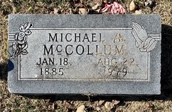
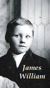
Sarah Rebecca “Sadie” Hoylman McCollum
| Birth | : | 30 Jul 1867 West Virginia, USA |
| Death | : | 6 Jul 1959 Butler County, Kansas, USA |
| Burial | : | North Shore Memory Gardens, Coloma, Berrien County, USA |
| Coordinate | : | 42.2024994, -86.3908005 |
| Description | : | Daughter of Franklin Renick Hoylman and Mary Catherine Kincaid. Married:16 September 1883. |
frequently asked questions (FAQ):
-
Where is Sarah Rebecca “Sadie” Hoylman McCollum's memorial?
Sarah Rebecca “Sadie” Hoylman McCollum's memorial is located at: North Shore Memory Gardens, Coloma, Berrien County, USA.
-
When did Sarah Rebecca “Sadie” Hoylman McCollum death?
Sarah Rebecca “Sadie” Hoylman McCollum death on 6 Jul 1959 in Butler County, Kansas, USA
-
Where are the coordinates of the Sarah Rebecca “Sadie” Hoylman McCollum's memorial?
Latitude: 42.2024994
Longitude: -86.3908005
Family Members:
Parent
Spouse
Siblings

Children
Flowers:


Nearby Cemetories:
1. Curtis Cemetery
Hagar Township, Berrien County, USA
Coordinate: 42.1856003, -86.3544006
2. Harris Cemetery
Lake Michigan Beach, Berrien County, USA
Coordinate: 42.2144012, -86.3482971
3. Lake Shore Cemetery
Riverside, Berrien County, USA
Coordinate: 42.1669388, -86.4177780
4. Coloma Cemetery
Coloma, Berrien County, USA
Coordinate: 42.1860008, -86.3119965
5. Boyer Cemetery
Bainbridge Center, Berrien County, USA
Coordinate: 42.1572222, -86.3305556
6. Kniebes Cemetery
Coloma, Berrien County, USA
Coordinate: 42.1511002, -86.3071976
7. Millburg Cemetery
Millburg, Berrien County, USA
Coordinate: 42.1264000, -86.3486023
8. Saint Josephs Catholic Cemetery
Watervliet, Berrien County, USA
Coordinate: 42.1852989, -86.2722015
9. Baptist Cemetery
Bainbridge Center, Berrien County, USA
Coordinate: 42.1455600, -86.2947300
10. Morton Hill Cemetery
Benton Harbor, Berrien County, USA
Coordinate: 42.1194000, -86.4417038
11. Fish Cemetery
Covert, Van Buren County, USA
Coordinate: 42.2655983, -86.2981033
12. Saint Marys Catholic Church Cemetery
Watervliet, Berrien County, USA
Coordinate: 42.1450000, -86.2916670
13. Saint Pauls United Church of Christ Cemetery
Watervliet, Berrien County, USA
Coordinate: 42.1447222, -86.2819444
14. Watervliet Cemetery
Watervliet, Berrien County, USA
Coordinate: 42.1886110, -86.2536110
15. New Hope United Methodist Church Cemetery
Bainbridge Center, Berrien County, USA
Coordinate: 42.1380530, -86.2812620
16. Emmanuel Home Cemetery
Covert, Van Buren County, USA
Coordinate: 42.2508253, -86.2624946
17. B'nai Sholom Cemetery
Fair Plain, Berrien County, USA
Coordinate: 42.0938988, -86.4163971
18. Crystal Springs Cemetery
Benton Harbor, Berrien County, USA
Coordinate: 42.0918999, -86.4150009
19. Temple Beth El Memorial Park
Berrien County, USA
Coordinate: 42.0908660, -86.4154530
20. Pearl Cemetery
Benton Township, Berrien County, USA
Coordinate: 42.0905991, -86.3641968
21. Calvary Cemetery
Benton Harbor, Berrien County, USA
Coordinate: 42.0901820, -86.4196160
22. Fairview Memorial Cemetery
Watervliet, Berrien County, USA
Coordinate: 42.1969440, -86.2236110
23. Bainbridge Cemetery
Bainbridge Center, Berrien County, USA
Coordinate: 42.1156006, -86.2694016
24. Byers Cemetery
Bainbridge Center, Berrien County, USA
Coordinate: 42.1156700, -86.2680820