
| Birth | : | 5 Sep 1811 Stouts Mills, Gilmer County, West Virginia, USA |
| Death | : | 17 Jul 1873 Braxton County, West Virginia, USA |
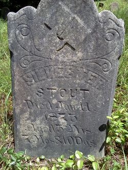
| Burial | : | Michael Stump Cemetery-Steer Creek, Stumptown, Gilmer County, USA |
| Coordinate | : | 38.8273200, -80.9736800 |
| Description | : | Sarah Stout, a daughter of Hezekiah Stout Jr., was born about 1811 and died in 1856. She married Jesse Stump. Jesse, a son of Michael Sr. and Sarah (Hughes) Stump, was born June 17, 1808 in the part of Harrison County VA that became Gilmer County WV. She married Jesse Stump on 1830 Jesse Stump, died July 1861, age 53 yrs, born Lewis co., son of Michael Stump & Margaret Stump, death reported by wife, Sarah Stump [nee Sarah Stout] DEATHS Stouts in Braxton Co., WV Patricia Seitas Sarah Stump [nee Sarah Stout], died July 17, 1873, age 61yr,... Read More |
frequently asked questions (FAQ):
-
Where is Sarah Sallie Stout Stump's memorial?
Sarah Sallie Stout Stump's memorial is located at: Michael Stump Cemetery-Steer Creek, Stumptown, Gilmer County, USA.
-
When did Sarah Sallie Stout Stump death?
Sarah Sallie Stout Stump death on 17 Jul 1873 in Braxton County, West Virginia, USA
-
Where are the coordinates of the Sarah Sallie Stout Stump's memorial?
Latitude: 38.8273200
Longitude: -80.9736800
Family Members:
Parent
Spouse

Siblings
Children
Flowers:


Nearby Cemetories:
1. Michael Stump Cemetery-Steer Creek
Stumptown, Gilmer County, USA
Coordinate: 38.8273200, -80.9736800
2. Elihu-Stump Cemetery
Gilmer County, USA
Coordinate: 38.8403015, -80.9878006
3. Collins Community Cemetery
Stumptown, Gilmer County, USA
Coordinate: 38.8459700, -80.9903630
4. Chestnut Lick Community Church Cemetery
Gilmer County, USA
Coordinate: 38.8223950, -80.9426220
5. Mount Pisgah Church Cemetery
Stumptown, Gilmer County, USA
Coordinate: 38.8469900, -80.9932700
6. Susan Stump Cemetery
Shock, Gilmer County, USA
Coordinate: 38.8012660, -80.9749330
7. Meadows Cemetery
Gilmer County, USA
Coordinate: 38.8506012, -80.9492035
8. Stump Cemetery
Stumptown, Gilmer County, USA
Coordinate: 38.8495000, -81.0030000
9. Snakeroot Cemetery
Gilmer County, USA
Coordinate: 38.8586006, -80.9910965
10. Normantown Cemetery
Normantown, Gilmer County, USA
Coordinate: 38.8511040, -80.9403910
11. Mollohan Cemetery
Normantown, Gilmer County, USA
Coordinate: 38.8429600, -80.9262500
12. Oak Grove Cemetery
Normantown, Gilmer County, USA
Coordinate: 38.8061420, -80.9267360
13. Upper Steer Run Baptist Church Cemetery
Gilmer County, USA
Coordinate: 38.8429370, -80.9227830
14. Boggs Cemetery
Normantown, Gilmer County, USA
Coordinate: 38.8238160, -80.9127130
15. Turner Cemetery
Lockney, Gilmer County, USA
Coordinate: 38.8764000, -80.9555969
16. Johnny Godfrey Cemetery
Lockney, Gilmer County, USA
Coordinate: 38.8755150, -80.9503720
17. Bennett Cemetery
Calhoun County, USA
Coordinate: 38.8636017, -81.0314026
18. Albert VanHorn Cemetery
Orton, Gilmer County, USA
Coordinate: 38.8178020, -80.8983150
19. Riddle Cemetery
Lockney, Gilmer County, USA
Coordinate: 38.8854710, -80.9561810
20. Kyer Cemetery
Perkins, Gilmer County, USA
Coordinate: 38.7861111, -80.9169444
21. Mount Camel Baptist Church Cemetery
Gassaway, Braxton County, USA
Coordinate: 38.8174450, -80.8914080
22. Mount Carmel Cemetery
Normantown, Gilmer County, USA
Coordinate: 38.8174280, -80.8913720
23. Moore Cemetery
Normantown, Gilmer County, USA
Coordinate: 38.7986160, -80.8970590
24. Beall Cemetery
Normantown, Gilmer County, USA
Coordinate: 38.8461306, -80.8910306