
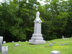
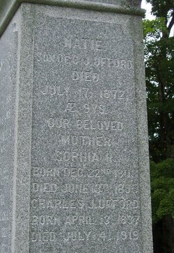
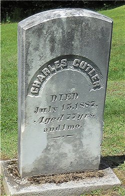
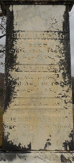
Sophia Huntington Cutler Ufford
| Birth | : | 22 Dec 1803 Glover, Orleans County, Vermont, USA |
| Death | : | 13 Jun 1895 Barton, Orleans County, Vermont, USA |
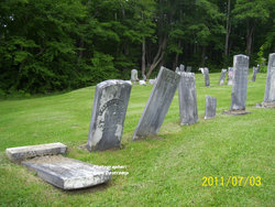
| Burial | : | Shamburger Cemetery, Moore County, USA |
| Coordinate | : | 35.4533005, -79.7300034 |
| Description | : | Born the daughter of Nathan Cutler & Martha "Patty" [Blanchard] Cutler. The following is courtesy of Cindy Walcott: Mrs. Sophia [Cutler] Ufford, mother of C.J. Ufford, died on Thursday last, at the home of her son, where she had resided since about 1870, aged 91 years. She was a resident of Glover until she came to this village [Barton]. She has been an invalid for about eight years from the effects of an accident. She was a very intelligent, capable woman, and had many friends among former and later acquaintances. Her funeral was held on Saturday,... Read More |
frequently asked questions (FAQ):
-
Where is Sophia Huntington Cutler Ufford's memorial?
Sophia Huntington Cutler Ufford's memorial is located at: Shamburger Cemetery, Moore County, USA.
-
When did Sophia Huntington Cutler Ufford death?
Sophia Huntington Cutler Ufford death on 13 Jun 1895 in Barton, Orleans County, Vermont, USA
-
Where are the coordinates of the Sophia Huntington Cutler Ufford's memorial?
Latitude: 35.4533005
Longitude: -79.7300034
Family Members:
Parent

Spouse
Siblings

Children
Flowers:


Nearby Cemetories:
1. Shamburger Cemetery
Moore County, USA
Coordinate: 35.4533005, -79.7300034
2. Dover Baptist Church Cemetery
Moore County, USA
Coordinate: 35.4381670, -79.7322950
3. Davis Family Cemetery
Dover, Moore County, USA
Coordinate: 35.4298300, -79.7088600
4. Mount Zion Wesleyan Church Cemetery
Moore County, USA
Coordinate: 35.4838290, -79.7376190
5. Archibald Freeman Family Cemetery
Star, Montgomery County, USA
Coordinate: 35.4300259, -79.7675443
6. Owen/Brewer camp meeting cemetery
Robbins, Moore County, USA
Coordinate: 35.4408422, -79.6820429
7. Melton family cemetery
Robbins, Moore County, USA
Coordinate: 35.4404412, -79.6787718
8. White Oak Springs Baptist Church Cemetery
Star, Montgomery County, USA
Coordinate: 35.4339943, -79.7816391
9. Guiding Light Baptist Church Cemetery
Robbins, Moore County, USA
Coordinate: 35.4202520, -79.6899960
10. Bascom Chapel United Methodist Church Cemetery
Robbins, Moore County, USA
Coordinate: 35.4393080, -79.6755880
11. Lassiter Cemetery
Montgomery County, USA
Coordinate: 35.4132350, -79.7614400
12. Ether United Methodist Church Cemetery
Star, Montgomery County, USA
Coordinate: 35.4418250, -79.7890830
13. Cagle Cemetery
Moore County, USA
Coordinate: 35.5007090, -79.7518280
14. Little Oak Church of God Cemetery
Robbins, Moore County, USA
Coordinate: 35.4773960, -79.6720470
15. Asbury Baptist Church Cemetery
Montgomery County, USA
Coordinate: 35.4904900, -79.7765990
16. Allred Family Cemetery
Westmore, Moore County, USA
Coordinate: 35.4769500, -79.6687400
17. New Hope Baptist Church Cemetery
Star, Montgomery County, USA
Coordinate: 35.4023520, -79.7590360
18. Star House of Praise Cemetery
Star, Montgomery County, USA
Coordinate: 35.4137600, -79.7848290
19. Deaton-Lamonds Cemetery
Star, Montgomery County, USA
Coordinate: 35.3978454, -79.7593053
20. Union Grove Baptist Church Cemetery
Seagrove, Randolph County, USA
Coordinate: 35.5137430, -79.7224430
21. New Hope Cemetery
Star, Montgomery County, USA
Coordinate: 35.3950005, -79.7561035
22. Hursey-Freeman Cemetery
Star, Montgomery County, USA
Coordinate: 35.4092130, -79.7847950
23. Allen Family Cemetery
Eagle Springs, Moore County, USA
Coordinate: 35.3922500, -79.7005300
24. Tucker - Freeman Cemetery
Star, Montgomery County, USA
Coordinate: 35.4118070, -79.7953790