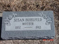
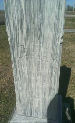
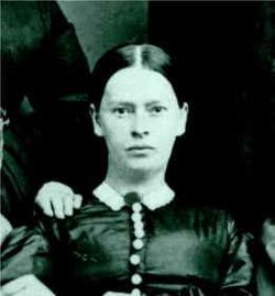
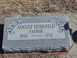
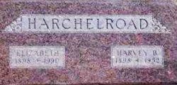
Susan B. Hargeleroad Hohlfeld
| Birth | : | 12 Jun 1856 Pennsylvania, USA |
| Death | : | 9 Nov 1912 Juniata, Adams County, Nebraska, USA |
| Burial | : | Valley View Cemetery, Warsaw, Coshocton County, USA |
| Coordinate | : | 40.3255997, -82.0139008 |
| Plot | : | Block 1, Lot 65 |
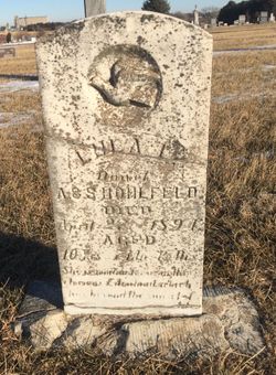
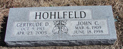
| Description | : | Full name Susannah Brugh Hargleroad. Married August Hohlfeld. The couple adopted Lulu who was killed in an accident in Hemet, California in 1894. Next they adopted John C. Hohlfeld in 1909. John C. Hohlfeld, Sr. set up this headstone. Dates and spelling of name taken from rootsweb at Ancestry.com |
frequently asked questions (FAQ):
-
Where is Susan B. Hargeleroad Hohlfeld's memorial?
Susan B. Hargeleroad Hohlfeld's memorial is located at: Valley View Cemetery, Warsaw, Coshocton County, USA.
-
When did Susan B. Hargeleroad Hohlfeld death?
Susan B. Hargeleroad Hohlfeld death on 9 Nov 1912 in Juniata, Adams County, Nebraska, USA
-
Where are the coordinates of the Susan B. Hargeleroad Hohlfeld's memorial?
Latitude: 40.3255997
Longitude: -82.0139008
Family Members:
Parent
Spouse
Siblings
Children
Flowers:
Nearby Cemetories:
1. Jefferson Presbyterian Cemetery
Warsaw, Coshocton County, USA
Coordinate: 40.3200690, -82.0165291
2. Antioch Cemetery
Coshocton County, USA
Coordinate: 40.3046989, -81.9933014
3. Bateman Cemetery
Warsaw, Coshocton County, USA
Coordinate: 40.3483840, -81.9876370
4. Blooming Grove Cemetery
Randle, Coshocton County, USA
Coordinate: 40.3017006, -81.9843979
5. Darling Run Cemetery
Nellie, Coshocton County, USA
Coordinate: 40.3436012, -82.0505981
6. Bethel Cemetery
Warsaw, Coshocton County, USA
Coordinate: 40.3615800, -82.0165150
7. Mohawk Methodist Church Cemetery
Mohawk Village, Coshocton County, USA
Coordinate: 40.3182290, -82.0724610
8. Mount Zion Methodist Church Cemetery
Metham, Coshocton County, USA
Coordinate: 40.3559580, -81.9522140
9. Saint Elizabeth Mission Cemetery
Spring Mountain, Coshocton County, USA
Coordinate: 40.3817900, -82.0108300
10. Waring Cemetery
Metham, Coshocton County, USA
Coordinate: 40.3505580, -81.9470740
11. Butler East Cemetery
Nellie, Coshocton County, USA
Coordinate: 40.3514580, -82.0818970
12. Weatherwax Cemetery
Clark, Coshocton County, USA
Coordinate: 40.3839560, -81.9918080
13. Foster-Lowary-McCullough Cemetery
Coshocton County, USA
Coordinate: 40.2708400, -81.9761450
14. Bucklew Cemetery
Metham, Coshocton County, USA
Coordinate: 40.3849983, -81.9858017
15. Butler West Cemetery
Nellie, Coshocton County, USA
Coordinate: 40.3523620, -82.0961490
16. Casebeer Cemetery
Metham, Coshocton County, USA
Coordinate: 40.3629220, -81.9360840
17. Mikesell Cemetery
West Bedford, Coshocton County, USA
Coordinate: 40.2882500, -82.0963240
18. Blissfield Cemetery
Blissfield, Coshocton County, USA
Coordinate: 40.3927994, -81.9728012
19. McCurdy Family Cemetery
Tunnel Hill, Coshocton County, USA
Coordinate: 40.2508370, -82.0165580
20. Dutch Meeting House Cemetery
Warsaw, Coshocton County, USA
Coordinate: 40.3796207, -81.9459337
21. West Bedford Cemetery #1
Bedford Township, Coshocton County, USA
Coordinate: 40.2636000, -82.0739000
22. Machpelahs Burial Acres
Keene, Coshocton County, USA
Coordinate: 40.3208950, -81.9126210
23. Prairie Chapel Church Cemetery
Coshocton, Coshocton County, USA
Coordinate: 40.3049000, -81.9124000
24. Mohawk Baptist Church Cemetery
Nellie, Coshocton County, USA
Coordinate: 40.2941380, -82.1107120

