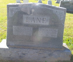
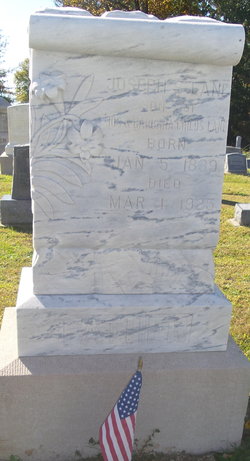
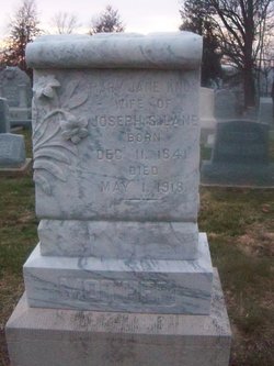
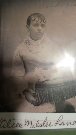
Thomas Richard Lane
| Birth | : | 8 Aug 1859 Brazeau, Perry County, Missouri, USA |
| Death | : | 18 Feb 1949 St. Louis County, Missouri, USA |
| Burial | : | Machpelah Cemetery, Mount Sterling, Montgomery County, USA |
| Coordinate | : | 38.0564003, -83.9310989 |
| Plot | : | Row 13 |
| Description | : | According to pioneers of Brazeau: Thomas Lane in 1884 went to the state of Kansas to homestead 180 acres of land near Mullinsville, KS. They traveled by covered wagon and camped out by the wayside most of the journey. While in Kansas they lived in a sod house as did most of those who homesteaded prarie land. From Brazeau Church history book Served as an elder beginning 1905 |
frequently asked questions (FAQ):
-
Where is Thomas Richard Lane's memorial?
Thomas Richard Lane's memorial is located at: Machpelah Cemetery, Mount Sterling, Montgomery County, USA.
-
When did Thomas Richard Lane death?
Thomas Richard Lane death on 18 Feb 1949 in St. Louis County, Missouri, USA
-
Where are the coordinates of the Thomas Richard Lane's memorial?
Latitude: 38.0564003
Longitude: -83.9310989
Family Members:
Parent
Spouse
Siblings
Children
Flowers:
Nearby Cemetories:
1. Machpelah Cemetery
Mount Sterling, Montgomery County, USA
Coordinate: 38.0564003, -83.9310989
2. Walker Cemetery
Mount Sterling, Montgomery County, USA
Coordinate: 38.0544870, -83.9321890
3. Lincolnview Cemetery
Mount Sterling, Montgomery County, USA
Coordinate: 38.0583330, -83.9275000
4. Fairview Cemetery
Mount Sterling, Montgomery County, USA
Coordinate: 38.0588989, -83.9272003
5. Olive Hill Cemetery
Mount Sterling, Montgomery County, USA
Coordinate: 38.0593987, -83.9263992
6. Estill's Defeat Cemetery
Mount Sterling, Montgomery County, USA
Coordinate: 38.0539120, -83.9376340
7. Episcopal Church Cemetery
Mount Sterling, Montgomery County, USA
Coordinate: 38.0566670, -83.9441670
8. Magowan Cemetery
Mount Sterling, Montgomery County, USA
Coordinate: 38.0483017, -83.9178009
9. Divine and Ramey Cemetery
Mount Sterling, Montgomery County, USA
Coordinate: 38.0680560, -83.9227780
10. Love Cemetery
Montgomery County, USA
Coordinate: 38.0460590, -83.9179920
11. Daniel Cemetery
Mount Sterling, Montgomery County, USA
Coordinate: 38.0666670, -83.9452780
12. Civil War Cemetery
Montgomery County, USA
Coordinate: 38.0561110, -83.9505560
13. Hopwood Cemetery
Montgomery County, USA
Coordinate: 38.0597229, -83.9083328
14. Saint Thomas Cemetery
Mount Sterling, Montgomery County, USA
Coordinate: 38.0710983, -83.9483032
15. Chenault Cemetery
Mount Sterling, Montgomery County, USA
Coordinate: 38.0357450, -83.9220540
16. Spratt and Cockrell Family Cemetery
Mount Sterling, Montgomery County, USA
Coordinate: 38.0337100, -83.9377460
17. Lockridge Cemetery
Montgomery County, USA
Coordinate: 38.0397220, -83.8933330
18. Calk Cemetery
Mount Sterling, Montgomery County, USA
Coordinate: 38.0290670, -83.9609640
19. Ferguson Cemetery
Grassy Lick, Montgomery County, USA
Coordinate: 38.0680560, -83.9750000
20. Orear Cemetery
Montgomery County, USA
Coordinate: 38.0204210, -83.9019290
21. Orear Cemetery
Montgomery County, USA
Coordinate: 38.0238890, -83.9675000
22. Jones Cemetery
Montgomery County, USA
Coordinate: 38.0891991, -83.8822021
23. Cheatham Cemetery
Montgomery County, USA
Coordinate: 38.0194440, -83.8800000
24. Fletcher-Garrett Cemetery
Montgomery County, USA
Coordinate: 38.0128674, -83.9738331

