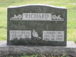
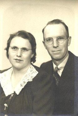
Vera Irene Gerard Richard
| Birth | : | 29 Apr 1919 Norton County, Kansas, USA |
| Death | : | 9 Jul 1975 Kansas City, Wyandotte County, Kansas, USA |
| Burial | : | Saint Joseph City Cemetery, Saint Joseph, Berrien County, USA |
| Coordinate | : | 42.0960090, -86.4905980 |
| Description | : | Blade-Empire - Concordia - July 10, 1975 Mrs. John W. Richard Irene Richard was born April 29, 1919 in Norton County, Kansas, the daughter of Mr. and Mrs. M. A. Gerard. She passed away at K.U. Medical Center July 9, 1975 at the age of 56 years, 2 months, and 10 days, after an illness of 3 1/2 months. Irene moved to Cloud County with her family at the age of three and lived here until the time of her death. She was employed by Seymours of Concordia for more than 30 years. Irene was married to... Read More |
frequently asked questions (FAQ):
-
Where is Vera Irene Gerard Richard's memorial?
Vera Irene Gerard Richard's memorial is located at: Saint Joseph City Cemetery, Saint Joseph, Berrien County, USA.
-
When did Vera Irene Gerard Richard death?
Vera Irene Gerard Richard death on 9 Jul 1975 in Kansas City, Wyandotte County, Kansas, USA
-
Where are the coordinates of the Vera Irene Gerard Richard's memorial?
Latitude: 42.0960090
Longitude: -86.4905980
Family Members:
Parent
Spouse
Siblings
Flowers:
Nearby Cemetories:
1. Resurrection Cemetery
Saint Joseph, Berrien County, USA
Coordinate: 42.0975800, -86.4920883
2. First Congregational Church UCC Memorial Garden
Saint Joseph, Berrien County, USA
Coordinate: 42.0949790, -86.4842940
3. Saint Joseph First UMC Memorial Garden
Saint Joseph, Berrien County, USA
Coordinate: 42.0810930, -86.4909620
4. Highland Cemetery
Saint Joseph, Berrien County, USA
Coordinate: 42.0650980, -86.4987150
5. Riverview Cemetery
Saint Joseph, Berrien County, USA
Coordinate: 42.0657997, -86.4657974
6. Morton Hill Cemetery
Benton Harbor, Berrien County, USA
Coordinate: 42.1194000, -86.4417038
7. Calvary Cemetery
Benton Harbor, Berrien County, USA
Coordinate: 42.0901820, -86.4196160
8. B'nai Sholom Cemetery
Fair Plain, Berrien County, USA
Coordinate: 42.0938988, -86.4163971
9. Temple Beth El Memorial Park
Berrien County, USA
Coordinate: 42.0908660, -86.4154530
10. Hickory Bluff Cemetery
Stevensville, Berrien County, USA
Coordinate: 42.0398670, -86.4952000
11. Crystal Springs Cemetery
Benton Harbor, Berrien County, USA
Coordinate: 42.0918999, -86.4150009
12. Jerome Cemetery
Saint Joseph, Berrien County, USA
Coordinate: 42.0302699, -86.4758279
13. Spring Run Cemetery
Scottdale, Berrien County, USA
Coordinate: 42.0407600, -86.4348526
14. Lincoln Charter Township Cemetery
Stevensville, Berrien County, USA
Coordinate: 42.0271490, -86.5139110
15. Bethel Cemetery
Sodus, Berrien County, USA
Coordinate: 42.0652770, -86.4013880
16. Lake Shore Cemetery
Riverside, Berrien County, USA
Coordinate: 42.1669388, -86.4177780
17. Pearl Cemetery
Benton Township, Berrien County, USA
Coordinate: 42.0905991, -86.3641968
18. Royalton Cemetery
Saint Joseph, Berrien County, USA
Coordinate: 42.0094365, -86.4249946
19. Millburg Cemetery
Millburg, Berrien County, USA
Coordinate: 42.1264000, -86.3486023
20. Mount Pleasant Cemetery
Sodus Township, Berrien County, USA
Coordinate: 42.0194016, -86.3581009
21. Brant Cemetery
Bainbridge Township, Berrien County, USA
Coordinate: 42.0866000, -86.3197000
22. North Shore Memory Gardens
Coloma, Berrien County, USA
Coordinate: 42.2024994, -86.3908005
23. Feather Cemetery
Hinchman, Berrien County, USA
Coordinate: 41.9720955, -86.4356689
24. Ruggles Cemetery
Baroda, Berrien County, USA
Coordinate: 41.9644012, -86.4906006

