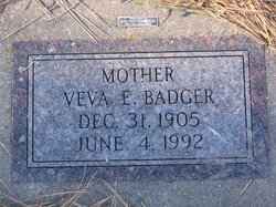
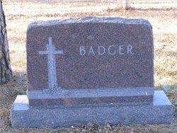
Veva Eveline Woodward Badger
| Birth | : | 31 Dec 1905 Callaway, Custer County, Nebraska, USA |
| Death | : | 4 Jun 1992 Las Vegas, Clark County, Nevada, USA |
| Burial | : | Hollybrook War Memorial, Southampton, Southampton Unitary Authority, England |
| Coordinate | : | 50.9337420, -1.4311350 |
| Plot | : | Div B Blk 104 Lot 001 Grave 003 |
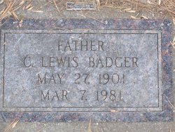
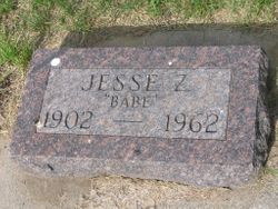
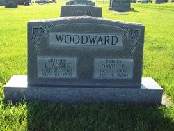
| Description | : | Veva Eveline Woodward was born 31 Dec 1905 in Callaway, Custer Co, Nebraska and died 4 Jun 1992 in Las Vegas, Clark Co, Nevada. Veva, born third of ten children, was the daughter of Herman Delbert and Ella Myrtle (Nicholson) Woodward. Her siblings include in birth order: Jesse Zacharia 1902, Mattie Ethel Feb 1904, Veva Eveline 1905, Orvel Elisha George 1907, Anna Audra 1910, Arle Maria 1912, Lawrence Elmer 1913, Dorothea Delila 1916, Beverly Burnham 1918, Helen Juanita 1923. Veva married Charles Lewis Badger 20 Apr 1924 in Dupree, SD; 8 children. C. Lewis Badger, born in Illinois, was the second... Read More |
frequently asked questions (FAQ):
-
Where is Veva Eveline Woodward Badger's memorial?
Veva Eveline Woodward Badger's memorial is located at: Hollybrook War Memorial, Southampton, Southampton Unitary Authority, England.
-
When did Veva Eveline Woodward Badger death?
Veva Eveline Woodward Badger death on 4 Jun 1992 in Las Vegas, Clark County, Nevada, USA
-
Where are the coordinates of the Veva Eveline Woodward Badger's memorial?
Latitude: 50.9337420
Longitude: -1.4311350
Family Members:
Parent
Spouse
Siblings
Children
Flowers:
Nearby Cemetories:
1. Hollybrook War Memorial
Southampton, Southampton Unitary Authority, England
Coordinate: 50.9337420, -1.4311350
2. Hollybrook Cemetery
Southampton, Southampton Unitary Authority, England
Coordinate: 50.9340680, -1.4312970
3. St. James by the Park Cemetery
Southampton Unitary Authority, England
Coordinate: 50.9267988, -1.4283898
4. St James by the Park Churchyard
Shirley, Southampton Unitary Authority, England
Coordinate: 50.9266800, -1.4285800
5. Southampton Old Cemetery
Southampton, Southampton Unitary Authority, England
Coordinate: 50.9202900, -1.4130650
6. St. Nicholas Churchyard
Millbrook, Southampton Unitary Authority, England
Coordinate: 50.9139100, -1.4439800
7. Millbrook Cemetery
Millbrook, Southampton Unitary Authority, England
Coordinate: 50.9164900, -1.4526100
8. Holy Trinity Churchyard
Millbrook, Southampton Unitary Authority, England
Coordinate: 50.9158400, -1.4535100
9. Highfield Churchyard
Portswood, Southampton Unitary Authority, England
Coordinate: 50.9295400, -1.3949800
10. St John the Evangelist Churchyard
Rownhams, Test Valley Borough, England
Coordinate: 50.9520900, -1.4541200
11. Southampton Crematorium and Garden of Remembrance
Southampton, Southampton Unitary Authority, England
Coordinate: 50.9471770, -1.3899120
12. St. Deny's Churchyard
Chilworth, Test Valley Borough, England
Coordinate: 50.9669770, -1.4226050
13. St. Mary's Churchyard
Swaythling, Southampton Unitary Authority, England
Coordinate: 50.9367800, -1.3752300
14. All Saints Catacombs and Burial Ground (Defunct)
Southampton, Southampton Unitary Authority, England
Coordinate: 50.9013350, -1.4021500
15. St Michael the Archangel Churchyard
Southampton, Southampton Unitary Authority, England
Coordinate: 50.8996200, -1.4056900
16. St Mary Churchyard
Southampton, Southampton Unitary Authority, England
Coordinate: 50.9027100, -1.3960800
17. Holyrood Church
Southampton Unitary Authority, England
Coordinate: 50.8997498, -1.4034560
18. Holyrood Churchyard
Southampton, Southampton Unitary Authority, England
Coordinate: 50.8996600, -1.4035300
19. St. Mary the Virgin Churchyard
Eling, New Forest District, England
Coordinate: 50.9103000, -1.4795700
20. St Boniface Churchyard
Nursling, Test Valley Borough, England
Coordinate: 50.9464660, -1.4896760
21. St Lawrence with St John Churchyard
Southampton, Southampton Unitary Authority, England
Coordinate: 50.8977570, -1.4052470
22. Eling Cemetery
Eling, New Forest District, England
Coordinate: 50.9092640, -1.4817810
23. St Nicolas Churchyard
North Stoneham, Eastleigh Borough, England
Coordinate: 50.9535160, -1.3741760
24. St. Julien's Church
Southampton, Southampton Unitary Authority, England
Coordinate: 50.8965000, -1.4036000

