
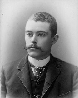

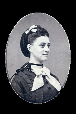
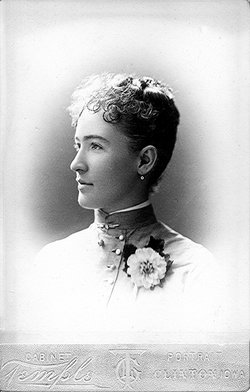
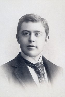
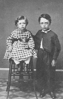
Ward Worthington Cooley
| Birth | : | 22 Aug 1861 Milton, Chittenden County, Vermont, USA |
| Death | : | 25 Aug 1932 Clinton, Clinton County, Iowa, USA |
| Burial | : | St Margaret of Antioch Churchyard Extension, Hinton Waldrist, Vale of White Horse District, England |
| Coordinate | : | 51.6911016, -1.4589705 |
| Description | : | Funeral Services for Ward W. Cooley, died Wednesday evening, will be held in the Rockwell Mortuary Chapel. Burial will be in Oakland Cemetery. Friends may call at the chapel between 7 and 9 o'clock this evening. Ward W. Cooley was born in Vermont, August 22, 1861, the son of Albin D. Cooley and Elizabeth F. Fisher Cooley. He came to Iowa with his parents in 1863, his father having been a veteran railroad man, coming to Clinton with I. B. Howe, builder of the first railroad running west from this city. Mr. Cooley was married to Miss Bertha... Read More |
frequently asked questions (FAQ):
-
Where is Ward Worthington Cooley's memorial?
Ward Worthington Cooley's memorial is located at: St Margaret of Antioch Churchyard Extension, Hinton Waldrist, Vale of White Horse District, England.
-
When did Ward Worthington Cooley death?
Ward Worthington Cooley death on 25 Aug 1932 in Clinton, Clinton County, Iowa, USA
-
Where are the coordinates of the Ward Worthington Cooley's memorial?
Latitude: 51.6911016
Longitude: -1.4589705
Family Members:
Parent
Spouse
Siblings

Children


Flowers:


Nearby Cemetories:
1. St Margaret of Antioch Churchyard Extension
Hinton Waldrist, Vale of White Horse District, England
Coordinate: 51.6911016, -1.4589705
2. St. Margaret Churchyard
Hinton Waldrist, Vale of White Horse District, England
Coordinate: 51.6894380, -1.4587200
3. Saint Mary Churchyard
Longworth, Vale of White Horse District, England
Coordinate: 51.6926577, -1.4457428
4. St Marys Churchyard
Shifford, West Oxfordshire District, England
Coordinate: 51.7151440, -1.4631340
5. All Saints Church
Pusey, Vale of White Horse District, England
Coordinate: 51.6663890, -1.4801330
6. St. John the Baptist Churchyard
Kingston Bagpuize, Vale of White Horse District, England
Coordinate: 51.6820690, -1.4127410
7. St Mary Churchyard
Buckland, Vale of White Horse District, England
Coordinate: 51.6819730, -1.5060150
8. St George Roman Catholic Churchyard
Buckland, Vale of White Horse District, England
Coordinate: 51.6804300, -1.5068720
9. Cote Baptist Chapel
Cote, West Oxfordshire District, England
Coordinate: 51.7254430, -1.4929510
10. St Nicholas Churchyard
Fyfield, Vale of White Horse District, England
Coordinate: 51.6871100, -1.3888600
11. St. Giles' Churchyard
Standlake, West Oxfordshire District, England
Coordinate: 51.7299550, -1.4262300
12. St. Peter Churchyard
Charney Bassett, Vale of White Horse District, England
Coordinate: 51.6472944, -1.4501905
13. St. James the Great Churchyard
Aston, West Oxfordshire District, England
Coordinate: 51.7252620, -1.5059510
14. St Mary's Churchyard
Lyford, Vale of White Horse District, England
Coordinate: 51.6456433, -1.4371256
15. St George's Parish Church
Hatford, Vale of White Horse District, England
Coordinate: 51.6510000, -1.5120000
16. St. Denys' Churchyard
Northmoor, West Oxfordshire District, England
Coordinate: 51.7230000, -1.3918000
17. St. Lawrence Churchyard
Tubney, Vale of White Horse District, England
Coordinate: 51.6903100, -1.3712600
18. St. Luke's Churchyard
Garford, Vale of White Horse District, England
Coordinate: 51.6637514, -1.3815467
19. St Deny's Churchyard
Stanford-in-the-Vale, Vale of White Horse District, England
Coordinate: 51.6399960, -1.5062800
20. Littleworth Cemetery
Littleworth, Vale of White Horse District, England
Coordinate: 51.6722500, -1.5492500
21. South Oxfordshire Memorial Park and Crematorium
Garford, Vale of White Horse District, England
Coordinate: 51.6535980, -1.3767840
22. St. James The Great Churchyard
West Hanney, Vale of White Horse District, England
Coordinate: 51.6325030, -1.4144360
23. St Laurence Church
Appleton, Vale of White Horse District, England
Coordinate: 51.7110290, -1.3588780
24. St. Mary the Virgin Churchyard
Bampton, West Oxfordshire District, England
Coordinate: 51.7278250, -1.5487270