
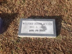
Welford Roane Wilson
| Birth | : | 8 Dec 1910 Virginia, USA |
| Death | : | 29 Aug 2008 Gloucester County, Virginia, USA |
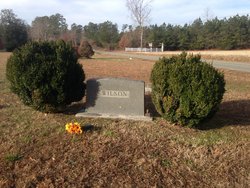
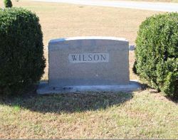
| Burial | : | Olive Branch United Methodist Church Cemetery, Harcum, Gloucester County, USA |
| Coordinate | : | 37.5070790, -76.5191580 |
| Description | : | GLOUCESTER — Welford Roane Wilson, 97, died at his home on Friday, Aug. 29, 2008. He was born in Cash, Va., and retired in 1976 from Virginia Dept. of Transportation as a heavy equipment operator. He was a member of Olive Branch United Methodist Church, the Men's Bible Class, United Methodist Men, and the treasurer of the building fund of the church. Welford was the oldest member of Gloucester Volunteer Fire and Rescue, the Redman Council, and the Piankatank Community League. He was a graduate of New Upton School. He was preceded in death by his wife of 67 years, Evelyn Elizabeth... Read More |
frequently asked questions (FAQ):
-
Where is Welford Roane Wilson's memorial?
Welford Roane Wilson's memorial is located at: Olive Branch United Methodist Church Cemetery, Harcum, Gloucester County, USA.
-
When did Welford Roane Wilson death?
Welford Roane Wilson death on 29 Aug 2008 in Gloucester County, Virginia, USA
-
Where are the coordinates of the Welford Roane Wilson's memorial?
Latitude: 37.5070790
Longitude: -76.5191580
Family Members:
Parent

Spouse
Siblings

Flowers:


Nearby Cemetories:
1. Ebenezer Baptist Church Cemetery
Gloucester, Gloucester County, USA
Coordinate: 37.4989000, -76.5308960
2. Gleaning Baptist Church Cemetery
Harcum, Gloucester County, USA
Coordinate: 37.5151120, -76.4972470
3. Zion Hill Baptist Church Cemetery
Gloucester, Gloucester County, USA
Coordinate: 37.4840290, -76.5263470
4. New Mount Zion Baptist Church Cemetery
Gloucester County, USA
Coordinate: 37.5112070, -76.5924850
5. Barn Elms Plantation Cemetery
Middlesex County, USA
Coordinate: 37.5435146, -76.4572527
6. Rising Valley Baptist Church Cemetery
Gloucester County, USA
Coordinate: 37.4663940, -76.4589210
7. Salem United Methodist Church Cemetery
Gloucester, Gloucester County, USA
Coordinate: 37.5283210, -76.5938500
8. Windsor Gardens Cemetery
Mathews, Mathews County, USA
Coordinate: 37.4808390, -76.4458140
9. Grafton Baptist Church Cemetery
Hartfield, Middlesex County, USA
Coordinate: 37.5594100, -76.4698150
10. Lower United Methodist Church Cemetery
Hartfield, Middlesex County, USA
Coordinate: 37.5525990, -76.4584960
11. Locust Grove United Methodist Church Cemetery
Soles, Mathews County, USA
Coordinate: 37.4897570, -76.4385580
12. Windsor Road Family Cemetery
Dutton, Gloucester County, USA
Coordinate: 37.4837990, -76.4406860
13. Mount Zion United Methodist Church Cemetery
Gloucester, Gloucester County, USA
Coordinate: 37.4506600, -76.4724080
14. Holland Point Cemetery
Mathews, Mathews County, USA
Coordinate: 37.5094400, -76.4338900
15. Shepherdsville Baptist Church Cemetery
Gloucester County, USA
Coordinate: 37.4509200, -76.5684680
16. Church of the Visitation Cemetery
Topping, Middlesex County, USA
Coordinate: 37.5717930, -76.4854130
17. Mount Olive Church Cemetery
Harfield, Middlesex County, USA
Coordinate: 37.5410570, -76.4327490
18. Harmony Grove Baptist Church Cemetery
Topping, Middlesex County, USA
Coordinate: 37.5809160, -76.4876420
19. Petsworth Parish Episcopal Church Cemetery
Gloucester County, USA
Coordinate: 37.4637186, -76.6046384
20. Grace Bible Church Cemetery
Ark, Gloucester County, USA
Coordinate: 37.4411260, -76.5790070
21. Spring Hill Baptist Church Cemetery
Cobbs Creek, Mathews County, USA
Coordinate: 37.4936730, -76.4160275
22. First Baptist Church of Harmony Village Cemetery
Harmony Village, Middlesex County, USA
Coordinate: 37.5873840, -76.4905660
23. Ware Episcopal Church Cemetery
Gloucester, Gloucester County, USA
Coordinate: 37.4227470, -76.5078880
24. Unnamed Colonial Era Farm Cemetery
Owl Trap, Gloucester County, USA
Coordinate: 37.5239449, -76.6276016