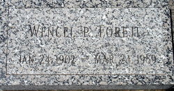
Wencel P. Forejt
| Birth | : | 24 Jan 1902 Nenzel, Cherry County, Nebraska, USA |
| Death | : | 24 Mar 1989 Niobrara, Knox County, Nebraska, USA |
| Burial | : | Runnymede Memorial, Englefield Green, Runnymede Borough, England |
| Coordinate | : | 51.4378433, -0.5649990 |
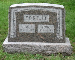
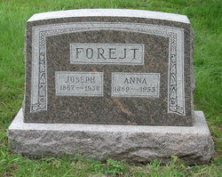
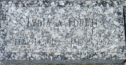
| Description | : | WENCEL P. FOREJT was born January 24, 1902 in Nenzel, NE and died March 24, 1989 in Niobrara, NE at age 87. PARENTS: Joseph Forejt 1867 Bohemia - 1938 NE Anna Kudelka 1869 Moravia - 1953 NE SPOUSE: On December 15, 1930, Wencel married Lydia A. Suchy, daughter of Vaclav and Anna (Slechta) Suchy. Wencel and Lydia celebrated their 50th Wedding Anniversary in December 1980. Lydia died 11 months later. Wencel attended school at Niobrara. He and Lydia resided all their lives on a farm south of Niobrara. He was a member of Ionic Lodge... Read More |
frequently asked questions (FAQ):
-
Where is Wencel P. Forejt's memorial?
Wencel P. Forejt's memorial is located at: Runnymede Memorial, Englefield Green, Runnymede Borough, England.
-
When did Wencel P. Forejt death?
Wencel P. Forejt death on 24 Mar 1989 in Niobrara, Knox County, Nebraska, USA
-
Where are the coordinates of the Wencel P. Forejt's memorial?
Latitude: 51.4378433
Longitude: -0.5649990
Family Members:
Parent
Spouse
Siblings
Children
Flowers:
Nearby Cemetories:
1. Runnymede Memorial
Englefield Green, Runnymede Borough, England
Coordinate: 51.4378433, -0.5649990
2. Englefield Green Cemetery
Englefield Green, Runnymede Borough, England
Coordinate: 51.4273640, -0.5730490
3. St. John the Baptist Churchyard
Egham, Runnymede Borough, England
Coordinate: 51.4327120, -0.5443380
4. Saint Andrew's Churchyard
Wraysbury, Windsor and Maidenhead Royal Borough, England
Coordinate: 51.4558200, -0.5600900
5. St. Peter and St. Andrew Churchyard
Old Windsor, Windsor and Maidenhead Royal Borough, England
Coordinate: 51.4621120, -0.5727310
6. Church Road Cemetery
Old Windsor, Windsor and Maidenhead Royal Borough, England
Coordinate: 51.4622500, -0.5805900
7. St. Mary's Churchyard
Staines, Spelthorne Borough, England
Coordinate: 51.4365400, -0.5191540
8. Christ Church Churchyard
Virginia Water, Runnymede Borough, England
Coordinate: 51.4073160, -0.5796440
9. St Marys Churchyard
Thorpe, Runnymede Borough, England
Coordinate: 51.4075720, -0.5293820
10. St Michael's Churchyard
Horton, Aylesbury Vale District, England
Coordinate: 51.4725400, -0.5402620
11. St Michael Churchyard
Horton, Windsor and Maidenhead Royal Borough, England
Coordinate: 51.4728500, -0.5403800
12. Royal Burial Ground
Windsor, Windsor and Maidenhead Royal Borough, England
Coordinate: 51.4740562, -0.5986640
13. Adelaide Cottage
Windsor, Windsor and Maidenhead Royal Borough, England
Coordinate: 51.4790700, -0.5903400
14. Datchet Parish Council Cemetery
Datchet, Windsor and Maidenhead Royal Borough, England
Coordinate: 51.4836530, -0.5657230
15. St. Mary the Virgin Churchyard
Datchet, Windsor and Maidenhead Royal Borough, England
Coordinate: 51.4843260, -0.5782760
16. London Road Cemetery
Staines, Spelthorne Borough, England
Coordinate: 51.4380000, -0.4889100
17. Windsor Cemetery
Windsor, Windsor and Maidenhead Royal Borough, England
Coordinate: 51.4703170, -0.6231090
18. Slopes of Windsor
Windsor, Windsor and Maidenhead Royal Borough, England
Coordinate: 51.4850000, -0.5950000
19. St John the Baptist Churchyard
Windsor, Windsor and Maidenhead Royal Borough, England
Coordinate: 51.4786250, -0.6136450
20. Stanwell Cemetery
Stanwell, Spelthorne Borough, England
Coordinate: 51.4523640, -0.4840770
21. Albert Memorial Chapel
Windsor, Windsor and Maidenhead Royal Borough, England
Coordinate: 51.4837180, -0.6061340
22. St. George's Chapel
Windsor, Windsor and Maidenhead Royal Borough, England
Coordinate: 51.4835910, -0.6068820
23. Saint Thomas Churchyard
Colnbrook, Slough Borough, England
Coordinate: 51.4845890, -0.5219910
24. All Saints Churchyard
Laleham, Spelthorne Borough, England
Coordinate: 51.4091880, -0.4898680

