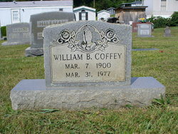
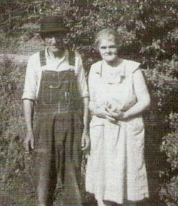
William Brownloe “Bill” Coffey
| Birth | : | 7 Mar 1900 Bean Station, Grainger County, Tennessee, USA |
| Death | : | 31 Mar 1977 Bean Station, Grainger County, Tennessee, USA |
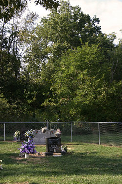
| Burial | : | Meadow Branch Cemetery, Bean Station, Grainger County, USA |
| Coordinate | : | 36.3572006, -83.2822037 |
| Description | : | William B.Coffey,age 77 of Route 1 Mooresburg, Tennessee passed away today,Thursday morning at Doctor's Hospital following a brief illness. He was a retired farmer and a native of Grainger County.He was the son of the late John and Martha White Coffey. He was a member of the Oak Hill Baptist Church.Services will be Sunday at 2 p.m. at the Westside Chapel,Rev.Joe Collins officating. Internment will be at Meadow Branch Cemetery at Bean Station. The body remains at the funeral home where the family will receive friends on Saturday evening. Westside Chapel Funeral home are in charge of arrangements. |
frequently asked questions (FAQ):
-
Where is William Brownloe “Bill” Coffey's memorial?
William Brownloe “Bill” Coffey's memorial is located at: Meadow Branch Cemetery, Bean Station, Grainger County, USA.
-
When did William Brownloe “Bill” Coffey death?
William Brownloe “Bill” Coffey death on 31 Mar 1977 in Bean Station, Grainger County, Tennessee, USA
-
Where are the coordinates of the William Brownloe “Bill” Coffey's memorial?
Latitude: 36.3572006
Longitude: -83.2822037
Family Members:
Parent
Spouse
Siblings
Children
Flowers:
Nearby Cemetories:
1. Meadow Branch Cemetery
Bean Station, Grainger County, USA
Coordinate: 36.3572006, -83.2822037
2. Holt Cemetery #2
Bean Station, Grainger County, USA
Coordinate: 36.3630560, -83.2844440
3. Moores Chapel Cemetery
Bean Station, Grainger County, USA
Coordinate: 36.3488998, -83.2897034
4. Central United Methodist Church Cemetery
Bean Station, Grainger County, USA
Coordinate: 36.3422740, -83.2798470
5. DeBord Cemetery
Bean Station, Grainger County, USA
Coordinate: 36.3315000, -83.2834000
6. Garrett Cemetery
Grainger County, USA
Coordinate: 36.3414001, -83.3082962
7. Samsel Lakeview Cemetery
Bean Station, Grainger County, USA
Coordinate: 36.3475800, -83.3189468
8. Samsel Cemetery
Bean Station, Grainger County, USA
Coordinate: 36.3424020, -83.3167060
9. County Line Cemetery
Bean Station, Grainger County, USA
Coordinate: 36.3207700, -83.2789850
10. Meek Cemetery
Bean Station, Grainger County, USA
Coordinate: 36.3207180, -83.2797150
11. Dalton Cemetery
Bean Station, Grainger County, USA
Coordinate: 36.3428001, -83.3296967
12. First Independent Freewill Baptist Church Cemetery
Bean Station, Grainger County, USA
Coordinate: 36.3158860, -83.2855850
13. Adriel Baptist Church Cemetery
Bean Station, Grainger County, USA
Coordinate: 36.3125000, -83.2897034
14. Samsel Cemetery
Bean Station, Grainger County, USA
Coordinate: 36.3114014, -83.2925034
15. Bowlin Cemetery
Hancock County, USA
Coordinate: 36.4067001, -83.2581024
16. Bowlin Cemetery
Bray, Hancock County, USA
Coordinate: 36.4141340, -83.2956790
17. Dodson Cemetery
Bean Station, Grainger County, USA
Coordinate: 36.2989006, -83.2869034
18. Rocky Summit Cemetery
Bean Station, Grainger County, USA
Coordinate: 36.2984750, -83.2799030
19. Adams Cemetery
Hancock County, USA
Coordinate: 36.4134570, -83.3106410
20. Grantham Cemetery
Grainger County, USA
Coordinate: 36.2946860, -83.2794570
21. Harville Cemetery
Grainger County, USA
Coordinate: 36.3811802, -83.3543986
22. Harris Cemetery
Grainger County, USA
Coordinate: 36.3055992, -83.3308029
23. Greene Cemetery
Hancock County, USA
Coordinate: 36.4184400, -83.2531400
24. Armstrong Cemetery
Hawkins County, USA
Coordinate: 36.3417015, -83.2031021

