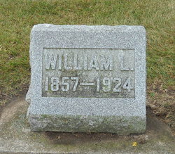
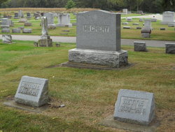
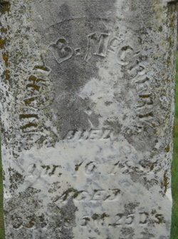
William Luther McCrery
| Birth | : | 3 Mar 1857 Clarksville, Butler County, Iowa, USA |
| Death | : | 8 Jul 1924 Clarksville, Butler County, Iowa, USA |
| Burial | : | Holy Trinity Churchyard, Cleeve, North Somerset Unitary Authority, England |
| Coordinate | : | 51.3908200, -2.7773600 |
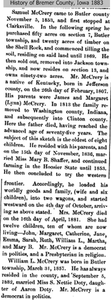
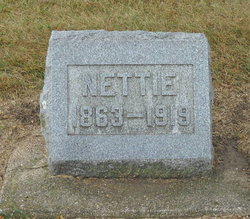
| Description | : | William McCreary, Clarksville, Dead CLARKESVILLE, IA - July 9 - William McCreary, lifetime resident of this place and its immediate vicinity, died this morning from pernicious anemia after an illness of more than two years. The funeral will be at the home at 2:30 p.m. Thursday, with Reverend D. N. Morgan, pastor of the Presbyterian Church, officiating. Mr. McCreary was born March 30, 1857, on a farm two and one-half miles southwest of town. His wife, who was Nettie Doty before their marriage, died four years ago. Surviving are two daughters, Mae and Emma, and three sisters, Mrs. Sarah Marquand and Mrs.... Read More |
frequently asked questions (FAQ):
-
Where is William Luther McCrery's memorial?
William Luther McCrery's memorial is located at: Holy Trinity Churchyard, Cleeve, North Somerset Unitary Authority, England.
-
When did William Luther McCrery death?
William Luther McCrery death on 8 Jul 1924 in Clarksville, Butler County, Iowa, USA
-
Where are the coordinates of the William Luther McCrery's memorial?
Latitude: 51.3908200
Longitude: -2.7773600
Family Members:
Parent
Spouse
Siblings
Children
Flowers:
Nearby Cemetories:
1. Holy Trinity Churchyard
Cleeve, North Somerset Unitary Authority, England
Coordinate: 51.3908200, -2.7773600
2. St. Nicholas' Churchyard
Brockley, North Somerset Unitary Authority, England
Coordinate: 51.3988950, -2.7686830
3. Saint Bridget's Churchyard
Chelvey, North Somerset Unitary Authority, England
Coordinate: 51.4117570, -2.7689680
4. Yatton Parish Council Burial Grounds
Yatton, North Somerset Unitary Authority, England
Coordinate: 51.3840541, -2.8182519
5. St. Mary's Churchyard
Yatton, North Somerset Unitary Authority, England
Coordinate: 51.3847720, -2.8185510
6. Wrington Chapel
Wrington, North Somerset Unitary Authority, England
Coordinate: 51.3651900, -2.7638270
7. St Andrew Churchyard
Congresbury, North Somerset Unitary Authority, England
Coordinate: 51.3701100, -2.8121320
8. All Saints Churchyard
Wrington, North Somerset Unitary Authority, England
Coordinate: 51.3610710, -2.7657110
9. Holy Trinity Churchyard
Nailsea, North Somerset Unitary Authority, England
Coordinate: 51.4258140, -2.7692830
10. St. Andrew's Churchyard
Backwell, North Somerset Unitary Authority, England
Coordinate: 51.4118600, -2.7297400
11. Christ Church Churchyard
Redhill, North Somerset Unitary Authority, England
Coordinate: 51.3657790, -2.7245240
12. Christ Church Churchyard
Nailsea, North Somerset Unitary Authority, England
Coordinate: 51.4336490, -2.7612050
13. Nailsea Garden of Rest
Nailsea, North Somerset Unitary Authority, England
Coordinate: 51.4340540, -2.7613880
14. Langford Chapelyard
Lower Langford, North Somerset Unitary Authority, England
Coordinate: 51.3434850, -2.7715630
15. Saint John the Evangelist Churchyard
Kenn, North Somerset Unitary Authority, England
Coordinate: 51.4168000, -2.8413000
16. Ss Quiricus & Julietta Churchyard
Tickenham, North Somerset Unitary Authority, England
Coordinate: 51.4394000, -2.7814000
17. St Katharine and The Noble Army Churchyard
Felton, North Somerset Unitary Authority, England
Coordinate: 51.3876440, -2.6979950
18. St Mary's Church
Lower Langford, North Somerset Unitary Authority, England
Coordinate: 51.3399805, -2.7813469
19. St Michael & All Angels
Flax Bourton, North Somerset Unitary Authority, England
Coordinate: 51.4212620, -2.7109840
20. All Saints Churchyard
Kingston Seymour, North Somerset Unitary Authority, England
Coordinate: 51.3974392, -2.8627201
21. Ss Mary and Edward Churchyard
Barrow Gurney, North Somerset Unitary Authority, England
Coordinate: 51.4130630, -2.6989510
22. Holy Saviour Churchyard
Puxton, North Somerset Unitary Authority, England
Coordinate: 51.3652680, -2.8536510
23. Saint John the Baptist Churchyard
Churchill, North Somerset Unitary Authority, England
Coordinate: 51.3384750, -2.8092710
24. Methodist Church Burial Ground
Churchill, North Somerset Unitary Authority, England
Coordinate: 51.3344140, -2.8000610

