| Memorials | : | 1 |
| Location | : | Houghton Regis, Central Bedfordshire Unitary Authority, England |
| Coordinate | : | 51.9048640, -0.5212930 |
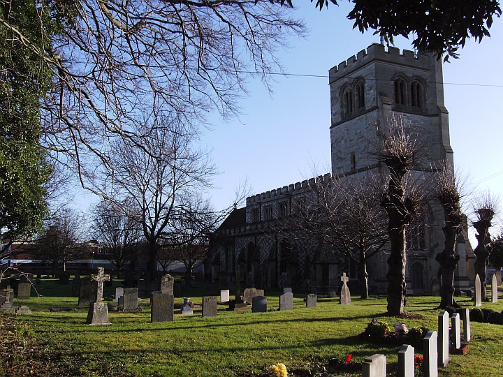
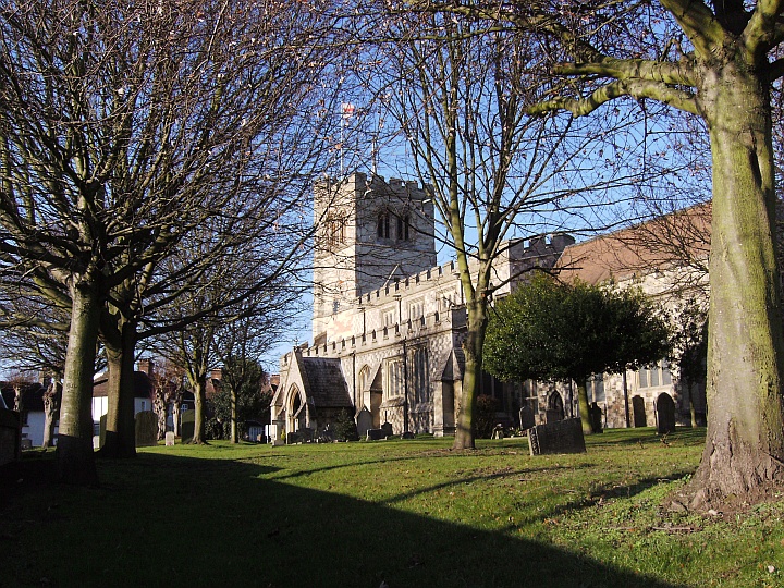
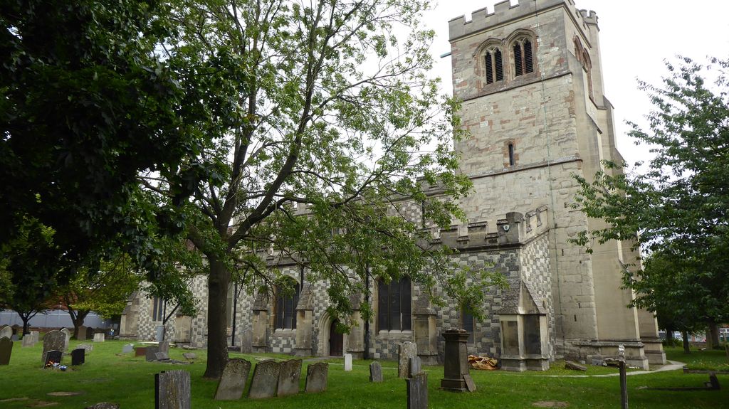
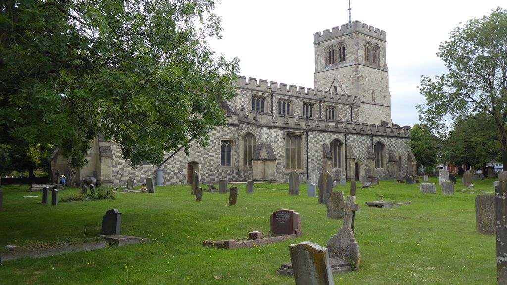
| Description | : | All Saints' Church was built in the 14th century, with the west tower added in the 15th century, however the Domesday Book (AD 1086) records an earlier Saxon church at Houghton Regis. Most of the church walls and windows were rebuilt or replaced in the 19th century and restorations continued through to repairs to the tower towards the end of the 20th century. The main building is a chequer work of flint and Totternhoe stone. The future film actor Gary Cooper was baptised in the Church of All Saints in 1911. The church building is surrounded... Read More |
frequently asked questions (FAQ):
-
Where is All Saints Churchyard?
All Saints Churchyard is located at Houghton Regis, Central Bedfordshire Unitary Authority ,Bedfordshire ,England.
-
All Saints Churchyard cemetery's updated grave count on graveviews.com?
0 memorials
-
Where are the coordinates of the All Saints Churchyard?
Latitude: 51.9048640
Longitude: -0.5212930
Nearby Cemetories:
1. Houghton Regis Cemetery
Houghton Regis, Central Bedfordshire Unitary Authority, England
Coordinate: 51.9019710, -0.5229130
2. Dunstable Priory
Dunstable, Central Bedfordshire Unitary Authority, England
Coordinate: 51.8859940, -0.5177920
3. Dunstable Cemetery
Dunstable, Central Bedfordshire Unitary Authority, England
Coordinate: 51.8831062, -0.5316300
4. All Saints Churchyard
Chalgrave, Central Bedfordshire Unitary Authority, England
Coordinate: 51.9362000, -0.5343000
5. St. Mary the Virgin Churchyard
Sundon, Central Bedfordshire Unitary Authority, England
Coordinate: 51.9301970, -0.4769740
6. St Giles of Provence churchyard
Totternhoe, Central Bedfordshire Unitary Authority, England
Coordinate: 51.8778108, -0.5656137
7. St Mary the Virgin Churchyard
Eaton Bray, Central Bedfordshire Unitary Authority, England
Coordinate: 51.8776980, -0.5655540
8. All Saints Churchyard
Tilsworth, Central Bedfordshire Unitary Authority, England
Coordinate: 51.9083138, -0.5837350
9. St George of England Parish Church
Toddington, Central Bedfordshire Unitary Authority, England
Coordinate: 51.9498000, -0.5318000
10. St Mary the Virgin, Kensworth
Kensworth, Central Bedfordshire Unitary Authority, England
Coordinate: 51.8602233, -0.5037911
11. Toddington Parish Cemetery
Toddington, Central Bedfordshire Unitary Authority, England
Coordinate: 51.9509830, -0.5282330
12. Holy Trinity Churchyard
Biscot, Luton Borough, England
Coordinate: 51.9028700, -0.4375560
13. St. Nicholas Churchyard
Hockliffe, Central Bedfordshire Unitary Authority, England
Coordinate: 51.9328680, -0.5964160
14. St. Mary Magdalene Churchyard
Whipsnade, Central Bedfordshire Unitary Authority, England
Coordinate: 51.8510078, -0.5324191
15. All Saints Churchyard
Caddington, Central Bedfordshire Unitary Authority, England
Coordinate: 51.8670460, -0.4561910
16. St Michael Churchyard
Eggington, Central Bedfordshire Unitary Authority, England
Coordinate: 51.9168460, -0.6103740
17. St Mary the Virgin Churchyard
Edlesborough, Aylesbury Vale District, England
Coordinate: 51.8617700, -0.5918500
18. St Mary the Virgin Churchyard
Harlington, Central Bedfordshire Unitary Authority, England
Coordinate: 51.9637650, -0.4909810
19. St Mary the Virgin Church Cemetery
Harlington, Central Bedfordshire Unitary Authority, England
Coordinate: 51.9645140, -0.4887520
20. Luton General Cemetery
Luton, Luton Borough, England
Coordinate: 51.8773780, -0.4242060
21. Aley Green Cemetery
Slip End, Central Bedfordshire Unitary Authority, England
Coordinate: 51.8522500, -0.4496420
22. St Peter and All Saints Churchyard
Battlesden, Central Bedfordshire Unitary Authority, England
Coordinate: 51.9520610, -0.6059540
23. St. Michael and All Angels Churchyard
Billington, Central Bedfordshire Unitary Authority, England
Coordinate: 51.8936510, -0.6347710
24. Friend's Burial Ground
Luton, Luton Borough, England
Coordinate: 51.8738060, -0.4170870


