
| Memorials | : | 0 |
| Location | : | Sundon, Central Bedfordshire Unitary Authority, England |
| Coordinate | : | 51.9301970, -0.4769740 |
frequently asked questions (FAQ):
-
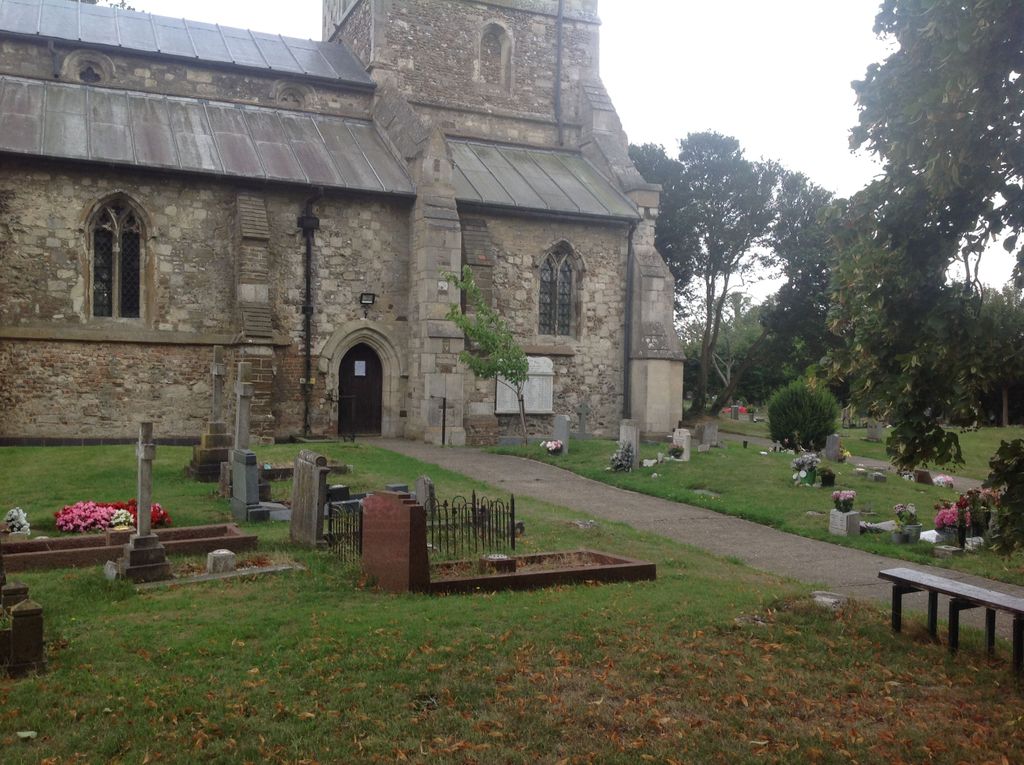
Where is St. Mary the Virgin Churchyard?
St. Mary the Virgin Churchyard is located at Sundon, Central Bedfordshire Unitary Authority ,Bedfordshire ,England.
-
St. Mary the Virgin Churchyard cemetery's updated grave count on graveviews.com?
0 memorials
-
Where are the coordinates of the St. Mary the Virgin Churchyard?
Latitude: 51.9301970
Longitude: -0.4769740
Nearby Cemetories:
1. St Mary the Virgin Churchyard
Harlington, Central Bedfordshire Unitary Authority, England
Coordinate: 51.9637650, -0.4909810
2. St Mary the Virgin Church Cemetery
Harlington, Central Bedfordshire Unitary Authority, England
Coordinate: 51.9645140, -0.4887520
3. All Saints Churchyard
Chalgrave, Central Bedfordshire Unitary Authority, England
Coordinate: 51.9362000, -0.5343000
4. Holy Trinity Churchyard
Biscot, Luton Borough, England
Coordinate: 51.9028700, -0.4375560
5. All Saints Churchyard
Houghton Regis, Central Bedfordshire Unitary Authority, England
Coordinate: 51.9048640, -0.5212930
6. Toddington Parish Cemetery
Toddington, Central Bedfordshire Unitary Authority, England
Coordinate: 51.9509830, -0.5282330
7. St George of England Parish Church
Toddington, Central Bedfordshire Unitary Authority, England
Coordinate: 51.9498000, -0.5318000
8. Houghton Regis Cemetery
Houghton Regis, Central Bedfordshire Unitary Authority, England
Coordinate: 51.9019710, -0.5229130
9. Dunstable Priory
Dunstable, Central Bedfordshire Unitary Authority, England
Coordinate: 51.8859940, -0.5177920
10. St. Mary Magdalene Church Cemetery
Westoning, Central Bedfordshire Unitary Authority, England
Coordinate: 51.9834500, -0.5014400
11. St. Mary Magdalene Churchyard
Westoning, Central Bedfordshire Unitary Authority, England
Coordinate: 51.9841592, -0.5041169
12. Vale Cemetery and Crematorium
Luton, Luton Borough, England
Coordinate: 51.9070900, -0.3924930
13. Dunstable Cemetery
Dunstable, Central Bedfordshire Unitary Authority, England
Coordinate: 51.8831062, -0.5316300
14. St. Faith's Churchyard
Hexton, North Hertfordshire District, England
Coordinate: 51.9609275, -0.3944721
15. Luton General Cemetery
Luton, Luton Borough, England
Coordinate: 51.8773780, -0.4242060
16. St Nicholas Churchyard
Tingrith, Central Bedfordshire Unitary Authority, England
Coordinate: 51.9812660, -0.5347790
17. St. James Churchyard
Pulloxhill, Central Bedfordshire Unitary Authority, England
Coordinate: 51.9924399, -0.4552110
18. All Saints Churchyard
Caddington, Central Bedfordshire Unitary Authority, England
Coordinate: 51.8670460, -0.4561910
19. St. Mary's Churchyard
Luton, Luton Borough, England
Coordinate: 51.8788681, -0.4100020
20. Friend's Burial Ground
Luton, Luton Borough, England
Coordinate: 51.8738060, -0.4170870
21. Church Burial Ground
Luton, Luton Borough, England
Coordinate: 51.8794640, -0.4027310
22. St Peter and St Paul Churchyard
Flitwick, Central Bedfordshire Unitary Authority, England
Coordinate: 51.9970866, -0.5015783
23. Quaker Burial Ground
Luton, Luton Borough, England
Coordinate: 51.8791910, -0.4023320
24. Flitwick Burial Ground
Flitwick, Central Bedfordshire Unitary Authority, England
Coordinate: 51.9974993, -0.5008905