
| Memorials | : | 0 |
| Location | : | Bloxwich, Metropolitan Borough of Walsall, England |
| Coordinate | : | 52.6188070, -1.9963110 |
frequently asked questions (FAQ):
-
Where is Bloxwich Cemetery?
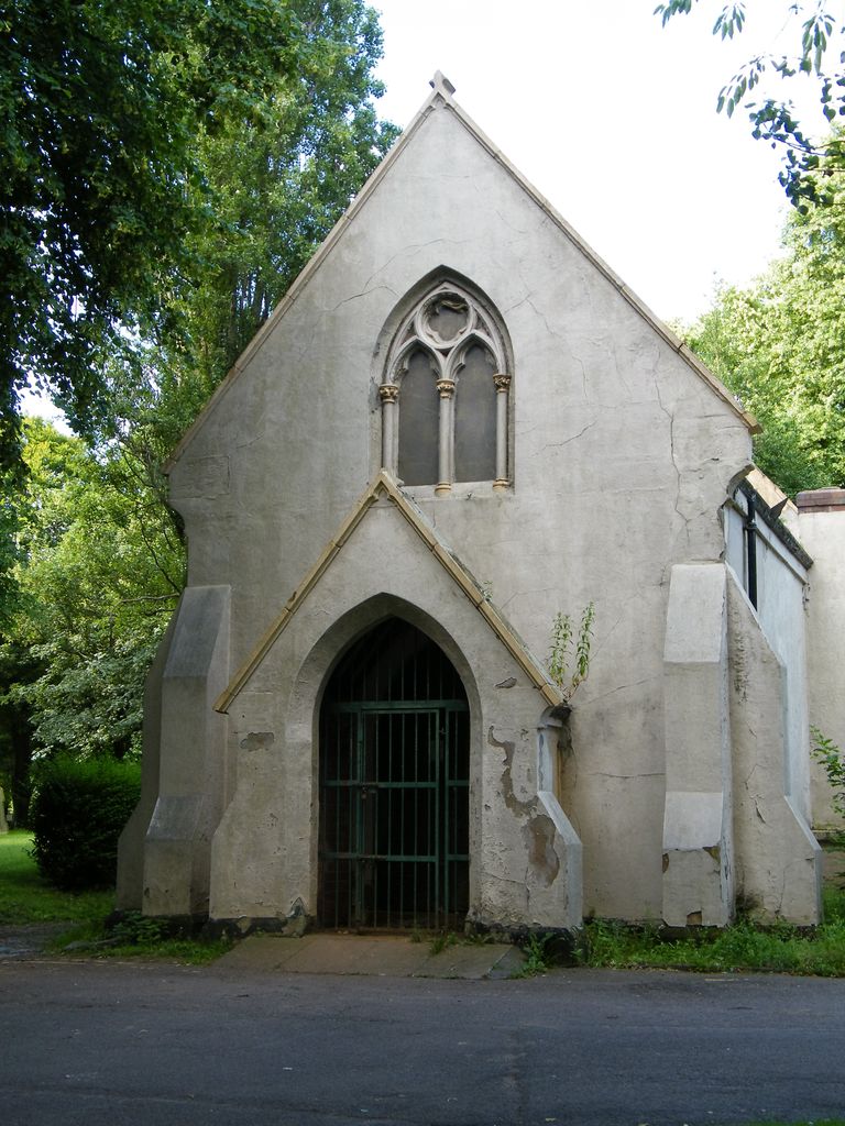
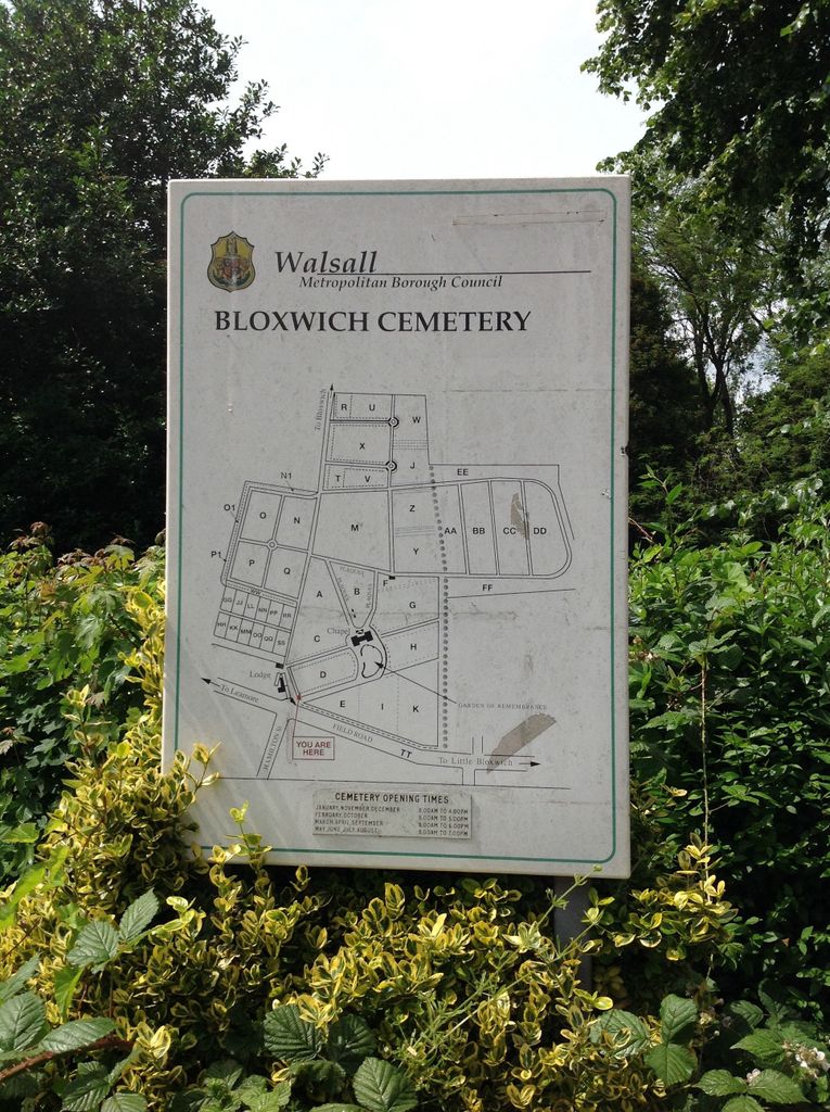
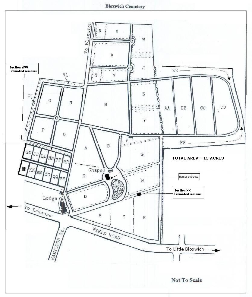
Bloxwich Cemetery is located at Field Road Bloxwich, Metropolitan Borough of Walsall ,West Midlands ,England.
-
Bloxwich Cemetery cemetery's updated grave count on graveviews.com?
0 memorials
-
Where are the coordinates of the Bloxwich Cemetery?
Latitude: 52.6188070
Longitude: -1.9963110
Nearby Cemetories:
1. All Saints Church Cemetery
Bloxwich, Metropolitan Borough of Walsall, England
Coordinate: 52.6147940, -2.0050330
2. North Walsall Cemetery
Bloxwich, Metropolitan Borough of Walsall, England
Coordinate: 52.6321680, -2.0151070
3. Ryecroft Cemetery
Walsall, Metropolitan Borough of Walsall, England
Coordinate: 52.6012820, -1.9752140
4. Holy Trinity Churchyard Shortheath
Willenhall, Metropolitan Borough of Walsall, England
Coordinate: 52.6047160, -2.0364190
5. Willenhall Lawn Cemetery
Willenhall, Metropolitan Borough of Walsall, England
Coordinate: 52.6001870, -2.0327110
6. Strawberry Lane Cemetery
Cheslyn Hay, South Staffordshire Borough, England
Coordinate: 52.6485291, -2.0300821
7. Bentley Cemetery
Willenhall, Metropolitan Borough of Walsall, England
Coordinate: 52.5868880, -2.0299620
8. Queen Street Cemetery
Walsall, Metropolitan Borough of Walsall, England
Coordinate: 52.5797190, -1.9929050
9. St Mary Roman Catholic Churchyard
Walsall, Metropolitan Borough of Walsall, England
Coordinate: 52.5797300, -1.9835900
10. Bath Street Burial Grounds
Walsall, Metropolitan Borough of Walsall, England
Coordinate: 52.5801310, -1.9799960
11. James Bridge Cemetery
Darlaston, Metropolitan Borough of Walsall, England
Coordinate: 52.5765076, -2.0185659
12. St. Giles Church Cholera Burial Ground
Willenhall, Metropolitan Borough of Coventry, England
Coordinate: 52.5851060, -2.0498580
13. Wood Street Cemetery
Willenhall, Metropolitan Borough of Walsall, England
Coordinate: 52.5867500, -2.0528900
14. St Giles Church Cemetery
Willenhall, Metropolitan Borough of Walsall, England
Coordinate: 52.5841600, -2.0504000
15. Cheslyn Hay Cemetery
Cheslyn Hay, South Staffordshire Borough, England
Coordinate: 52.6581170, -2.0431790
16. Great Wyrley Cemetery
Great Wyrley, South Staffordshire Borough, England
Coordinate: 52.6642130, -2.0269380
17. St. Mark's Churchyard
Great Wyrley, South Staffordshire Borough, England
Coordinate: 52.6664250, -2.0231955
18. Fallings Heath Cemetery
Wednesbury, Metropolitan Borough of Sandwell, England
Coordinate: 52.5689100, -2.0182820
19. St. Thomas Churchyard
Wednesfield, Metropolitan Borough of Wolverhampton, England
Coordinate: 52.5997080, -2.0835350
20. All Saints Churchyard
Moxley, Metropolitan Borough of Walsall, England
Coordinate: 52.5666000, -2.0350200
21. Wood Green Cemetery
Wednesbury, Metropolitan Borough of Sandwell, England
Coordinate: 52.5585990, -2.0081480
22. Wednesfield New Burial Ground
Wednesfield, Metropolitan Borough of Wolverhampton, England
Coordinate: 52.6003500, -2.0918900
23. St. Anne Churchyard Chasetown
Burntwood, Lichfield District, England
Coordinate: 52.6693850, -1.9381720
24. St Peter's Churchyard
Stonnall, Lichfield District, England
Coordinate: 52.6266750, -1.8923110