
| Memorials | : | 0 |
| Location | : | Pondersbridge, Fenland District, England |
| Coordinate | : | 52.5107400, -0.1427800 |
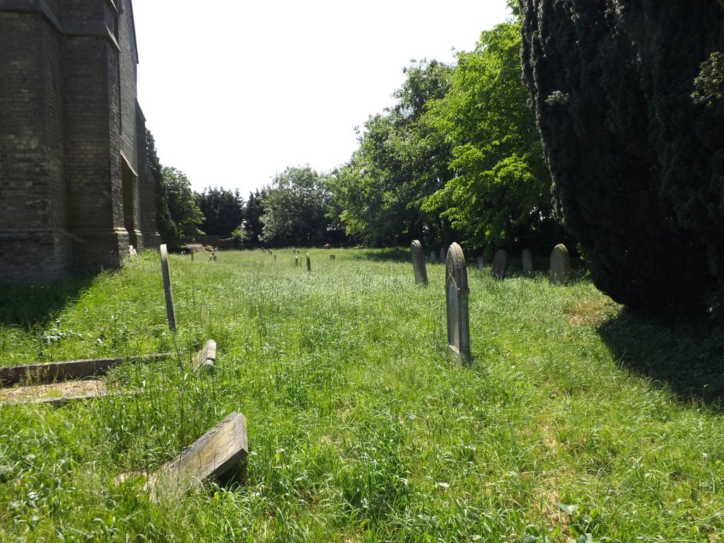
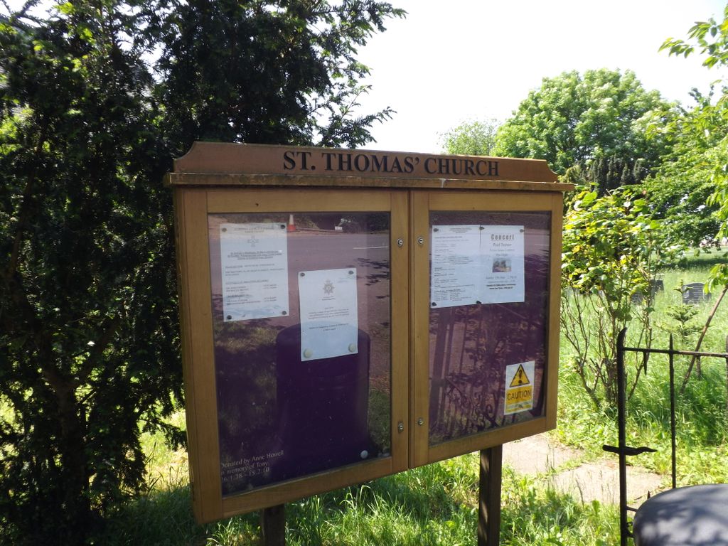
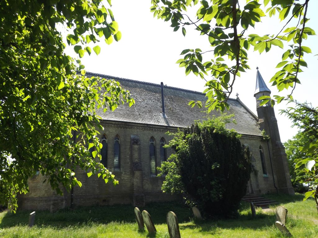
| Description | : | Pondersbridge is a village in Whittlesey civil parish, part of the Fenland district of Cambridgeshire, situated on the B1040 road. The Church of St. Thomas was built in 1869 to replace a previous church in the village. The main part of Pondersbridge is contained within a triangle of roads - the B1040, the B1095 (from Stanground) and The Drove. |
frequently asked questions (FAQ):
-
Where is St. Thomas Churchyard?
St. Thomas Churchyard is located at Oil Mills Road Pondersbridge, Fenland District ,Cambridgeshire , PE26 2TREngland.
-
St. Thomas Churchyard cemetery's updated grave count on graveviews.com?
0 memorials
-
Where are the coordinates of the St. Thomas Churchyard?
Latitude: 52.5107400
Longitude: -0.1427800
Nearby Cemetories:
1. St. Andrew's Churchyard
Whittlesey, Fenland District, England
Coordinate: 52.5558673, -0.1330800
2. Saint Mary's Churchyard
Whittlesey, Fenland District, England
Coordinate: 52.5556600, -0.1278000
3. Whittlesey Cemetery
Whittlesey, Fenland District, England
Coordinate: 52.5583700, -0.1232450
4. Wood Lane Cemetery
Ramsey, Huntingdonshire District, England
Coordinate: 52.4525800, -0.0994800
5. Stanground Cemetery
Stanground, Peterborough Unitary Authority, England
Coordinate: 52.5516860, -0.2273100
6. Holy Trinity Churchyard
Coates, Fenland District, England
Coordinate: 52.5626500, -0.0756700
7. Ramsey Abbey
Ramsey, Huntingdonshire District, England
Coordinate: 52.4483330, -0.1008330
8. Holme Cemetery
Holme, Huntingdonshire District, England
Coordinate: 52.4726120, -0.2408410
9. Benwick Cemetery
Benwick, Fenland District, England
Coordinate: 52.4967300, -0.0259400
10. St. Margaret's churchyard
Fletton, Peterborough Unitary Authority, England
Coordinate: 52.5584400, -0.2350100
11. St. Giles' Churchyard
Holme, Huntingdonshire District, England
Coordinate: 52.4767090, -0.2502880
12. Fletton Cemetery
Fletton, Peterborough Unitary Authority, England
Coordinate: 52.5611534, -0.2350550
13. Saint Peter's Churchyard
Yaxley, Huntingdonshire District, England
Coordinate: 52.5117400, -0.2672200
14. Yaxley Cemetery
Peterborough, Peterborough Unitary Authority, England
Coordinate: 52.5137400, -0.2700500
15. Woodston Cemetery
Woodston, Peterborough Unitary Authority, England
Coordinate: 52.5607090, -0.2529700
16. Peterborough Cathedral
Peterborough, Peterborough Unitary Authority, England
Coordinate: 52.5725280, -0.2392390
17. Upwood Cemetery
Upwood, Huntingdonshire District, England
Coordinate: 52.4240800, -0.1525400
18. St. John the Baptist Church
Peterborough, Peterborough Unitary Authority, England
Coordinate: 52.5727200, -0.2438210
19. St. Mary's Churchyard
Ramsey Saint Marys, Huntingdonshire District, England
Coordinate: 52.4688020, -0.0153334
20. Broadway Cemetery
Peterborough, Peterborough Unitary Authority, England
Coordinate: 52.5796750, -0.2350260
21. All Saints Churchyard
Conington, Huntingdonshire District, England
Coordinate: 52.4581985, -0.2642000
22. Eastfield Cemetery
Peterborough, Peterborough Unitary Authority, England
Coordinate: 52.5890690, -0.2225360
23. Stilton Cemetery
Stilton, Huntingdonshire District, England
Coordinate: 52.4895230, -0.2923260
24. All Saints at Botolphbridge (Not Extant)
Orton Longueville, Peterborough Unitary Authority, England
Coordinate: 52.5615344, -0.2731584