
| Memorials | : | 10 |
| Location | : | Sedgemere, Selwyn District, New Zealand |
| Coordinate | : | -43.8366600, 172.3149500 |
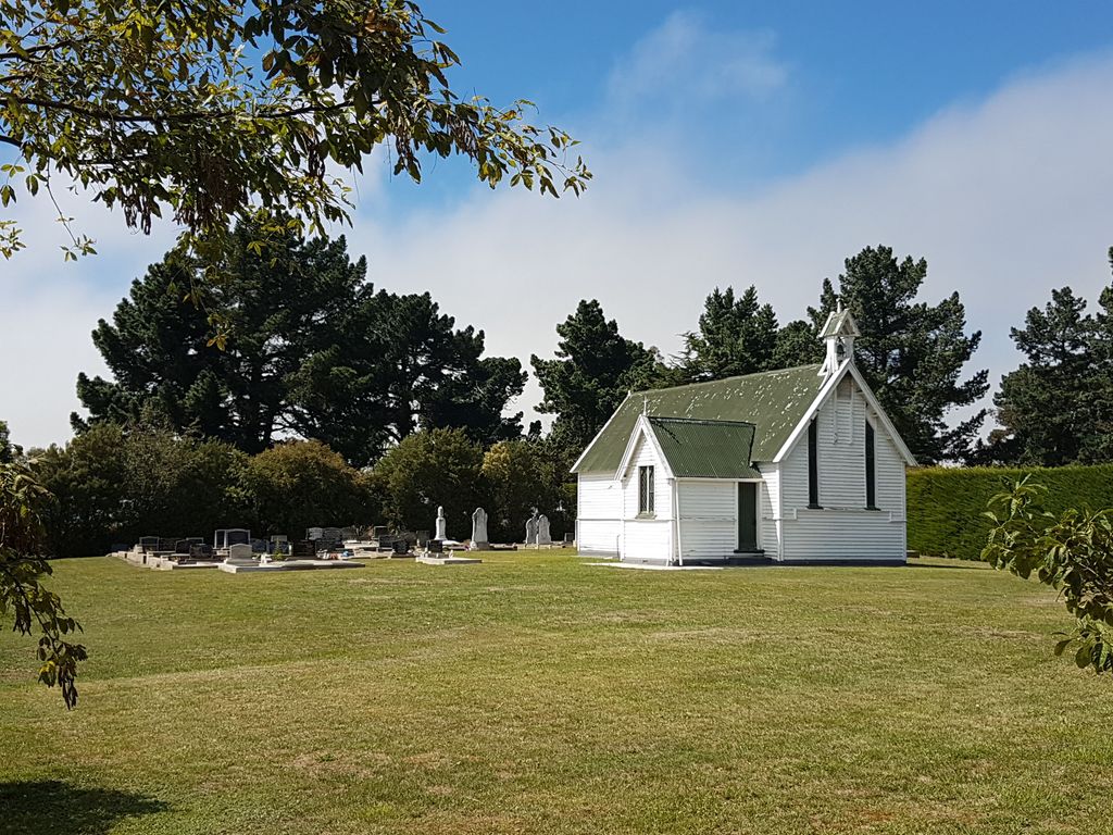
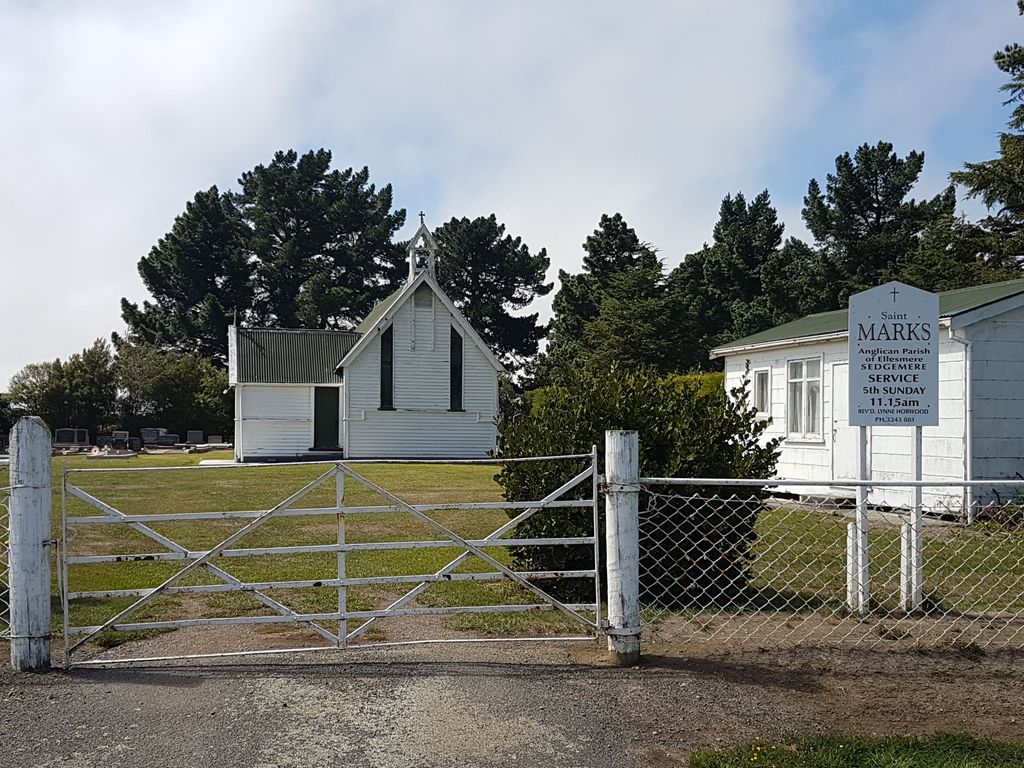
| Description | : | This cemetery is in the grounds of St. Mark's Anglican Church. There is 1 Commonwealth burial of the 1939-1945 war here: Noel Raymond Frederick Alexander, a Private who was the son of Frederick and May Alexander, of nearby Lakeside. He died on the 28 January 1942 at the age of 33. John Henry Hurford, a soldier of the Anglo-Boer War who died of disease is also buried here. He was from Doyleston, in Canterbury and a member of the first contingent New Zealand Mounted Rifles in the South African War. After 12 months' fighting, Mr Hurford was invalided home with... Read More |
frequently asked questions (FAQ):
-
Where is Sedgemere Cemetery?
Sedgemere Cemetery is located at 453 Leeston Taumutu Rd Sedgemere, Selwyn District ,Canterbury , 7682New Zealand.
-
Sedgemere Cemetery cemetery's updated grave count on graveviews.com?
10 memorials
-
Where are the coordinates of the Sedgemere Cemetery?
Latitude: -43.8366600
Longitude: 172.3149500
Nearby Cemetories:
1. Hone Wetere Churchyard
Taumutu, Selwyn District, New Zealand
Coordinate: -43.8567680, 172.3586330
2. St James Churchyard
Southbridge, Selwyn District, New Zealand
Coordinate: -43.8092360, 172.2502680
3. Ellesmere Catholic Cemetery
Leeston, Selwyn District, New Zealand
Coordinate: -43.7845860, 172.2690990
4. Ellesmere Public Cemetery
Leeston, Selwyn District, New Zealand
Coordinate: -43.7775690, 172.2599220
5. Bishops Corner Cemetery
Southbridge, Selwyn District, New Zealand
Coordinate: -43.7824100, 172.2422900
6. Killinchy Cemetery
Leeston, Selwyn District, New Zealand
Coordinate: -43.7325610, 172.2411540
7. St Luke's Anglican Churchyard
Brookside, Selwyn District, New Zealand
Coordinate: -43.6903100, 172.3029000
8. Brookside Cemetery
Brookside, Selwyn District, New Zealand
Coordinate: -43.6751800, 172.2683700
9. Dorie Cemetery
Dorie, Ashburton District, New Zealand
Coordinate: -43.8772900, 172.0862500
10. Kyle Cemetery
Dorie, Ashburton District, New Zealand
Coordinate: -43.9193236, 172.0979192
11. St Mary's Churchyard
Springston, Selwyn District, New Zealand
Coordinate: -43.6446560, 172.4263590
12. Dunsandel Cemetery
Dunsandel, Selwyn District, New Zealand
Coordinate: -43.6710940, 172.1382620
13. Springston Cemetery
Lincoln, Selwyn District, New Zealand
Coordinate: -43.6404360, 172.4509420
14. Lincoln Cemetery
Lincoln, Selwyn District, New Zealand
Coordinate: -43.6311790, 172.4862570
15. Rakaia Cemetery
Rakaia, Ashburton District, New Zealand
Coordinate: -43.7548910, 171.9939270
16. Church of the Epiphany Churchyard
Teddington, Christchurch City, New Zealand
Coordinate: -43.7016200, 172.6182200
17. Weedons Cemetery
Weedons, Selwyn District, New Zealand
Coordinate: -43.5670010, 172.4015870
18. Chertsey Cemetery
Chertsey, Ashburton District, New Zealand
Coordinate: -43.8030500, 171.9319400
19. St Kentigern Anglican Churchyard
Ataahua, Christchurch City, New Zealand
Coordinate: -43.7507000, 172.6875900
20. Prebbleton Cemetery
Prebbleton, Selwyn District, New Zealand
Coordinate: -43.5887200, 172.5053500
21. Shands Road Cemetery
Prebbleton, Selwyn District, New Zealand
Coordinate: -43.5792540, 172.4888630
22. All Saint's Churchyard
Prebbleton, Selwyn District, New Zealand
Coordinate: -43.5781040, 172.5131430
23. St Peters Churchyard
Teddington, Christchurch City, New Zealand
Coordinate: -43.6719000, 172.6590100
24. St Saviours Churchyard
Templeton, Christchurch City, New Zealand
Coordinate: -43.5501420, 172.4714620