
| Memorials | : | 11 |
| Location | : | Leeston, Selwyn District, New Zealand |
| Website | : | www.selwyn.govt.nz/facilities-and-parks/cemeteries |
| Coordinate | : | -43.7325610, 172.2411540 |
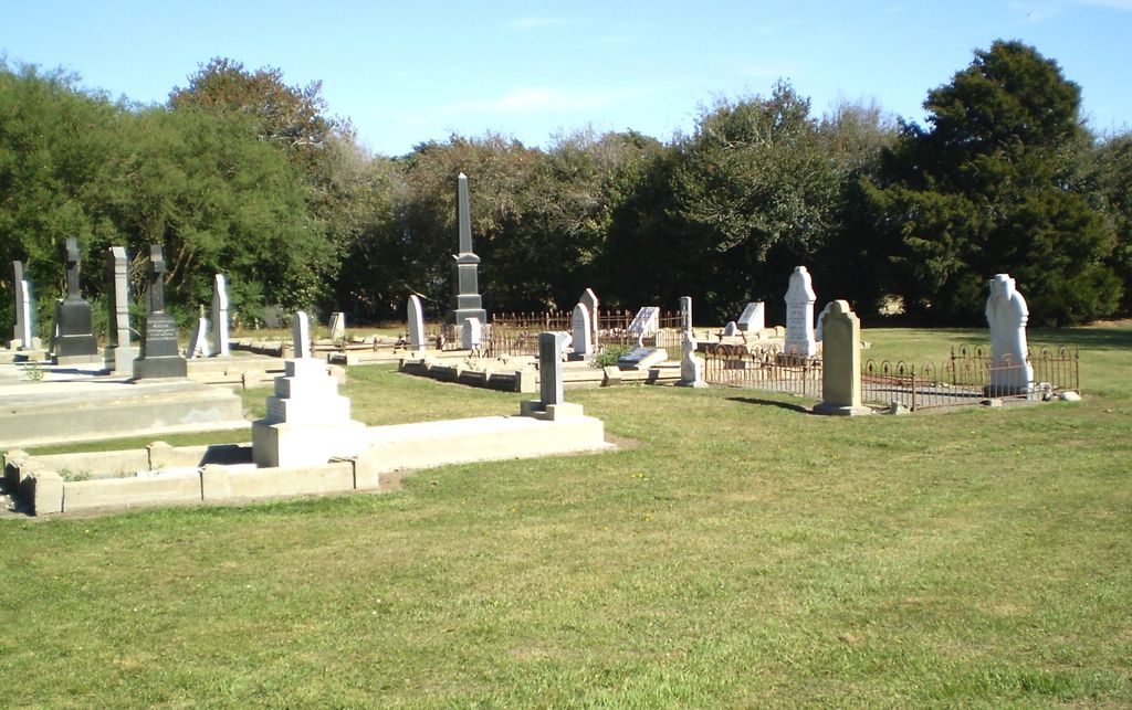
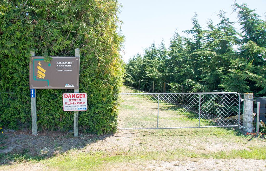
| Description | : | This was the cemetery attached to All Saints Anglican Church which was consecrated in 1883. The first recorded burial took place in 1876, but from the 1920s, there was only limited use of the cemetery. In 1981, the church was demolished, the property subdivided and the cemetery vested in the Ellesmere County Council. It is now managed by Selwyn District Council. The cemetery is not visible from the roadside being surrounded by hedging. It is accessed via a metal gate and grassed pathway. |
frequently asked questions (FAQ):
-
Where is Killinchy Cemetery?
Killinchy Cemetery is located at Leeston Dunsandel Road Leeston, Selwyn District ,Canterbury , 7682New Zealand.
-
Killinchy Cemetery cemetery's updated grave count on graveviews.com?
11 memorials
-
Where are the coordinates of the Killinchy Cemetery?
Latitude: -43.7325610
Longitude: 172.2411540
Nearby Cemetories:
1. Ellesmere Public Cemetery
Leeston, Selwyn District, New Zealand
Coordinate: -43.7775690, 172.2599220
2. Bishops Corner Cemetery
Southbridge, Selwyn District, New Zealand
Coordinate: -43.7824100, 172.2422900
3. Ellesmere Catholic Cemetery
Leeston, Selwyn District, New Zealand
Coordinate: -43.7845860, 172.2690990
4. Brookside Cemetery
Brookside, Selwyn District, New Zealand
Coordinate: -43.6751800, 172.2683700
5. St Luke's Anglican Churchyard
Brookside, Selwyn District, New Zealand
Coordinate: -43.6903100, 172.3029000
6. St James Churchyard
Southbridge, Selwyn District, New Zealand
Coordinate: -43.8092360, 172.2502680
7. Dunsandel Cemetery
Dunsandel, Selwyn District, New Zealand
Coordinate: -43.6710940, 172.1382620
8. Sedgemere Cemetery
Sedgemere, Selwyn District, New Zealand
Coordinate: -43.8366600, 172.3149500
9. Hone Wetere Churchyard
Taumutu, Selwyn District, New Zealand
Coordinate: -43.8567680, 172.3586330
10. St Mary's Churchyard
Springston, Selwyn District, New Zealand
Coordinate: -43.6446560, 172.4263590
11. Springston Cemetery
Lincoln, Selwyn District, New Zealand
Coordinate: -43.6404360, 172.4509420
12. Rakaia Cemetery
Rakaia, Ashburton District, New Zealand
Coordinate: -43.7548910, 171.9939270
13. Dorie Cemetery
Dorie, Ashburton District, New Zealand
Coordinate: -43.8772900, 172.0862500
14. Weedons Cemetery
Weedons, Selwyn District, New Zealand
Coordinate: -43.5670010, 172.4015870
15. Lincoln Cemetery
Lincoln, Selwyn District, New Zealand
Coordinate: -43.6311790, 172.4862570
16. Kyle Cemetery
Dorie, Ashburton District, New Zealand
Coordinate: -43.9193236, 172.0979192
17. Greendale Cemetery
Greendale, Selwyn District, New Zealand
Coordinate: -43.5447560, 172.0772460
18. St Paul's Anglican Church Cemetery
West Melton, Selwyn District, New Zealand
Coordinate: -43.5261700, 172.3701800
19. Chertsey Cemetery
Chertsey, Ashburton District, New Zealand
Coordinate: -43.8030500, 171.9319400
20. Shands Road Cemetery
Prebbleton, Selwyn District, New Zealand
Coordinate: -43.5792540, 172.4888630
21. Halkett Presbyterian Churchyard
Halkett, Selwyn District, New Zealand
Coordinate: -43.5011000, 172.3220900
22. St George's Anglican Churchyard
Kirwee, Selwyn District, New Zealand
Coordinate: -43.4940826, 172.2182446
23. Prebbleton Cemetery
Prebbleton, Selwyn District, New Zealand
Coordinate: -43.5887200, 172.5053500
24. Kirwee Cemetery
Kirwee, Selwyn District, New Zealand
Coordinate: -43.4935800, 172.2118100