
| Memorials | : | 0 |
| Location | : | Wanstrow, Mendip District, England |
| Coordinate | : | 51.1735190, -2.4164890 |
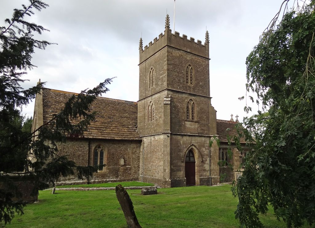
| Description | : | St Marys Church Wanstrow (not to be confused with nearby St Marys Church, Cloford, Wanstrow)is a Grade II listed building. Built in the 15th Century and rebuilt and extended in the 19th Century. Made from local limestone rubble and ashlar with a stone tile roof. The nave has a South tower with both North and South transepts. The tower dates from 1810. |
frequently asked questions (FAQ):
-
Where is The Blessed Virgin Mary Churchyard?
The Blessed Virgin Mary Churchyard is located at Church Street Wanstrow, Mendip District ,Somerset ,England.
-
The Blessed Virgin Mary Churchyard cemetery's updated grave count on graveviews.com?
0 memorials
-
Where are the coordinates of the The Blessed Virgin Mary Churchyard?
Latitude: 51.1735190
Longitude: -2.4164890
Nearby Cemetories:
1. St. Mary's Churchyard
Mendip District, England
Coordinate: 51.1942400, -2.3928700
2. Saint Mary The Virgin
Batcombe, Mendip District, England
Coordinate: 51.1495900, -2.4433900
3. St Mary's Church
Witham Friary, Mendip District, England
Coordinate: 51.1686850, -2.3676100
4. Saint Bartholomew Chapel Churchyard
Cranmore, Mendip District, England
Coordinate: 51.1882990, -2.4759150
5. St Bartholomew Churchyard
Cranmore, Mendip District, England
Coordinate: 51.1882670, -2.4760330
6. St Mary's, Chesterblade
Evercreech, Mendip District, England
Coordinate: 51.1692610, -2.4861180
7. All Saints Churchyard
Nunney, Mendip District, England
Coordinate: 51.2098694, -2.3772340
8. Byfields Cemetery
Nunney, Mendip District, England
Coordinate: 51.2077210, -2.3722630
9. St. Leonard's Churchyard
Mendip District, England
Coordinate: 51.2033660, -2.3512620
10. Church of St John the Baptist
Brewham, South Somerset District, England
Coordinate: 51.1236330, -2.4017130
11. Saint Giles Churchyard
Leigh-on-Mendip, Mendip District, England
Coordinate: 51.2239000, -2.4416000
12. St Leonard Church
Marston Magna, South Somerset District, England
Coordinate: 51.2058070, -2.3488020
13. St James Church
Milton Clevedon, Mendip District, England
Coordinate: 51.1381600, -2.4809000
14. Bruton Cemetery
Bruton, South Somerset District, England
Coordinate: 51.1208280, -2.4464270
15. St George's Churchyard
Whatley, Mendip District, England
Coordinate: 51.2270030, -2.3822140
16. Evercreech Cemetery
Evercreech, Mendip District, England
Coordinate: 51.1461300, -2.4989500
17. St. Aldhelm Churchyard
Doulting, Mendip District, England
Coordinate: 51.1862880, -2.5077290
18. St Peter Churchyard
Evercreech, Mendip District, England
Coordinate: 51.1462670, -2.5025440
19. St Michael & All Angels
Stoke St Michael, Mendip District, England
Coordinate: 51.2208300, -2.4819900
20. Blessed Virgin Mary Churchyard
Bruton, South Somerset District, England
Coordinate: 51.1115790, -2.4520520
21. Bruton Abbey
Bruton, South Somerset District, England
Coordinate: 51.1114890, -2.4530300
22. St Edmund's Church Vobster
Mells, Mendip District, England
Coordinate: 51.2418000, -2.4244930
23. Holy Trinity Churchyard
Coleford, Mendip District, England
Coordinate: 51.2394100, -2.4503100
24. St Andrew Churchyard
Mells, Mendip District, England
Coordinate: 51.2420710, -2.3912060