
| Memorials | : | 21 |
| Location | : | Stryker, Williams County, USA |
| Coordinate | : | 41.4782982, -84.4389038 |
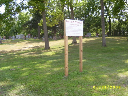
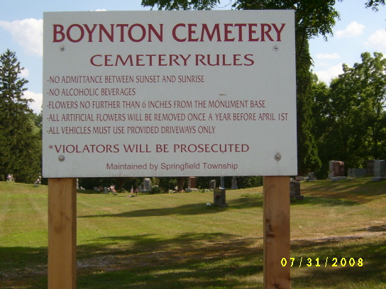
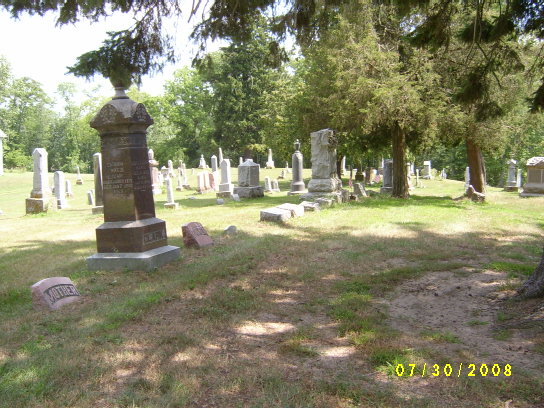
| Description | : | It has also been called Springfield Cemetery, since it is located in Springfield Twp. It is located southwest of Stryker on the south side of State Route 34, 3/4 mile west of SR 191. The original size was 4.25 acres which was deeded to John Stubbs in 1835, and transferred to the township in 1865. |
frequently asked questions (FAQ):
-
Where is Boynton Cemetery?
Boynton Cemetery is located at Stryker, Williams County ,Ohio ,USA.
-
Boynton Cemetery cemetery's updated grave count on graveviews.com?
19 memorials
-
Where are the coordinates of the Boynton Cemetery?
Latitude: 41.4782982
Longitude: -84.4389038
Nearby Cemetories:
1. Oakwood Cemetery
Stryker, Williams County, USA
Coordinate: 41.4978900, -84.4274700
2. French Cemetery
Springfield Township, Williams County, USA
Coordinate: 41.5039100, -84.4485500
3. Beaver Creek Cemetery
Williams County, USA
Coordinate: 41.4808006, -84.4858017
4. Bodel Cemetery
Stryker, Williams County, USA
Coordinate: 41.5277080, -84.4495600
5. Buck Cemetery
Williams County, USA
Coordinate: 41.4272003, -84.4250031
6. Old Pulaski Cemetery
Williams County, USA
Coordinate: 41.5135994, -84.5119019
7. Zion Cemetery
Williams County, USA
Coordinate: 41.4417000, -84.3628006
8. Shiffler Cemetery
Jefferson Township, Williams County, USA
Coordinate: 41.5325012, -84.5063934
9. Lockport Cemetery
Stryker, Williams County, USA
Coordinate: 41.5466690, -84.3927765
10. Evansport Cemetery
Evansport, Defiance County, USA
Coordinate: 41.4075012, -84.3964005
11. Kunkle Cemetery
Williams County, USA
Coordinate: 41.5561150, -84.4762400
12. Fountain Grove Cemetery
Bryan, Williams County, USA
Coordinate: 41.4572182, -84.5480576
13. Goll Cemetery
Archbold, Fulton County, USA
Coordinate: 41.5558014, -84.3677979
14. Floral Grove Cemetery
West Unity, Williams County, USA
Coordinate: 41.5708008, -84.4158020
15. Williams County Infirmary Cemetery
West Unity, Williams County, USA
Coordinate: 41.5571430, -84.5097860
16. Saint Johns Methodist Cemetery
Defiance County, USA
Coordinate: 41.3878700, -84.3943100
17. Archbold Cemetery
Archbold, Fulton County, USA
Coordinate: 41.5028000, -84.3058014
18. Reform Cemetery
Archbold, Fulton County, USA
Coordinate: 41.5039790, -84.3061070
19. Saint John Lutheran Church Cemetery
Ridgeville Township, Henry County, USA
Coordinate: 41.4425410, -84.3084650
20. Trinity Lutheran Cemetery
Ney, Defiance County, USA
Coordinate: 41.4016991, -84.5353012
21. Doll Cemetery
Ney, Defiance County, USA
Coordinate: 41.3809319, -84.4963684
22. Saint Marks Lutheran Cemetery
Defiance, Defiance County, USA
Coordinate: 41.4129240, -84.3257920
23. McCauley Cemetery
Defiance County, USA
Coordinate: 41.3697014, -84.4203033
24. Doud Cemetery
Ney, Defiance County, USA
Coordinate: 41.3811680, -84.5161110